
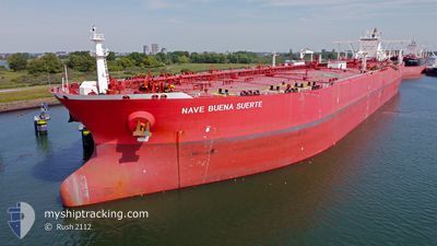
NAVE BUENA SUERTE
Tanker
Current Trip
| Time Travelled | 9 days |
|---|---|
| Remaining Time | --- |
| Distance Travelled | 3001.44 nm |
| Remaining Distance | --- |
| AVG Speed | 12.9 Knots |
| MAX Speed | 15.6 Knots |
| AVG Wind | 12.8 knots |
| MAX Wind | 41.8 knots |
| MIN Temp | 15.2°C / 59.36°F |
| MAX Temp | 25.6°C / 78.08°F |
| Draught | 10.6 m |
| Position Received | 9 d ago |
Current Position
| Longitude | 17.37993° |
|---|---|
| Latitude | -34.15687° |
| Status | Under way using engine |
| Speed | 15 Knots |
| Course | 254.1° |
| Area | South Atlantic Ocean |
| Station | T-AIS |
| Position Received | 9 d ago |
Info
Information
The current position of NAVE BUENA SUERTE is in South Atlantic Ocean with coordinates -34.15687° / 17.37993° as reported on 2024-04-14 12:01 by AIS to our vessel tracker app. The vessel's current speed is 15 Knots and is heading at the port of LA PALOMA. The estimated time of arrival as calculated by MyShipTracking vessel tracking app is 2024-04-25 23:00 LT
The vessel NAVE BUENA SUERTE (IMO: 9514561, MMSI: 477814400) is a Tanker It's sailing under the flag of [HK] Hong Kong.
In this page you can find informations about the vessels current position, last detected port calls, and current voyage information. If the vessels is not in coverage by AIS you will find the latest position.
The current position of NAVE BUENA SUERTE is detected by our AIS receivers and we are not responsible for the reliability of the data. The last position was recorded while the vessel was in Coverage by the Ais receivers of our vessel tracking app.
The current draught of NAVE BUENA SUERTE as reported by AIS is 10.6 meters
Weather
| Temperature | 25.7°C / 78.26°F |
|---|---|
| Wind Speed | 9 knots |
| Direction | 65° ENE |
| Pressure | 1016.8 hPa |
| Humidity | 75.4 % |
| Cloud Coverage | 49 % |
Featured Company
Most Visited Ports (Last year)
| Port | Arrivals | |
|---|---|---|
| 2 | ||
| 1 |
Last Trips
| Origin | Departure | Destination | Arrival | Distance |
|---|
Events
| Time | Event | Details | Position / Dest | Info |
|---|---|---|---|---|
| 2024-04-14 12:07 | Status Changed | Default Under way using engine |
-34.16594 / 17.35111
UY LAP
|
Speed: 15 kn Course: 254.1° |
| 2024-04-14 12:01 | OUT of Coverage |
-34.15687 / 17.37993
South Atlantic Ocean
UY LAP
|
Speed: 15 kn Course: 254.1° |
|
| 2024-04-14 11:49 | Status Changed | Under way using engine Default |
-34.14114 / 17.43535
UY LAP
|
Speed: 14 kn Course: 249° |
| 2024-04-14 11:28 | Status Changed | Default Under way using engine |
-34.11167 / 17.52570
UY LAP
|
Speed: 13.9 kn Course: 251.3° |
| 2024-04-14 11:21 | Status Changed | Under way using engine Default |
-34.10180 / 17.55511
UY LAP
|
Speed: 13.7 kn Course: 246° |
| 2024-04-14 11:05 | Status Changed | Default Under way using engine |
-34.08017 / 17.62336
UY LAP
|
Speed: 13.7 kn Course: 248.9° |
| 2024-04-14 10:59 | Status Changed | Under way using engine Default |
-34.07145 / 17.65163
UY LAP
|
Speed: 13.8 kn Course: 250° |
| 2024-04-14 10:54 | Status Changed | Default Under way using engine |
-34.06452 / 17.67399
UY LAP
|
Speed: 13.8 kn Course: 248.1° |
| 2024-04-14 08:58 | Destination Changed | UY LAP CAPE TOWN |
-33.90510 / 18.16725
UY LAP
|
Speed: 13.6 kn Course: 245.4° |
| 2024-04-14 08:58 | ETA Changed | 2024/04/25 23:00 2024/04/01 12:00 |
-33.90510 / 18.16725
UY LAP
|
Speed: 13.6 kn Course: 245.4° |