
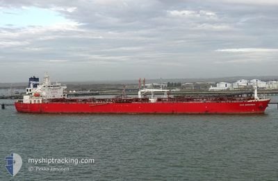
NAVE ANDROMEDA
Crude Oil Tanker
Current Trip
| Time Travelled | 2 days |
|---|---|
| Remaining Time | 1 day |
| Distance Travelled | 11.45 nm |
| Remaining Distance | 479.53 nm |
| AVG Speed | 6.5 Knots |
| MAX Speed | 8.5 Knots |
| AVG Wind | 4.9 knots |
| MAX Wind | 8 knots |
| MIN Temp | 25.9°C / 78.62°F |
| MAX Temp | 27.6°C / 81.68°F |
| Draught | 8.2 m |
| Position Received | 2 m ago |
Current Position
| Longitude | 56.51540° |
|---|---|
| Latitude | 25.16628° |
| Status | At anchor |
| Speed | 0.1 Knots |
| Course | 153° |
| Area | Gulf of Oman |
| Station | T-AIS |
| Position Received | 2 m ago |
Info
Information
The current position of NAVE ANDROMEDA is in Gulf of Oman with coordinates 25.16628° / 56.51540° as reported on 2024-04-23 15:41 by AIS to our vessel tracker app. The vessel's current speed is 0.1 Knots and is heading at the port of RAS TANURA. The estimated time of arrival as calculated by MyShipTracking vessel tracking app is 2024-04-24 17:35 LT
The vessel NAVE ANDROMEDA (IMO: 9580405, MMSI: 636015407) is a Crude Oil Tanker that was built in 2011 ( 13 years old ). It's sailing under the flag of [LR] Liberia.
In this page you can find informations about the vessels current position, last detected port calls, and current voyage information. If the vessels is not in coverage by AIS you will find the latest position.
The current position of NAVE ANDROMEDA is detected by our AIS receivers and we are not responsible for the reliability of the data. The last position was recorded while the vessel was in Coverage by the Ais receivers of our vessel tracking app.
The current draught of NAVE ANDROMEDA as reported by AIS is 8.2 meters
Weather
| Temperature | 27.1°C / 80.78°F |
|---|---|
| Wind Speed | 8 knots |
| Direction | 166° SSE |
| Pressure | 1004.8 hPa |
| Humidity | 67.5 % |
| Cloud Coverage | 4 % |
Featured Company
Last Port Calls
| Port | Arrival | Departure | Time In Port |
|---|---|---|---|
| 2024-04-19 14:39 | 2024-04-21 08:33 | 1 d | |
| 2024-03-19 21:38 | 2024-03-21 23:09 | 2 d | |
| 2024-02-19 17:17 | 2024-02-20 21:42 | 1 d | |
| 2024-02-16 02:30 | 2024-02-19 05:55 | 3 d | |
| 2024-02-06 23:25 | 2024-02-09 16:49 | 2 d |
Last Trips
| Origin | Departure | Destination | Arrival | Distance | |
|---|---|---|---|---|---|
| 2024-03-22 07:09 | 2024-04-19 18:39 | 6111.41 nm | |||
| 2024-02-21 05:42 | 2024-03-20 05:38 | 4096.67 nm | |||
| 2024-02-19 13:55 | 2024-02-20 01:17 | 14.48 nm | |||
| 2024-02-10 00:49 | 2024-02-16 10:30 | 1687.24 nm | |||
| 2024-01-26 20:59 | 2024-02-07 07:25 | 923.53 nm |
Events
| Time | Event | Details | Position / Dest | Info |
|---|---|---|---|---|
| 2024-04-23 14:26 | Status Changed | At anchor Default |
25.16606 / 56.51501
AE FJR<<>>SA RTA
|
Speed: Course: 140° |
| 2024-04-23 14:23 | Status Changed | Default At anchor |
25.16605 / 56.51498
AE FJR<<>>SA RTA
|
Speed: Course: 137° |
| 2024-04-23 14:02 | Status Changed | At anchor Default |
25.16587 / 56.51481
AE FJR<<>>SA RTA
|
Speed: Course: 133° |
| 2024-04-23 13:59 | Status Changed | Default At anchor |
25.16587 / 56.51478
AE FJR<<>>SA RTA
|
Speed: 0.1 kn Course: 134° |
| 2024-04-23 10:26 | Status Changed | At anchor Default |
25.16484 / 56.51457
AE FJR<<>>SA RTA
|
Speed: Course: 103° |
| 2024-04-23 10:23 | Status Changed | Default At anchor |
25.16479 / 56.51465
AE FJR<<>>SA RTA
|
Speed: Course: 103° |
| 2024-04-23 10:02 | Status Changed | At anchor Default |
25.16457 / 56.51463
AE FJR<<>>SA RTA
|
Speed: 0.1 kn Course: 93° |
| 2024-04-23 09:59 | Status Changed | Default At anchor |
25.16452 / 56.51463
AE FJR<<>>SA RTA
|
Speed: Course: 93° |
| 2024-04-23 09:38 | Status Changed | At anchor Default |
25.16449 / 56.51452
AE FJR<<>>SA RTA
|
Speed: Course: 92° |
| 2024-04-23 09:35 | Status Changed | Default At anchor |
25.16449 / 56.51453
AE FJR<<>>SA RTA
|
Speed: Course: 91° |