
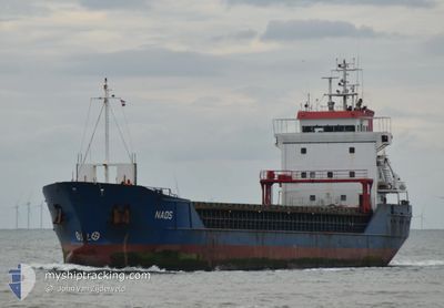
NAOS
General Cargo
Current Trip
| Time Travelled | 4 days |
|---|---|
| Remaining Time | 5 days |
| Distance Travelled | 279.76 nm |
| Remaining Distance | 893.88 nm |
| AVG Speed | 7.8 Knots |
| MAX Speed | 12.3 Knots |
| AVG Wind | 18.5 knots |
| MAX Wind | 38.3 knots |
| MIN Temp | 4.4°C / 39.92°F |
| MAX Temp | 14.1°C / 57.38°F |
| Draught | 6.1 m |
| Position Received | 3 m ago |
Current Position
| Longitude | --- |
|---|---|
| Latitude | --- |
| Status | Under way using engine |
| Speed | 9 Knots |
| Course | 308.2° |
| Area | English Channel |
| Station | T-AIS |
| Position Received | 3 m ago |
Info
Information
The current position of NAOS is in English Channel with coordinates 49.88543° / -1.33216° as reported on 2025-12-09 01:48 by AIS to our vessel tracker app. The vessel's current speed is 9 Knots and is heading at the port of SETUBAL. The estimated time of arrival as calculated by MyShipTracking vessel tracking app is 2025-12-14 04:31 LT
The vessel NAOS (IMO: 9136137, MMSI: 305269000) is a General Cargo that was built in 1996 ( 29 years old ). It's sailing under the flag of [AG] Antigua Barbuda.
In this page you can find informations about the vessels current position, last detected port calls, and current voyage information. If the vessels is not in coverage by AIS you will find the latest position.
The current position of NAOS is detected by our AIS receivers and we are not responsible for the reliability of the data. The last position was recorded while the vessel was in Coverage by the Ais receivers of our vessel tracking app.
The current draught of NAOS as reported by AIS is 6.1 meters
Weather
| Temperature | 13.1°C / 55.58°F |
|---|---|
| Wind Speed | 21 knots |
| Direction | 175° S |
| Pressure | 1008.5 hPa |
| Humidity | 83.1 % |
| Cloud Coverage | 100 % |
Featured Company
Last Port Calls
| Port | Arrival | Departure | Time In Port |
|---|---|---|---|
| 2025-12-02 16:02 | 2025-12-04 14:27 | 1 d | |
| 2025-11-30 01:13 | 2025-12-01 22:36 | 1 d | |
| 2025-11-24 09:37 | 2025-11-25 06:09 | 20 h | |
| 2025-11-22 17:59 | 2025-11-24 00:46 | 1 d | |
| 2025-11-14 20:38 | 2025-11-20 05:42 | 5 d | |
| 2025-11-13 22:20 | 2025-11-14 19:23 | 21 h | |
| 2025-11-11 03:10 | 2025-11-11 18:45 | 15 h | |
| 2025-11-09 00:23 | 2025-11-09 16:41 | 16 h | |
| 2025-11-06 15:13 | 2025-11-07 07:02 | 15 h | |
| 2025-11-01 19:52 | 2025-11-05 17:12 | 3 d |
Last Trips
| Origin | Departure | Destination | Arrival | Distance | |
|---|---|---|---|---|---|
| 2025-12-01 22:36 | 2025-12-02 16:02 | 129.34 nm | |||
| 2025-11-25 06:09 | 2025-11-30 01:13 | 768.45 nm | |||
| 2025-11-24 00:46 | 2025-11-24 09:37 | 71.68 nm | |||
| 2025-11-20 05:42 | 2025-11-22 17:59 | 498.64 nm | |||
| 2025-11-14 19:23 | 2025-11-14 20:38 | 14.23 nm | |||
| 2025-11-11 18:45 | 2025-11-13 22:20 | 340.66 nm | |||
| 2025-11-09 16:41 | 2025-11-11 03:10 | 338.71 nm | |||
| 2025-11-07 07:02 | 2025-11-09 00:23 | 340.22 nm | |||
| 2025-11-05 17:12 | 2025-11-06 15:13 | 188.04 nm | |||
| 2025-10-31 21:41 | 2025-11-01 19:52 | 215.17 nm |
Events
| Time | Event | Details | Position / Dest | Info |
|---|---|---|---|---|
| 2025-12-09 01:39 | Status Changed | Under way using engine Default |
49.87069 / -1.30409
PT SET
|
Speed: 8.6 kn Course: 312° |
| 2025-12-09 01:35 | Status Changed | Default Under way using engine |
49.86459 / -1.29351
PT SET
|
Speed: 8.3 kn Course: 314.5° |
| 2025-12-09 01:28 | Status Changed | Under way using engine Default |
49.85414 / -1.27640
PT SET
|
Speed: 8.3 kn Course: 317° |
| 2025-12-09 01:11 | IN Coverage |
49.85414 / -1.27640
English Channel
PT SET
|
Speed: 8.4 kn Course: 317° |
|
| 2025-12-09 00:19 | Status Changed | Default Under way using engine |
49.73885 / -1.13719
PT SET
|
Speed: 6.9 kn Course: 329.4° |
| 2025-12-09 00:12 | OUT of Coverage |
49.72769 / -1.12724
English Channel
PT SET
|
Speed: 6.9 kn Course: 329.4° |
|
| 2025-12-08 23:48 | Status Changed | Under way using engine Default |
49.68681 / -1.09428
PT SET
|
Speed: 6.9 kn Course: 335° |
| 2025-12-08 23:11 | Status Changed | Default Under way using engine |
49.62071 / -1.05006
PT SET
|
Speed: 7 kn Course: 314.3° |
| 2025-12-08 23:05 | Status Changed | Under way using engine Default |
49.61034 / -1.04169
PT SET
|
Speed: 7.2 kn Course: 304° |
| 2025-12-08 23:03 | Status Changed | Default Under way using engine |
49.60792 / -1.03662
PT SET
|
Speed: 7.4 kn Course: 306.5° |