
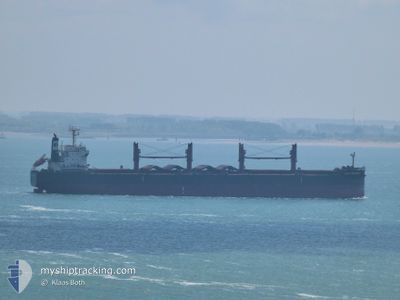
BULK FRIENDSHIP
Cargo
Current Trip
KEEP CLR UNDERWTROPS
| Time Travelled | 38 days |
|---|---|
| Remaining Time | --- |
| Distance Travelled | 5929.90 nm |
| Remaining Distance | --- |
| AVG Speed | 8.5 Knots |
| MAX Speed | 12.1 Knots |
| AVG Wind | 12.4 knots |
| MAX Wind | 31.3 knots |
| MIN Temp | 15.4°C / 59.72°F |
| MAX Temp | 31.3°C / 88.34°F |
| Draught | 11.9 m |
| Position Received | 4 d ago |
Current Position
| Longitude | 57.47608° |
|---|---|
| Latitude | -20.12512° |
| Status | At anchor |
| Speed | |
| Course | 249° |
| Area | Indian Ocean |
| Station | T-AIS |
| Position Received | 4 d ago |
Info
Information
The current position of BULK FRIENDSHIP is in Indian Ocean with coordinates -20.12512° / 57.47608° as reported on 2024-04-15 09:03 by AIS to our vessel tracker app. The vessel's current speed is 0 Knots
The vessel BULK FRIENDSHIP (IMO: 9496977, MMSI: 353421000) is a Cargo It's sailing under the flag of [PA] Panama.
In this page you can find informations about the vessels current position, last detected port calls, and current voyage information. If the vessels is not in coverage by AIS you will find the latest position.
The current position of BULK FRIENDSHIP is detected by our AIS receivers and we are not responsible for the reliability of the data. The last position was recorded while the vessel was in Coverage by the Ais receivers of our vessel tracking app.
The current draught of BULK FRIENDSHIP as reported by AIS is 11.9 meters
Weather
| Temperature | 28.6°C / 83.48°F |
|---|---|
| Wind Speed | 17 knots |
| Direction | 111° ESE |
| Pressure | 1009 hPa |
| Humidity | 67.1 % |
| Cloud Coverage | 75 % |
Featured Company
Most Visited Ports (Last year)
| Port | Arrivals | |
|---|---|---|
| 2 | ||
| 2 | ||
| 1 | ||
| 1 | ||
| 1 | ||
| 1 |
Events
| Time | Event | Details | Position / Dest | Info |
|---|---|---|---|---|
| 2024-04-15 23:57 | START Moving | 1.12 nm, North West of PORT LOUIS |
-20.12544 / 57.47101
KEEP CLR UNDERWTROPS
|
Speed: 4.3 kn Course: 306° |
| 2024-04-15 09:07 | Status Changed | Default At anchor |
-20.12500 / 57.47500
KEEP CLR UNDERWTROPS
|
Speed: Course: 249° |
| 2024-04-15 09:03 | Status Changed | At anchor Default |
-20.12512 / 57.47608
KEEP CLR UNDERWTROPS
|
Speed: Course: -1° |
| 2024-04-15 09:03 | OUT of Coverage |
-20.12512 / 57.47608
Indian Ocean
|
Speed: Course: 92.6° |
|
| 2024-04-15 08:46 | IN Coverage |
-20.12512 / 57.47608
Indian Ocean
|
Speed: Course: 92.6° |
|
| 2024-04-14 10:52 | Status Changed | Default At anchor |
-20.12833 / 57.47333
KEEP CLR UNDERWTROPS
|
Speed: Course: 10° |
| 2024-04-14 10:45 | Status Changed | At anchor Default |
-20.12841 / 57.47407
KEEP CLR UNDERWTROPS
|
Speed: Course: -1° |
| 2024-04-14 10:45 | OUT of Coverage |
-20.12841 / 57.47407
Indian Ocean
|
Speed: Course: 129.9° |
|
| 2024-04-14 10:40 | IN Coverage |
-20.12841 / 57.47407
Indian Ocean
|
Speed: Course: 129.9° |
|
| 2024-04-14 10:15 | Draught Changed | 11.9 12 |
-20.12667 / 57.47333
KEEP CLR UNDERWTROPS
|
Speed: Course: -1° |