
MYRTOS
Crude Oil Tanker
Current Trip
| Time Travelled | 5 days |
|---|---|
| Remaining Time | 6 days |
| Distance Travelled | 1584.05 nm |
| Remaining Distance | 1621.94 nm |
| AVG Speed | 11.7 Knots |
| MAX Speed | 11.7 Knots |
| AVG Wind | 5.8 knots |
| MAX Wind | 14.8 knots |
| MIN Temp | 24.6°C / 76.28°F |
| MAX Temp | 28.7°C / 83.66°F |
| Draught | 12.7 m |
| Position Received | 4 d ago |
Current Position
| Longitude | 57.15292° |
|---|---|
| Latitude | 24.69158° |
| Status | Under way using engine |
| Speed | 12.5 Knots |
| Course | 144.9° |
| Area | Gulf of Oman |
| Station | T-AIS |
| Position Received | 4 d ago |
Info
Information
The current position of MYRTOS is in Gulf of Oman with coordinates 24.69158° / 57.15292° as reported on 2024-04-21 03:43 by AIS to our vessel tracker app. The vessel's current speed is 12.5 Knots and is heading at the port of SUEZ CANAL. The estimated time of arrival as calculated by MyShipTracking vessel tracking app is 2024-05-01 08:25 LT
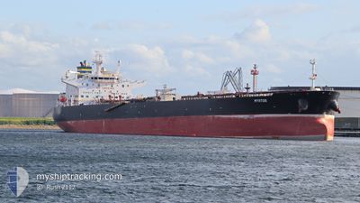
The vessel MYRTOS (IMO: 9389100, MMSI: 249592000) is a Crude Oil Tanker that was built in 2009 ( 15 years old ). It's sailing under the flag of [MT] Malta.
In this page you can find informations about the vessels current position, last detected port calls, and current voyage information. If the vessels is not in coverage by AIS you will find the latest position.
The current position of MYRTOS is detected by our AIS receivers and we are not responsible for the reliability of the data. The last position was recorded while the vessel was in Coverage by the Ais receivers of our vessel tracking app.
The current draught of MYRTOS as reported by AIS is 12.7 meters
Weather
| Temperature | 28.3°C / 82.94°F |
|---|---|
| Wind Speed | 8 knots |
| Direction | 96° E |
| Pressure | 1009.1 hPa |
| Humidity | 76.3 % |
| Cloud Coverage | 10 % |
Featured Company
Last Port Calls
| Port | Arrival | Departure | Time In Port |
|---|---|---|---|
| 2024-04-18 07:57 | 2024-04-19 07:21 | 23 h | |
| 2024-04-01 05:08 | 2024-04-01 14:50 | 9 h | |
| 2024-03-16 12:42 | 2024-03-19 21:41 | 3 d | |
| 2024-03-08 09:59 | 2024-03-09 15:48 | 1 d | |
| 2024-02-15 01:57 | 2024-02-17 12:45 | 2 d |
Most Visited Ports (Last year)
| Port | Arrivals | |
|---|---|---|
| 4 | ||
| 2 | ||
| 2 | ||
| 2 | ||
| 2 | ||
| 1 |
Last Trips
| Origin | Departure | Destination | Arrival | Distance | |
|---|---|---|---|---|---|
| 2024-03-19 22:41 | 2024-04-18 10:57 | 7041.59 nm | |||
| 2024-03-19 22:41 | 2024-04-01 07:08 | 3397.99 nm | |||
| 2024-03-09 16:48 | 2024-03-16 13:42 | 801.13 nm | |||
| 2024-02-17 06:45 | 2024-03-08 10:59 | 5046.71 nm | |||
| 2024-01-17 05:24 | 2024-02-14 19:57 | 5546.65 nm |
Events
| Time | Event | Details | Position / Dest | Info |
|---|---|---|---|---|
| 2024-04-21 03:47 | Status Changed | Default Under way using engine |
24.67994 / 57.16256
EG SUZ
|
Speed: 12.5 kn Course: 144.9° |
| 2024-04-21 03:43 | OUT of Coverage |
24.69158 / 57.15292
Gulf of Oman
EG SUZ
|
Speed: 12.5 kn Course: 144.9° |
|
| 2024-04-21 01:29 | Change Sea Area | Omani part of the Gulf of Oman United Arab Emirates part of the Gulf of Oman |
25.06798 / 56.91076
Gulf of Oman
EG SUZ
|
Speed: 11.7 kn Course: 172.5° |
| 2024-04-20 22:35 | Change Sea Area | United Arab Emirates part of the Gulf of Oman Omani part of the Gulf of Oman |
25.66108 / 56.80978
Gulf of Oman
EG SUZ
|
Speed: 12.3 kn Course: 173.8° |
| 2024-04-20 21:23 | Change Sea Area | Omani part of the Gulf of Oman Omani part of the Persian Gulf |
25.90489 / 56.75841
Gulf of Oman
EG SUZ
|
Speed: 12.4 kn Course: 185.5° |
| 2024-04-20 21:21 | Status Changed | Under way using engine Default |
25.91304 / 56.75891
EG SUZ
|
Speed: 12.5 kn Course: 181° |
| 2024-04-20 21:04 | IN Coverage |
25.90489 / 56.75841
Gulf of Oman
EG SUZ
|
Speed: 12.4 kn Course: 185.5° |
|
| 2024-04-20 14:33 | Status Changed | Default Under way using engine |
26.22348 / 55.97641
EG SUZ
|
Speed: 12.3 kn Course: 39.9° |
| 2024-04-20 14:24 | OUT of Coverage |
26.20047 / 55.95540
Persian Gulf
EG SUZ
|
Speed: 12.3 kn Course: 39.9° |
|
| 2024-04-20 14:11 | Change Sea Area | Omani part of the Persian Gulf United Arab Emirates part of the Persian Gulf |
26.16643 / 55.92335
Persian Gulf
EG SUZ
|
Speed: 12.2 kn Course: 42.1° |