
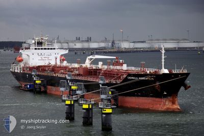
MTM DUBLIN
Oil/Chemical Tanker
Current Trip
| Time Travelled | 2 days |
|---|---|
| Remaining Time | 1 day |
| Distance Travelled | 452.71 nm |
| Remaining Distance | 424.75 nm |
| AVG Speed | 11.6 Knots |
| MAX Speed | 15.1 Knots |
| AVG Wind | 15.4 knots |
| MAX Wind | 33.8 knots |
| MIN Temp | 12.2°C / 53.96°F |
| MAX Temp | 22°C / 71.6°F |
| Draught | 8.6 m |
| Position Received | 1 m ago |
Current Position
| Longitude | 27.96640° |
|---|---|
| Latitude | 36.46423° |
| Status | Under way using engine |
| Speed | 12.3 Knots |
| Course | 78° |
| Area | Aegean Sea |
| Station | T-AIS |
| Position Received | 1 m ago |
Info
Information
The current position of MTM DUBLIN is in Aegean Sea with coordinates 36.46423° / 27.96640° as reported on 2024-04-24 01:32 by AIS to our vessel tracker app. The vessel's current speed is 12.3 Knots and is heading at the port of TOROS. The estimated time of arrival as calculated by MyShipTracking vessel tracking app is 2024-04-25 13:39 LT
The vessel MTM DUBLIN (IMO: 9335824, MMSI: 563104400) is a Oil/Chemical Tanker that was built in 2007 ( 17 years old ). It's sailing under the flag of [SG] Singapore.
In this page you can find informations about the vessels current position, last detected port calls, and current voyage information. If the vessels is not in coverage by AIS you will find the latest position.
The current position of MTM DUBLIN is detected by our AIS receivers and we are not responsible for the reliability of the data. The last position was recorded while the vessel was in Coverage by the Ais receivers of our vessel tracking app.
The current draught of MTM DUBLIN as reported by AIS is 8.6 meters
Weather
| Temperature | 21.5°C / 70.7°F |
|---|---|
| Wind Speed | 27 knots |
| Direction | 135° SE |
| Pressure | 1006.8 hPa |
| Humidity | 55 % |
| Cloud Coverage | 100 % |
Featured Company
Last Port Calls
| Port | Arrival | Departure | Time In Port |
|---|---|---|---|
| 2024-04-17 06:13 | 2024-04-21 19:53 | 4 d | |
| 2024-04-15 04:28 | 2024-04-15 16:19 | 11 h | |
| 2024-04-13 12:46 | 2024-04-15 02:54 | 1 d | |
| 2024-03-13 17:42 | 2024-03-15 12:53 | 1 d | |
| 2024-03-10 15:33 | 2024-03-12 15:39 | 2 d | |
| 2024-02-25 07:10 | 2024-02-25 10:33 | 3 h | |
| 2024-02-19 04:06 | 2024-02-20 05:23 | 1 d | |
| 2024-02-07 12:31 | 2024-02-09 18:51 | 2 d |
Most Visited Ports (Last year)
| Port | Arrivals | |
|---|---|---|
| 6 | ||
| 3 | ||
| 2 | ||
| 2 | ||
| 2 | ||
| 1 |
Last Trips
| Origin | Departure | Destination | Arrival | Distance | |
|---|---|---|---|---|---|
| 2024-04-15 19:19 | 2024-04-17 09:13 | 94.96 nm | |||
| 2024-04-15 05:54 | 2024-04-15 07:28 | 14.47 nm | |||
| 2024-03-15 07:53 | 2024-04-13 15:46 | 6888.33 nm | |||
| 2024-03-12 10:39 | 2024-03-13 12:42 | 246.80 nm | |||
| 2024-02-25 05:33 | 2024-03-10 10:33 | 2338.19 nm | |||
| 2024-02-20 00:23 | 2024-02-25 02:10 | 789.03 nm | |||
| 2024-02-09 12:51 | 2024-02-18 23:06 | 2030.62 nm | |||
| 2023-12-15 15:28 | 2024-02-07 06:31 | 10961.96 nm |
Events
| Time | Event | Details | Position / Dest | Info |
|---|---|---|---|---|
| 2024-04-23 17:38 | Status Changed | Under way using engine Default |
36.92815 / 26.25138
YUMURTALIK
|
Speed: 10.1 kn Course: 118° |
| 2024-04-23 17:06 | Status Changed | Default Under way using engine |
36.99520 / 26.17822
YUMURTALIK
|
Speed: 10.2 kn Course: 149° |
| 2024-04-23 02:39 | ETA Changed | 2024/04/25 20:00 2024/04/25 06:00 |
39.61253 / 25.65070
YUMURTALIK
|
Speed: 13.2 kn Course: 199° |
| 2024-04-23 01:11 | Change Sea Area | Greek part of the Aegean Sea Turkish part of the Aegean Sea |
39.89740 / 25.84735
Aegean Sea
YUMURTALIK
|
Speed: 13.3 kn Course: 220° |
| 2024-04-23 00:52 | Status Changed | Under way using engine Default |
39.94868 / 25.90658
YUMURTALIK
|
Speed: 14.2 kn Course: 221° |
| 2024-04-23 00:32 | Status Changed | Default Under way using engine |
40.00638 / 25.97477
YUMURTALIK
|
Speed: 13.8 kn Course: 247° |
| 2024-04-23 00:28 | Status Changed | Under way using engine Default |
40.01670 / 25.99018
YUMURTALIK
|
Speed: 14.1 kn Course: 267° |
| 2024-04-23 00:16 | Status Changed | Default Under way using engine |
40.02163 / 26.05608
YUMURTALIK
|
Speed: 14.1 kn Course: 265° |
| 2024-04-22 23:52 | Change Sea Area | Turkish part of the Aegean Sea Turkish part of the Sea of Marmara |
40.02705 / 26.17350
Aegean Sea
YUMURTALIK
|
Speed: 14.1 kn Course: 260° |
| 2024-04-22 21:20 | Status Changed | Under way using engine Default |
40.39632 / 26.67985
YUMURTALIK
|
Speed: 9.2 kn Course: 234° |