
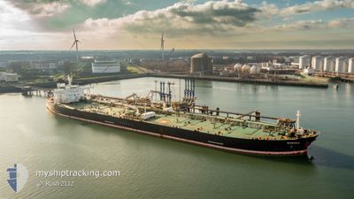
MT SAMURAI
Crude Oil Tanker
Current Trip
| Time Travelled | --- |
|---|---|
| Remaining Time | 1 h, 58 mins |
| Distance Travelled | 2723.97 nm |
| Remaining Distance | 16.19 nm |
| AVG Speed | 10.4 Knots |
| MAX Speed | 14.3 Knots |
| AVG Wind | 10 knots |
| MAX Wind | 31.7 knots |
| MIN Temp | 5.2°C / 41.36°F |
| MAX Temp | 30.2°C / 86.36°F |
| Draught | 8.8 m |
| Position Received | 1 m ago |
Current Position
| Longitude | 104.07250° |
|---|---|
| Latitude | 1.27872° |
| Status | Under way using engine |
| Speed | 6.9 Knots |
| Course | 260° |
| Area | Singapore Strait |
| Station | T-AIS |
| Position Received | 1 m ago |
Info
Information
The current position of MT SAMURAI is in Singapore Strait with coordinates 1.27872° / 104.07250° as reported on 2024-04-24 15:49 by AIS to our vessel tracker app. The vessel's current speed is 6.9 Knots and is heading at the port of SINGAPORE. The estimated time of arrival as calculated by MyShipTracking vessel tracking app is 2024-04-24 17:48 LT
The vessel MT SAMURAI (IMO: 9378876, MMSI: 636013852) is a Crude Oil Tanker that was built in 2009 ( 15 years old ). It's sailing under the flag of [LR] Liberia.
In this page you can find informations about the vessels current position, last detected port calls, and current voyage information. If the vessels is not in coverage by AIS you will find the latest position.
The current position of MT SAMURAI is detected by our AIS receivers and we are not responsible for the reliability of the data. The last position was recorded while the vessel was in Coverage by the Ais receivers of our vessel tracking app.
The current draught of MT SAMURAI as reported by AIS is 8.8 meters
Weather
| Temperature | 29.6°C / 85.28°F |
|---|---|
| Wind Speed | 9 knots |
| Direction | 102° ESE |
| Pressure | 1008.6 hPa |
| Humidity | 74.9 % |
| Cloud Coverage | 84 % |
Featured Company
Last Port Calls
| Port | Arrival | Departure | Time In Port |
|---|---|---|---|
| 2024-02-05 01:48 | 2024-02-06 01:43 | 23 h | |
| 2024-02-02 23:26 |
Most Visited Ports (Last year)
| Port | Arrivals | |
|---|---|---|
| 4 | ||
| 1 | ||
| 1 | ||
| 1 | ||
| 1 | ||
| 1 |
Last Trips
| Origin | Departure | Destination | Arrival | Distance | |
|---|---|---|---|---|---|
| 2024-02-03 03:26 | 2024-02-05 04:48 | 470.77 nm |
Events
| Time | Event | Details | Position / Dest | Info |
|---|---|---|---|---|
| 2024-04-24 14:36 | Draught Changed | 8.8 8.6 |
1.29090 / 104.22722
SINGAPORE
|
Speed: 7.6 kn Course: 262° |
| 2024-04-24 14:36 | Destination Changed | SINGAPORE ZOUSHAN,CHINA |
1.29090 / 104.22722
SINGAPORE
|
Speed: 7.6 kn Course: 262° |
| 2024-04-24 14:36 | ETA Changed | 2024/04/24 20:00 2024/03/02 11:00 |
1.29090 / 104.22722
SINGAPORE
|
Speed: 7.6 kn Course: 262° |
| 2024-04-24 13:50 | Change Sea Area | Malaysian part of the Singapore Strait Malaysian part of the South China Sea |
1.31677 / 104.33710
Singapore Strait
|
Speed: 10.1 kn Course: 239° |
| 2024-04-24 13:49 | Status Changed | Under way using engine Default |
1.31702 / 104.33752
ZOUSHAN,CHINA
|
Speed: 10.2 kn Course: 234° |
| 2024-04-24 13:44 | Status Changed | Default Under way using engine |
1.32628 / 104.34995
ZOUSHAN,CHINA
|
Speed: 11.9 kn Course: 229° |
| 2024-04-24 13:29 | Status Changed | Under way using engine Default |
1.35943 / 104.38800
ZOUSHAN,CHINA
|
Speed: 12 kn Course: 223° |
| 2024-04-24 13:20 | IN Coverage |
1.35525 / 104.38380
South China Sea
|
Speed: 12 kn Course: 226° |
|
| 2024-04-17 09:00 | START Moving | 7.59 nm, South of JINHAI HEAVY INDUSTR |
30.12873 / 122.25010
ZOUSHAN,CHINA
|
Speed: 3.5 kn Course: 135° |
| 2024-04-16 07:59 | STOP Moving | 7.16 nm, South of JINHAI HEAVY INDUSTR |
30.13590 / 122.24371
ZOUSHAN,CHINA
|
Speed: 0.2 kn Course: 120° |