
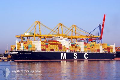
MSC TARANTO
Container Ship
Current Trip
| Time Travelled | 2 days |
|---|---|
| Remaining Time | 3 days |
| Distance Travelled | 1208.25 nm |
| Remaining Distance | 1483.95 nm |
| AVG Speed | 17.4 Knots |
| MAX Speed | 19.5 Knots |
| AVG Wind | 12.5 knots |
| MAX Wind | 20.6 knots |
| MIN Temp | 16°C / 60.8°F |
| MAX Temp | 20.3°C / 68.54°F |
| Draught | 15.4 m |
| Position Received | 1 d ago |
Current Position
| Longitude | -15.25426° |
|---|---|
| Latitude | 27.49451° |
| Status | Under way using engine |
| Speed | 16.4 Knots |
| Course | 201.2° |
| Area | North Atlantic Ocean |
| Station | T-AIS |
| Position Received | 1 d ago |
Info
Information
The current position of MSC TARANTO is in North Atlantic Ocean with coordinates 27.49451° / -15.25426° as reported on 2024-04-23 21:55 by AIS to our vessel tracker app. The vessel's current speed is 16.4 Knots and is heading at the port of ABIDJAN. The estimated time of arrival as calculated by MyShipTracking vessel tracking app is 2024-04-29 01:55 LT
The vessel MSC TARANTO (IMO: 9475258, MMSI: 636092247) is a Container Ship that was built in 2011 ( 13 years old ). It's sailing under the flag of [LR] Liberia.
In this page you can find informations about the vessels current position, last detected port calls, and current voyage information. If the vessels is not in coverage by AIS you will find the latest position.
The current position of MSC TARANTO is detected by our AIS receivers and we are not responsible for the reliability of the data. The last position was recorded while the vessel was in Coverage by the Ais receivers of our vessel tracking app.
The current draught of MSC TARANTO as reported by AIS is 15.4 meters
Weather
| Temperature | 19.4°C / 66.92°F |
|---|---|
| Wind Speed | 12 knots |
| Direction | 349° N |
| Pressure | 1011 hPa |
| Humidity | 87.1 % |
| Cloud Coverage | 45 % |
Featured Company
Last Port Calls
| Port | Arrival | Departure | Time In Port |
|---|---|---|---|
| 2024-04-21 15:42 | 2024-04-22 07:43 | 16 h | |
| 2024-04-19 05:41 | 2024-04-19 22:58 | 17 h | |
| 2024-04-17 06:23 | 2024-04-18 04:34 | 22 h | |
| 2024-04-15 00:07 | 2024-04-16 20:06 | 1 d | |
| 2024-04-11 12:10 | 2024-04-12 02:58 | 14 h | |
| 2024-04-08 09:19 | 2024-04-10 17:43 | 2 d | |
| 2024-04-04 21:12 | 2024-04-08 05:27 | 3 d | |
| 2024-03-29 22:33 | 2024-04-02 01:37 | 3 d | |
| 2024-03-18 14:50 | 2024-03-20 07:32 | 1 d | |
| 2024-02-22 20:48 | 2024-02-24 11:02 | 1 d |
Last Trips
| Origin | Departure | Destination | Arrival | Distance | |
|---|---|---|---|---|---|
| 2024-04-20 00:58 | 2024-04-21 16:42 | 354.42 nm | |||
| 2024-04-18 06:34 | 2024-04-19 07:41 | 358.64 nm | |||
| 2024-04-16 22:06 | 2024-04-17 08:23 | 161.45 nm | |||
| 2024-04-12 04:58 | 2024-04-15 02:07 | 222.52 nm | |||
| 2024-04-10 19:43 | 2024-04-11 14:10 | 234.97 nm | |||
| 2024-04-08 07:27 | 2024-04-08 11:19 | 52.86 nm | |||
| 2024-04-02 03:37 | 2024-04-04 23:12 | 496.59 nm | |||
| 2024-03-20 07:32 | 2024-03-29 23:33 | 4065.97 nm | |||
| 2024-02-24 19:02 | 2024-03-18 14:50 | 8185.06 nm | |||
| 2024-02-19 09:16 | 2024-02-23 04:48 | 1483.00 nm |
Events
| Time | Event | Details | Position / Dest | Info |
|---|---|---|---|---|
| 2024-04-23 22:02 | Status Changed | Default Under way using engine |
27.46291 / -15.26821
CIABJ
|
Speed: 16.4 kn Course: 201.2° |
| 2024-04-23 21:55 | OUT of Coverage |
27.49451 / -15.25426
North Atlantic Ocean
CIABJ
|
Speed: 16.4 kn Course: 201.2° |
|
| 2024-04-23 19:16 | Destination Changed | CIABJ TGLFW |
28.19308 / -14.97977
CIABJ
|
Speed: 16.8 kn Course: 198.8° |
| 2024-04-23 19:16 | ETA Changed | 2024/04/29 06:00 2024/04/29 03:00 |
28.19308 / -14.97977
CIABJ
|
Speed: 16.8 kn Course: 198.8° |
| 2024-04-23 16:23 | Status Changed | Under way using engine Default |
28.93947 / -14.59468
TGLFW
|
Speed: 18.7 kn Course: 207° |
| 2024-04-23 16:14 | Status Changed | Default Under way using engine |
28.98120 / -14.57048
TGLFW
|
Speed: 18.7 kn Course: 206.9° |
| 2024-04-23 13:52 | Status Changed | Under way using engine Default |
29.65605 / -14.20207
TGLFW
|
Speed: 19.3 kn Course: 206° |
| 2024-04-23 13:36 | Status Changed | Default Under way using engine |
29.73333 / -14.15833
TGLFW
|
Speed: 19.2 kn Course: 205.3° |
| 2024-04-23 13:29 | Status Changed | Under way using engine Default |
29.76899 / -14.14012
TGLFW
|
Speed: 19 kn Course: 204° |
| 2024-04-23 13:24 | Status Changed | Default Under way using engine |
29.79167 / -14.12667
TGLFW
|
Speed: 19 kn Course: 204.9° |