
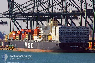
MSC SORAYA
Container Ship
Current Trip
| Time Travelled | 3 days |
|---|---|
| Remaining Time | --- |
| Distance Travelled | 1015.50 nm |
| Remaining Distance | 3052.54 nm |
| AVG Speed | 13.9 Knots |
| MAX Speed | 21.4 Knots |
| AVG Wind | 8.9 knots |
| MAX Wind | 16.9 knots |
| MIN Temp | 23.9°C / 75.02°F |
| MAX Temp | 28°C / 82.4°F |
| Draught | 13.3 m |
| Position Received | 2 d ago |
Current Position
| Longitude | 31.50366° |
|---|---|
| Latitude | -29.72184° |
| Status | Under way using engine |
| Speed | 14 Knots |
| Course | 60.6° |
| Area | Indian Ocean |
| Station | T-AIS |
| Position Received | 2 d ago |
Info
Information
The current position of MSC SORAYA is in Indian Ocean with coordinates -29.72184° / 31.50366° as reported on 2024-04-22 13:48 by AIS to our vessel tracker app. The vessel's current speed is 14 Knots and is heading at the port of JEBEL ALI. The estimated time of arrival as calculated by MyShipTracking vessel tracking app is 2024-05-05 01:00 LT
The vessel MSC SORAYA (IMO: 9372494, MMSI: 370271000) is a Container Ship that was built in 2008 ( 16 years old ). It's sailing under the flag of [PA] Panama.
In this page you can find informations about the vessels current position, last detected port calls, and current voyage information. If the vessels is not in coverage by AIS you will find the latest position.
The current position of MSC SORAYA is detected by our AIS receivers and we are not responsible for the reliability of the data. The last position was recorded while the vessel was in Coverage by the Ais receivers of our vessel tracking app.
The current draught of MSC SORAYA as reported by AIS is 13.3 meters
Weather
| Temperature | 28°C / 82.4°F |
|---|---|
| Wind Speed | 16 knots |
| Direction | 199° SSW |
| Pressure | 1010.6 hPa |
| Humidity | 65.8 % |
| Cloud Coverage | 69 % |
Featured Company
Last Port Calls
| Port | Arrival | Departure | Time In Port |
|---|---|---|---|
| 2024-04-15 16:58 | 2024-04-22 11:56 | 6 d | |
| 2024-04-07 08:40 | 2024-04-11 09:08 | 4 d | |
| 2024-03-18 01:02 | 2024-03-19 00:19 | 23 h | |
| 2024-03-15 01:04 | 2024-03-15 23:27 | 22 h | |
| 2024-03-10 11:07 | 2024-03-11 06:25 | 19 h | |
| 2024-03-07 16:53 | 2024-03-08 21:55 | 1 d | |
| 2024-03-05 00:12 | 2024-03-06 13:23 | 1 d | |
| 2024-03-03 11:08 | 2024-03-04 11:20 | 1 d | |
| 2024-03-01 01:00 | 2024-03-02 03:04 | 1 d | |
| 2024-02-23 22:52 | 2024-02-25 09:25 | 1 d |
Most Visited Ports (Last year)
| Port | Arrivals | |
|---|---|---|
| 5 | ||
| 4 | ||
| 4 | ||
| 4 | ||
| 3 | ||
| 3 |
Last Trips
| Origin | Departure | Destination | Arrival | Distance | |
|---|---|---|---|---|---|
| 2024-04-11 11:08 | 2024-04-15 18:58 | 548.78 nm | |||
| 2024-03-19 00:19 | 2024-04-07 10:40 | 5274.55 nm | |||
| 2024-03-15 23:27 | 2024-03-18 01:02 | 685.63 nm | |||
| 2024-03-11 07:25 | 2024-03-15 01:04 | 1003.45 nm | |||
| 2024-03-08 22:55 | 2024-03-10 12:07 | 561.11 nm | |||
| 2024-03-06 14:23 | 2024-03-07 17:53 | 437.89 nm | |||
| 2024-03-04 11:20 | 2024-03-05 01:12 | 180.75 nm | |||
| 2024-03-02 04:04 | 2024-03-03 11:08 | 188.21 nm | |||
| 2024-02-25 09:25 | 2024-03-01 02:00 | 1778.24 nm | |||
| 2024-02-12 05:44 | 2024-02-23 22:52 | 4944.81 nm |
Events
| Time | Event | Details | Position / Dest | Info |
|---|---|---|---|---|
| 2024-04-22 13:55 | Status Changed | Default Under way using engine |
-29.71053 / 31.52970
JEBELALI
|
Speed: 14 kn Course: 60.6° |
| 2024-04-22 13:48 | OUT of Coverage |
-29.72184 / 31.50366
Indian Ocean
JEBELALI
|
Speed: 14 kn Course: 60.6° |
|
| 2024-04-22 13:38 | Status Changed | Under way using engine Default |
-29.74042 / 31.46014
JEBELALI
|
Speed: 14 kn Course: 66° |
| 2024-04-22 13:30 | Status Changed | Default Under way using engine |
-29.75313 / 31.42777
JEBELALI
|
Speed: 14 kn Course: 62.8° |
| 2024-04-22 12:52 | Destination Changed | JEBELALI DURBAN |
-29.81399 / 31.27591
JEBELALI
|
Speed: 13.6 kn Course: 65.4° |
| 2024-04-22 12:52 | ETA Changed | 2024/05/05 01:00 2024/04/15 04:00 |
-29.81399 / 31.27591
JEBELALI
|
Speed: 13.6 kn Course: 65.4° |
| 2024-04-22 11:56 | PORT DEPARTURE |
|
-29.86766 / 31.05860
DURBAN
|
Speed: 6.8 kn Course: 39° |
| 2024-04-22 11:47 | Status Changed | Under way using engine Default |
-29.87861 / 31.04365
[ZA] DURBAN
|
Speed: 6.5 kn Course: 121° |
| 2024-04-22 11:43 | START Moving |
-29.87552 / 31.03554
[ZA] DURBAN
|
Speed: 6.5 kn Course: 121° |
|
| 2024-04-22 11:35 | STOP Moving |
-29.87245 / 31.03140
[ZA] DURBAN
|
Speed: 0.2 kn Course: 181° |