
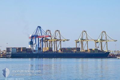
MSC QINGDAO
Cargo
Current Trip
| Time Travelled | 4 days |
|---|---|
| Remaining Time | 6 h, 18 mins |
| Distance Travelled | 1574.46 nm |
| Remaining Distance | 236.37 nm |
| AVG Speed | 14.2 Knots |
| MAX Speed | 16.9 Knots |
| AVG Wind | 8.1 knots |
| MAX Wind | 27.8 knots |
| MIN Temp | 15.2°C / 59.36°F |
| MAX Temp | 18.9°C / 66.02°F |
| Draught | 15 m |
| Position Received | 9 h, 17 m ago |
Current Position
| Longitude | -12.32412° |
|---|---|
| Latitude | 31.00122° |
| Status | Under way using engine |
| Speed | 15 Knots |
| Course | 227° |
| Area | North Atlantic Ocean |
| Station | T-AIS |
| Position Received | 9 h, 17 m ago |
Info
Information
The current position of MSC QINGDAO is in North Atlantic Ocean with coordinates 31.00122° / -12.32412° as reported on 2024-04-19 05:10 by AIS to our vessel tracker app. The vessel's current speed is 15 Knots and is heading at the port of LAS PALMAS. The estimated time of arrival as calculated by MyShipTracking vessel tracking app is 2024-04-19 20:45 LT
The vessel MSC QINGDAO (IMO: 925647000, MMSI: 636019331) is a Cargo It's sailing under the flag of [LR] Liberia.
In this page you can find informations about the vessels current position, last detected port calls, and current voyage information. If the vessels is not in coverage by AIS you will find the latest position.
The current position of MSC QINGDAO is detected by our AIS receivers and we are not responsible for the reliability of the data. The last position was recorded while the vessel was in Coverage by the Ais receivers of our vessel tracking app.
The current draught of MSC QINGDAO as reported by AIS is 15 meters
Weather
| Temperature | 19.8°C / 67.64°F |
|---|---|
| Wind Speed | 11 knots |
| Direction | 349° N |
| Pressure | 1017 hPa |
| Humidity | 76.1 % |
| Cloud Coverage | 81 % |
Featured Company
Last Port Calls
| Port | Arrival | Departure | Time In Port |
|---|---|---|---|
| 2024-04-13 09:50 | 2024-04-15 00:00 | 1 d | |
| 2024-04-10 01:01 | 2024-04-11 18:07 | 1 d | |
| 2024-04-05 19:27 | 2024-04-08 06:49 | 2 d | |
| 2024-03-23 20:11 | 2024-03-24 19:35 | 23 h | |
| 2024-03-21 01:48 | 2024-03-22 14:12 | 1 d | |
| 2024-03-18 09:26 | 2024-03-19 04:28 | 19 h | |
| 2024-03-16 08:53 | 2024-03-17 05:59 | 21 h | |
| 2024-03-13 08:40 | 2024-03-15 00:15 | 1 d | |
| 2024-03-02 00:09 | 2024-03-02 18:32 | 18 h | |
| 2024-02-28 19:54 | 2024-02-29 12:01 | 16 h |
Last Trips
| Origin | Departure | Destination | Arrival | Distance | |
|---|---|---|---|---|---|
| 2024-04-11 20:07 | 2024-04-13 11:50 | 685.60 nm | |||
| 2024-04-08 08:49 | 2024-04-10 03:01 | 215.23 nm | |||
| 2024-03-24 15:35 | 2024-04-05 21:27 | 4385.72 nm | |||
| 2024-03-22 10:12 | 2024-03-23 16:11 | 121.57 nm | |||
| 2024-03-19 00:28 | 2024-03-20 21:48 | 647.59 nm | |||
| 2024-03-17 01:59 | 2024-03-18 05:26 | 182.36 nm | |||
| 2024-03-14 20:15 | 2024-03-16 04:53 | 290.17 nm | |||
| 2024-03-02 19:32 | 2024-03-13 04:40 | 3540.13 nm | |||
| 2024-02-29 13:01 | 2024-03-02 01:09 | 404.71 nm | |||
| 2024-02-26 14:55 | 2024-02-28 20:54 | 511.59 nm |
Events
| Time | Event | Details | Position / Dest | Info |
|---|---|---|---|---|
| 2024-04-19 06:06 | Status Changed | Default Under way using engine |
30.83805 / -12.51667
ESLPA
|
Speed: 15 kn Course: 227° |
| 2024-04-19 05:10 | Status Changed | Under way using engine Default |
31.00122 / -12.32412
ESLPA
|
Speed: 15.2 kn Course: 226° |
| 2024-04-19 05:10 | OUT of Coverage |
31.00122 / -12.32412
North Atlantic Ocean
ESLPA
|
Speed: 15 kn Course: 227° |
|
| 2024-04-19 04:54 | Status Changed | Default Under way using engine |
31.04717 / -12.26702
ESLPA
|
Speed: 15.3 kn Course: 225° |
| 2024-04-19 04:13 | Detected in Sea | Spanish (Canary Islands) part of the North Atlantic Ocean |
31.16828 / -12.12202
North Atlantic Ocean
ESLPA
|
Speed: 15.3 kn Course: 224° |
| 2024-04-19 01:21 | Status Changed | Under way using engine Default |
31.67827 / -11.51313
ESLPA
|
Speed: 15.3 kn Course: 225° |
| 2024-04-19 01:13 | Status Changed | Default Under way using engine |
31.70198 / -11.48455
ESLPA
|
Speed: 15.3 kn Course: 225° |
| 2024-04-18 22:24 | Status Changed | Under way using engine Default |
32.20798 / -10.87210
ESLPA
|
Speed: 15.1 kn Course: 225° |
| 2024-04-18 22:03 | Status Changed | Default Under way using engine |
32.26973 / -10.79786
ESLPA
|
Speed: 14.9 kn Course: 225° |
| 2024-04-18 19:17 | Status Changed | Under way using engine Default |
32.75538 / -10.20965
ESLPA
|
Speed: 15.1 kn Course: 226° |