
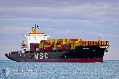
MSC PAOLA
Container Ship
Current Trip
| Time Travelled | 22 h, 27 mins |
|---|---|
| Remaining Time | --- |
| Distance Travelled | 20.64 nm |
| Remaining Distance | --- |
| AVG Speed | 4.6 Knots |
| MAX Speed | 9 Knots |
| AVG Wind | 4.5 knots |
| MAX Wind | 7 knots |
| MIN Temp | 27.6°C / 81.68°F |
| MAX Temp | 29.7°C / 85.46°F |
| Draught | 11.3 m |
| Position Received | Now |
Current Position
| Longitude | 103.51775° |
|---|---|
| Latitude | 1.16766° |
| Status | Under way using engine |
| Speed | 1 Knots |
| Course | 224° |
| Area | Singapore Strait |
| Station | T-AIS |
| Position Received | Now |
Info
Information
The current position of MSC PAOLA is in Singapore Strait with coordinates 1.16766° / 103.51775° as reported on 2024-04-19 07:25 by AIS to our vessel tracker app. The vessel's current speed is 1 Knots
The vessel MSC PAOLA (IMO: 9161297, MMSI: 636018318) is a Container Ship that was built in 1998 ( 26 years old ). It's sailing under the flag of [LR] Liberia.
In this page you can find informations about the vessels current position, last detected port calls, and current voyage information. If the vessels is not in coverage by AIS you will find the latest position.
The current position of MSC PAOLA is detected by our AIS receivers and we are not responsible for the reliability of the data. The last position was recorded while the vessel was in Coverage by the Ais receivers of our vessel tracking app.
The current draught of MSC PAOLA as reported by AIS is 11.3 meters
Weather
| Temperature | 29.3°C / 84.74°F |
|---|---|
| Wind Speed | 7 knots |
| Direction | 171° S |
| Pressure | 1006.4 hPa |
| Humidity | 74.2 % |
| Cloud Coverage | 100 % |
Featured Company
Last Port Calls
| Port | Arrival | Departure | Time In Port |
|---|---|---|---|
| 2024-04-17 21:07 | 2024-04-18 08:59 | 11 h | |
| 2024-04-15 20:51 | 2024-04-16 05:35 | 8 h | |
| 2024-04-08 10:14 | 2024-04-08 17:00 | 6 h | |
| 2024-04-04 12:29 | 2024-04-05 05:24 | 16 h | |
| 2024-03-31 03:25 | 2024-03-31 19:56 | 16 h | |
| 2024-03-26 12:05 | 2024-03-27 18:38 | 1 d | |
| 2024-03-14 01:31 | 2024-03-14 10:06 | 8 h | |
| 2024-03-10 23:40 | 2024-03-11 10:22 | 10 h | |
| 2024-03-09 14:47 | 2024-03-10 06:18 | 15 h | |
| 2024-03-07 23:24 | 2024-03-08 22:19 | 22 h |
Most Visited Ports (Last year)
| Port | Arrivals | |
|---|---|---|
| 20 | ||
| 17 | ||
| 11 | ||
| 9 | ||
| 9 | ||
| 6 |
Last Trips
| Origin | Departure | Destination | Arrival | Distance | |
|---|---|---|---|---|---|
| 2024-04-16 13:35 | 2024-04-18 05:07 | 196.74 nm | |||
| 2024-04-09 01:00 | 2024-04-16 04:51 | 1816.10 nm | |||
| 2024-04-05 13:24 | 2024-04-08 18:14 | 948.13 nm | |||
| 2024-04-01 03:56 | 2024-04-04 20:29 | 521.17 nm | |||
| 2024-03-28 03:38 | 2024-03-31 11:25 | 793.72 nm | |||
| 2024-03-14 17:06 | 2024-03-26 21:05 | 2701.40 nm | |||
| 2024-03-11 18:22 | 2024-03-14 08:31 | 832.99 nm | |||
| 2024-03-10 14:18 | 2024-03-11 07:40 | 49.01 nm | |||
| 2024-03-09 06:19 | 2024-03-09 22:47 | 27.73 nm | |||
| 2024-03-02 16:48 | 2024-03-08 07:24 | 1009.33 nm |
Events
| Time | Event | Details | Position / Dest | Info |
|---|---|---|---|---|
| 2024-04-19 05:38 | IN Coverage |
1.14425 / 103.53188
Singapore Strait
SGSIN
|
Speed: 0.6 kn Course: 191° |
|
| 2024-04-19 04:24 | OUT of Coverage |
1.17810 / 103.53932
Singapore Strait
SGSIN
|
Speed: 3.5 kn Course: 243.9° |
|
| 2024-04-19 04:21 | START Moving | 10.11 nm, South West of JURONG ISLAND |
1.17789 / 103.54184
SGSIN
|
Speed: 3.1 kn Course: 273° |
| 2024-04-19 01:04 | STOP Moving | 11.03 nm, South of TANJUNG PELEPAS |
1.16413 / 103.53115
SGSIN
|
Speed: 0.3 kn Course: 270° |
| 2024-04-18 22:09 | IN Coverage |
1.19237 / 103.47835
Singapore Strait
SGSIN
|
Speed: 4.6 kn Course: 120.2° |
|
| 2024-04-18 20:53 | OUT of Coverage |
1.18380 / 103.49631
Singapore Strait
SGSIN
|
Speed: 1.1 kn Course: 284.9° |
|
| 2024-04-18 19:58 | Change Sea Area | Malaysian part of the Singapore Strait Indonesian part of the Singapore Strait |
1.17547 / 103.48971
Singapore Strait
SGSIN
|
Speed: 3.3 kn Course: 87.4° |
| 2024-04-18 19:50 | IN Coverage |
1.17538 / 103.47826
Singapore Strait
SGSIN
|
Speed: 6.4 kn Course: 89.3° |
|
| 2024-04-18 16:30 | OUT of Coverage |
1.15132 / 103.51190
Singapore Strait
SGSIN
|
Speed: 0.5 kn Course: 220° |
|
| 2024-04-18 16:23 | Change Sea Area | Indonesian part of the Singapore Strait Malaysian part of the Singapore Strait |
1.15111 / 103.51324
Singapore Strait
SGSIN
|
Speed: 0.6 kn Course: 230° |