
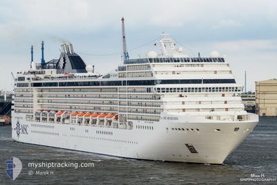
MSC ORCHESTRA
Passengers Ship
Current Trip
| Time Travelled | 2 days |
|---|---|
| Remaining Time | 3 h, 53 mins |
| Distance Travelled | 583.96 nm |
| Remaining Distance | 48.28 nm |
| AVG Speed | 12 Knots |
| MAX Speed | 19.6 Knots |
| AVG Wind | 12.4 knots |
| MAX Wind | 33.8 knots |
| MIN Temp | 7.5°C / 45.5°F |
| MAX Temp | 14.2°C / 57.56°F |
| Draught | 7.9 m |
| Position Received | 1 m ago |
Current Position
| Longitude | 8.48354° |
|---|---|
| Latitude | 43.70567° |
| Status | Under way using engine |
| Speed | 11.6 Knots |
| Course | 33.9° |
| Area | Ligurian Sea |
| Station | T-AIS |
| Position Received | 1 m ago |
Info
Information
The current position of MSC ORCHESTRA is in Ligurian Sea with coordinates 43.70567° / 8.48354° as reported on 2024-04-23 23:59 by AIS to our vessel tracker app. The vessel's current speed is 11.6 Knots and is heading at the port of GENOVA. The estimated time of arrival as calculated by MyShipTracking vessel tracking app is 2024-04-24 03:53 LT
The vessel MSC ORCHESTRA (IMO: 9320099, MMSI: 372497000) is a Passengers Ship that was built in 2007 ( 17 years old ). It's sailing under the flag of [PA] Panama.
In this page you can find informations about the vessels current position, last detected port calls, and current voyage information. If the vessels is not in coverage by AIS you will find the latest position.
The current position of MSC ORCHESTRA is detected by our AIS receivers and we are not responsible for the reliability of the data. The last position was recorded while the vessel was in Coverage by the Ais receivers of our vessel tracking app.
The current draught of MSC ORCHESTRA as reported by AIS is 7.9 meters
Weather
| Temperature | 10.4°C / 50.72°F |
|---|---|
| Wind Speed | 18 knots |
| Direction | 1° N |
| Pressure | 1007.6 hPa |
| Humidity | 74.2 % |
| Cloud Coverage | 100 % |
Featured Company
Last Port Calls
| Port | Arrival | Departure | Time In Port |
|---|---|---|---|
| 2024-04-21 05:46 | 2024-04-21 16:44 | 10 h | |
| 2024-04-19 05:19 | 2024-04-19 17:59 | 12 h | |
| 2024-04-18 10:07 | 2024-04-18 19:10 | 9 h | |
| 2024-04-17 07:19 | 2024-04-17 16:46 | 9 h | |
| 2024-04-16 03:22 | 2024-04-16 17:38 | 14 h | |
| 2024-04-15 05:00 | 2024-04-15 17:20 | 12 h | |
| 2024-04-13 05:04 | 2024-04-13 16:32 | 11 h | |
| 2024-04-12 09:03 | 2024-04-12 19:14 | 10 h | |
| 2024-04-11 06:48 | 2024-04-11 16:08 | 9 h | |
| 2024-04-10 04:34 | 2024-04-10 17:19 | 12 h |
Last Trips
| Origin | Departure | Destination | Arrival | Distance | |
|---|---|---|---|---|---|
| 2024-04-19 19:59 | 2024-04-21 07:46 | 525.96 nm | |||
| 2024-04-18 21:10 | 2024-04-19 07:19 | 145.10 nm | |||
| 2024-04-17 18:46 | 2024-04-18 12:07 | 323.80 nm | |||
| 2024-04-16 19:38 | 2024-04-17 09:19 | 239.28 nm | |||
| 2024-04-15 19:20 | 2024-04-16 05:22 | 160.90 nm | |||
| 2024-04-13 18:32 | 2024-04-15 07:00 | 576.38 nm | |||
| 2024-04-12 21:14 | 2024-04-13 07:04 | 145.11 nm | |||
| 2024-04-11 18:08 | 2024-04-12 11:03 | 297.14 nm | |||
| 2024-04-10 19:19 | 2024-04-11 08:48 | 239.19 nm | |||
| 2024-04-08 17:11 | 2024-04-09 07:12 | 242.16 nm |
Events
| Time | Event | Details | Position / Dest | Info |
|---|---|---|---|---|
| 2024-04-23 23:15 | Status Changed | Under way using engine Default |
43.58574 / 8.37180
ITGOA
|
Speed: 11.8 kn Course: 29° |
| 2024-04-23 23:08 | Status Changed | Default Under way using engine |
43.56567 / 8.35505
ITGOA
|
Speed: 11.7 kn Course: 30.9° |
| 2024-04-23 22:39 | Change Sea Area | Italian part of the Ligurian Sea Italian part of the Mediterranean Sea - Western Basin |
43.48992 / 8.28577
Ligurian Sea
ITGOA
|
Speed: 11.5 kn Course: 34° |
| 2024-04-23 22:14 | Change Sea Area | Italian part of the Mediterranean Sea - Western Basin French part of the Ligurian Sea |
43.41081 / 8.28698
Mediterranean Sea - Western Basin
ITGOA
|
Speed: 11.8 kn Course: 324.5° |
| 2024-04-23 22:14 | Status Changed | Under way using engine Default |
43.41081 / 8.28698
ITGOA
|
Speed: 11.9 kn Course: 318° |
| 2024-04-23 21:58 | IN Coverage |
43.41081 / 8.28698
Mediterranean Sea - Western Basin
ITGOA
|
Speed: 11.8 kn Course: 324.5° |
|
| 2024-04-23 20:17 | OUT of Coverage |
43.33130 / 8.79814
Ligurian Sea
ITGOA
|
Speed: 11.6 kn Course: 277.9° |
|
| 2024-04-23 17:34 | Change Sea Area | French part of the Ligurian Sea French part of the Tyrrhenian Sea |
43.24594 / 9.51202
Ligurian Sea
ITGOA
|
Speed: 11.7 kn Course: 279° |
| 2024-04-23 16:52 | Change Sea Area | French part of the Tyrrhenian Sea Italian part of the Tyrrhenian Sea |
43.14544 / 9.62639
Tyrrhenian Sea
ITGOA
|
Speed: 12.1 kn Course: 340.2° |
| 2024-04-23 13:48 | IN Coverage |
42.56146 / 9.82444
Tyrrhenian Sea
ITGOA
|
Speed: 12.6 kn Course: 355.5° |