
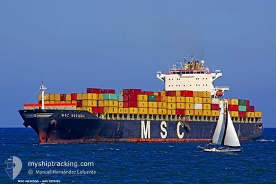
MSC NERISSA
Not available
Current Trip
| Time Travelled | 1 day |
|---|---|
| Remaining Time | --- |
| Distance Travelled | 394.31 nm |
| Remaining Distance | --- |
| AVG Speed | 16.2 Knots |
| MAX Speed | 17.5 Knots |
| AVG Wind | 17.5 knots |
| MAX Wind | 23 knots |
| MIN Temp | 13.8°C / 56.84°F |
| MAX Temp | 23.5°C / 74.3°F |
| Draught | 10 m |
| Position Received | 23 d ago |
Current Position
| Longitude | -61.66468° |
|---|---|
| Latitude | 16.66623° |
| Status | Under way using engine |
| Speed | 17.5 Knots |
| Course | 72.1° |
| Area | Caribbean Sea |
| Station | T-AIS |
| Position Received | 23 d ago |
Info
Information
The current position of MSC NERISSA is in Caribbean Sea with coordinates 16.66623° / -61.66468° as reported on 2024-03-31 19:54 by AIS to our vessel tracker app. The vessel's current speed is 17.5 Knots and is heading at the port of ABU DHABI.
The vessel MSC NERISSA (MMSI: 352948000) is a Not available It's sailing under the flag of [PA] Panama.
In this page you can find informations about the vessels current position, last detected port calls, and current voyage information. If the vessels is not in coverage by AIS you will find the latest position.
The current position of MSC NERISSA is detected by our AIS receivers and we are not responsible for the reliability of the data. The last position was recorded while the vessel was in Coverage by the Ais receivers of our vessel tracking app.
The current draught of MSC NERISSA as reported by AIS is 10 meters
Weather
| Temperature | 14.2°C / 57.56°F |
|---|---|
| Wind Speed | 12 knots |
| Direction | 152° SSE |
| Pressure | 1018.8 hPa |
| Humidity | 96.5 % |
| Cloud Coverage | 99 % |
Featured Company
Last Port Calls
| Port | Arrival | Departure | Time In Port |
|---|---|---|---|
| 2024-04-21 14:39 | 2024-04-23 11:07 | 1 d | |
| 2024-03-27 11:02 | 2024-03-28 23:57 | 1 d | |
| 2024-03-14 11:53 | 2024-03-16 12:21 | 2 d | |
| 2024-03-10 08:52 | 2024-03-10 15:10 | 6 h | |
| 2024-03-01 12:44 | 2024-03-02 13:05 | 1 d | |
| 2024-02-22 12:59 | 2024-02-25 21:58 | 3 d | |
| 2024-02-20 09:36 | 2024-02-22 02:28 | 1 d | |
| 2024-02-10 20:44 | 2024-02-11 10:30 | 13 h | |
| 2024-02-05 17:22 | 2024-02-07 12:43 | 1 d |
Last Trips
| Origin | Departure | Destination | Arrival | Distance | |
|---|---|---|---|---|---|
| 2024-03-28 18:57 | 2024-04-21 16:39 | 6317.64 nm | |||
| 2024-03-16 08:21 | 2024-03-27 06:02 | 3227.60 nm | |||
| 2024-03-10 12:10 | 2024-03-14 07:53 | 988.73 nm | |||
| 2024-03-02 13:05 | 2024-03-10 05:52 | 2756.40 nm | |||
| 2024-02-25 22:58 | 2024-03-01 12:44 | 1289.80 nm | |||
| 2024-02-22 03:28 | 2024-02-22 13:59 | 170.48 nm | |||
| 2024-02-11 06:30 | 2024-02-20 10:36 | 3752.13 nm | |||
| 2024-02-07 07:43 | 2024-02-10 16:44 | 977.10 nm | |||
| 2024-01-29 11:04 | 2024-02-05 12:22 | 2380.15 nm |
Events
| Time | Event | Details | Position / Dest | Info |
|---|---|---|---|---|
| 2024-04-23 11:07 | PORT DEPARTURE |
|
-22.92898 / 14.49720
ABU DHABI
|
Speed: 7.6 kn Course: 2° |
| 2024-04-23 10:56 | START Moving |
-22.94985 / 14.49410
[NA] WALVIS BAY
|
Speed: 3.4 kn Course: 35° |
|
| 2024-04-21 15:14 | STOP Moving |
-22.94984 / 14.48618
[NA] WALVIS BAY
|
Speed: Course: 26° |
|
| 2024-04-21 14:39 | PORT ARRIVAL |
|
-22.93669 / 14.49722
[NA] WALVIS BAY
|
Speed: 7.1 kn Course: 182° |
| 2024-04-21 13:03 | START Moving | 10.01 nm, North of WALVIS BAY |
-22.77216 / 14.50225
ABU DHABI
|
Speed: 6.1 kn Course: 283° |
| 2024-04-17 06:59 | STOP Moving | 10.05 nm, North of WALVIS BAY |
-22.77156 / 14.50524
ABU DHABI
|
Speed: 0.2 kn Course: 152° |