
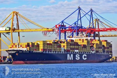
MSC MELISSA
Container Ship
Current Trip
EGPSW
| Time Travelled | 11 h, 0 mins |
|---|---|
| Remaining Time | --- |
| Distance Travelled | 4.30 nm |
| Remaining Distance | --- |
| AVG Speed | 16 Knots |
| MAX Speed | 16.3 Knots |
| AVG Wind | 6.7 knots |
| MAX Wind | 6.8 knots |
| MIN Temp | 18.9°C / 66.02°F |
| MAX Temp | 18.9°C / 66.02°F |
| Draught | 10.9 m |
| Position Received | 10 h, 3 m ago |
Current Position
| Longitude | 32.31976° |
|---|---|
| Latitude | 31.49594° |
| Status | Under way using engine |
| Speed | 16 Knots |
| Course | 307° |
| Area | Mediterranean Sea - Eastern Basin |
| Station | T-AIS |
| Position Received | 10 h, 3 m ago |
Info
Information
The current position of MSC MELISSA is in Mediterranean Sea - Eastern Basin with coordinates 31.49594° / 32.31976° as reported on 2024-04-18 23:34 by AIS to our vessel tracker app. The vessel's current speed is 16 Knots
The vessel MSC MELISSA (IMO: 9226918, MMSI: 354340000) is a Container Ship that was built in 2002 ( 22 years old ). It's sailing under the flag of [PA] Panama.
In this page you can find informations about the vessels current position, last detected port calls, and current voyage information. If the vessels is not in coverage by AIS you will find the latest position.
The current position of MSC MELISSA is detected by our AIS receivers and we are not responsible for the reliability of the data. The last position was recorded while the vessel was in Coverage by the Ais receivers of our vessel tracking app.
The current draught of MSC MELISSA as reported by AIS is 10.9 meters
Weather
| Temperature | 19°C / 66.2°F |
|---|---|
| Wind Speed | 7 knots |
| Direction | 325° NW |
| Pressure | 1013.8 hPa |
| Humidity | 78.6 % |
| Cloud Coverage | --- |
Featured Company
Last Port Calls
| Port | Arrival | Departure | Time In Port |
|---|---|---|---|
| 2024-04-18 06:49 | 2024-04-18 22:37 | 15 h | |
| 2024-04-16 22:39 | |||
| 2024-04-16 19:55 | 2024-04-16 21:46 | 1 h | |
| 2024-04-16 08:41 | |||
| 2024-04-13 03:18 | 2024-04-13 12:26 | 9 h | |
| 2024-04-11 22:03 | |||
| 2024-04-08 15:26 | 2024-04-09 06:51 | 15 h | |
| 2024-04-07 14:31 | 2024-04-08 07:32 | 17 h | |
| 2024-04-05 02:41 | 2024-04-05 11:36 | 8 h | |
| 2024-04-03 06:30 | 2024-04-03 17:32 | 11 h |
Most Visited Ports (Last year)
| Port | Arrivals | |
|---|---|---|
| 18 | ||
| 11 | ||
| 9 | ||
| 6 | ||
| 6 | ||
| 5 |
Last Trips
| Origin | Departure | Destination | Arrival | Distance | |
|---|---|---|---|---|---|
| 2024-04-17 00:46 | 2024-04-17 01:39 | 50.72 nm | |||
| 2024-04-12 01:03 | 2024-04-16 22:55 | 1323.18 nm | |||
| 2024-04-12 01:03 | 2024-04-16 10:41 | 878.73 nm | |||
| 2024-04-12 01:03 | 2024-04-13 05:18 | 341.35 nm | |||
| 2024-04-08 10:32 | 2024-04-08 18:26 | 82.82 nm | |||
| 2024-04-03 20:32 | 2024-04-07 17:31 | 1419.15 nm | |||
| 2024-04-03 20:32 | 2024-04-05 04:41 | 703.06 nm | |||
| 2024-04-03 08:46 | 2024-04-03 09:30 | 37.35 nm | |||
| 2024-03-31 12:55 | 2024-04-03 06:41 | 867.14 nm | |||
| 2024-03-30 10:49 | 2024-03-31 02:33 | 115.38 nm |
Events
| Time | Event | Details | Position / Dest | Info |
|---|---|---|---|---|
| 2024-04-18 23:34 | OUT of Coverage |
31.49594 / 32.31976
Mediterranean Sea - Eastern Basin
|
Speed: 16 kn Course: 307° |
|
| 2024-04-18 23:18 | IN Coverage |
31.43455 / 32.35138
Mediterranean Sea - Eastern Basin
|
Speed: 15.9 kn Course: 351° |
|
| 2024-04-18 22:37 | PORT DEPARTURE |
|
31.43201 / 32.35182
EGPSW
|
Speed: 6.3 kn Course: 33° |
| 2024-04-18 22:07 | OUT of Coverage |
31.25805 / 32.31282
Mediterranean Sea - Eastern Basin
[EG] PORT SAID
|
Speed: 6.3 kn Course: 35° |
|
| 2024-04-18 21:40 | IN Coverage |
31.23988 / 32.30317
Mediterranean Sea - Eastern Basin
[EG] PORT SAID
|
Speed: 0.8 kn Course: 104° |
|
| 2024-04-18 16:44 | OUT of Coverage |
31.24018 / 32.30203
Mediterranean Sea - Eastern Basin
[EG] PORT SAID
|
Speed: Course: 267° |
|
| 2024-04-18 16:44 | IN Coverage |
31.24018 / 32.30203
Mediterranean Sea - Eastern Basin
[EG] PORT SAID
|
Speed: Course: 267° |
|
| 2024-04-18 06:49 | PORT ARRIVAL |
|
31.24017 / 32.30203
[EG] PORT SAID
|
Speed: 1.4 kn Course: 187° |
| 2024-04-18 02:58 | Status Changed | Default Under way using engine |
31.42600 / 32.36124
EGPSW
|
Speed: 9.1 kn Course: 192° |
| 2024-04-18 02:54 | OUT of Coverage |
31.43583 / 32.36261
Mediterranean Sea - Eastern Basin
EGPSW
|
Speed: 9.1 kn Course: 192° |