
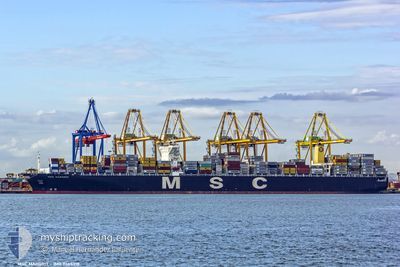
MSC MARGRIT
Container Ship
Current Trip
| Trip Time | 31 days |
|---|---|
| Trip Distance | 10555.79 nm |
| AVG Speed | 14.3 Knots |
| MAX Speed | 17 Knots |
| Draught | 16 m |
| AVG Wind | 13.6 knots |
| MAX Wind | 28.1 knots |
| MIN Temp | 5°C / 41°F |
| MAX Temp | 29.4°C / 84.92°F |
| Position Received | 1 m ago |
Current Position
| Longitude | 1.29137° |
|---|---|
| Latitude | 51.96191° |
| Status | Moored |
| Speed | |
| Course | 126° |
| Area | North Sea |
| Station | T-AIS |
| Position Received | 1 m ago |
Info
Information
The current position of MSC MARGRIT is in North Sea with coordinates 51.96191° / 1.29137° as reported on 2024-04-19 08:43 by AIS to our vessel tracker app. The vessel's current speed is 0 Knots and is currently inside the port of FELIXSTOWE.
The vessel MSC MARGRIT (IMO: 9465318, MMSI: 477307400) is a Container Ship that was built in 2012 ( 12 years old ). It's sailing under the flag of [HK] Hong Kong.
In this page you can find informations about the vessels current position, last detected port calls, and current voyage information. If the vessels is not in coverage by AIS you will find the latest position.
The current position of MSC MARGRIT is detected by our AIS receivers and we are not responsible for the reliability of the data. The last position was recorded while the vessel was in Coverage by the Ais receivers of our vessel tracking app.
The current draught of MSC MARGRIT as reported by AIS is 14 meters
Weather
| Temperature | 9.3°C / 48.74°F |
|---|---|
| Wind Speed | 17 knots |
| Direction | 301° WNW |
| Pressure | 1012.9 hPa |
| Humidity | 83.1 % |
| Cloud Coverage | 100 % |
Featured Company
Last Port Calls
| Port | Arrival | Departure | Time In Port |
|---|---|---|---|
| 2024-04-18 19:38 | |||
| 2024-03-18 00:51 | 2024-03-18 18:56 | 18 h | |
| 2024-03-12 22:55 | 2024-03-13 21:39 | 22 h | |
| 2024-03-08 16:56 | 2024-03-09 11:54 | 18 h |
Most Visited Ports (Last year)
| Port | Arrivals | |
|---|---|---|
| 6 | ||
| 6 | ||
| 6 | ||
| 5 | ||
| 4 | ||
| 4 |
Last Trips
| Origin | Departure | Destination | Arrival | Distance | |
|---|---|---|---|---|---|
| 2024-03-19 00:26 | 2024-04-18 20:38 | 10555.79 nm | |||
| 2024-03-14 05:39 | 2024-03-18 06:21 | 1523.27 nm | |||
| 2024-03-09 19:54 | 2024-03-13 06:55 | 1490.14 nm | |||
| 2024-01-22 06:15 | 2024-03-09 00:56 | 11890.09 nm |
Events
| Time | Event | Details | Position / Dest | Info |
|---|---|---|---|---|
| 2024-04-19 01:01 | Draught Changed | 14 16 |
51.96187 / 1.29125
[GB] FELIXSTOWE
|
Speed: Course: 126° |
| 2024-04-19 01:01 | ETA Changed | 2024/04/22 04:00 2024/04/17 04:00 |
51.96187 / 1.29125
[GB] FELIXSTOWE
|
Speed: Course: 126° |
| 2024-04-19 00:55 | Destination Changed | BEANR GBFXT |
51.96184 / 1.29131
[GB] FELIXSTOWE
|
Speed: Course: 126° |
| 2024-04-18 19:50 | Status Changed | Moored Constrained by her draught |
51.96182 / 1.29125
[GB] FELIXSTOWE
|
Speed: 0.1 kn Course: 128° |
| 2024-04-18 19:38 | PORT ARRIVAL |
|
51.96047 / 1.29174
[GB] FELIXSTOWE
|
Speed: 0.7 kn Course: 133° |
| 2024-04-18 19:06 | STOP Moving | 0.34 nm, South of FELIXSTOWE |
51.95338 / 1.30150
GBFXT
|
Speed: 0.3 kn Course: 272° |
| 2024-04-18 16:58 | Status Changed | Constrained by her draught Under way using engine |
51.84662 / 1.70189
GBFXT
|
Speed: 6.6 kn Course: 280.2° |
| 2024-04-18 16:13 | START Moving | 14.98 nm, East of FELIXSTOWE |
51.91387 / 1.69640
GBFXT
|
Speed: 3.1 kn Course: 352° |
| 2024-04-18 16:07 | Status Changed | Under way using engine At anchor |
51.91234 / 1.69914
GBFXT
|
Speed: 0.3 kn Course: 326° |
| 2024-04-17 03:53 | STOP Moving | 15.17 nm, East of FELIXSTOWE |
51.91111 / 1.70058
GBFXT
|
Speed: 0.2 kn Course: 344° |