
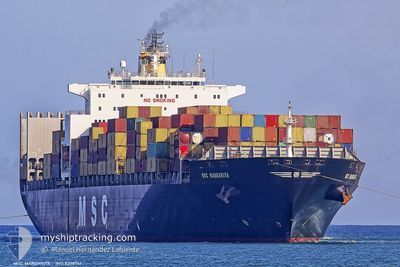
MSC MARGARITA
Not available
Current Trip
| Time Travelled | 12 days |
|---|---|
| Remaining Time | 2 days |
| Distance Travelled | 4704.05 nm |
| Remaining Distance | 567.17 nm |
| AVG Speed | 15.9 Knots |
| MAX Speed | 20.2 Knots |
| AVG Wind | 12.2 knots |
| MAX Wind | 24 knots |
| MIN Temp | 16.5°C / 61.7°F |
| MAX Temp | 30.1°C / 86.18°F |
| Draught | 14 m |
| Position Received | 16 h, 38 m ago |
Current Position
| Longitude | 95.84713° |
|---|---|
| Latitude | 6.00654° |
| Status | Under way using engine |
| Speed | 7.4 Knots |
| Course | 91° |
| Area | Andaman or Burma Sea |
| Station | T-AIS |
| Position Received | 16 h, 38 m ago |
Info
Information
The current position of MSC MARGARITA is in Andaman or Burma Sea with coordinates 6.00654° / 95.84713° as reported on 2024-04-18 14:29 by AIS to our vessel tracker app. The vessel's current speed is 7.4 Knots and is heading at the port of SINGAPORE. The estimated time of arrival as calculated by MyShipTracking vessel tracking app is 2024-04-21 20:37 LT
The vessel MSC MARGARITA (MMSI: 636016429) is a Not available It's sailing under the flag of [LR] Liberia.
In this page you can find informations about the vessels current position, last detected port calls, and current voyage information. If the vessels is not in coverage by AIS you will find the latest position.
The current position of MSC MARGARITA is detected by our AIS receivers and we are not responsible for the reliability of the data. The last position was recorded while the vessel was in Coverage by the Ais receivers of our vessel tracking app.
The current draught of MSC MARGARITA as reported by AIS is 14 meters
Weather
| Temperature | 29.4°C / 84.92°F |
|---|---|
| Wind Speed | 4 knots |
| Direction | 313° NW |
| Pressure | 1008.4 hPa |
| Humidity | 68.4 % |
| Cloud Coverage | 60 % |
Featured Company
Last Port Calls
| Port | Arrival | Departure | Time In Port |
|---|---|---|---|
| 2024-03-31 13:36 | 2024-04-06 12:27 | 5 d | |
| 2024-03-19 20:03 | 2024-03-23 06:00 | 3 d | |
| 2024-03-01 18:48 | 2024-03-02 19:30 | 1 d | |
| 2024-02-28 07:17 | 2024-02-29 03:09 | 19 h | |
| 2024-02-21 10:37 | 2024-02-22 03:46 | 17 h | |
| 2024-02-18 16:25 | 2024-02-19 22:48 | 1 d | |
| 2024-02-17 07:20 | 2024-02-17 16:43 | 9 h | |
| 2024-02-07 12:03 | 2024-02-16 22:08 | 9 d | |
| 2024-02-04 03:08 | 2024-02-04 12:25 | 9 h | |
| 2024-02-02 07:20 | 2024-02-03 14:11 | 1 d |
Last Trips
| Origin | Departure | Destination | Arrival | Distance | |
|---|---|---|---|---|---|
| 2024-03-23 08:00 | 2024-03-31 15:36 | 1945.81 nm | |||
| 2024-03-02 19:30 | 2024-03-19 22:03 | 4970.72 nm | |||
| 2024-02-29 03:09 | 2024-03-01 18:48 | 696.68 nm | |||
| 2024-02-22 04:46 | 2024-02-28 07:17 | 1184.80 nm | |||
| 2024-02-19 23:48 | 2024-02-21 11:37 | 569.76 nm | |||
| 2024-02-17 17:43 | 2024-02-18 17:25 | 350.20 nm | |||
| 2024-02-16 23:08 | 2024-02-17 08:20 | 119.13 nm | |||
| 2024-02-04 13:25 | 2024-02-07 13:03 | 341.04 nm | |||
| 2024-02-03 15:11 | 2024-02-04 04:08 | 142.88 nm | |||
| 2024-02-01 16:22 | 2024-02-02 08:20 | 197.99 nm |
Events
| Time | Event | Details | Position / Dest | Info |
|---|---|---|---|---|
| 2024-04-18 14:29 | OUT of Coverage |
6.00654 / 95.84713
Andaman or Burma Sea
|
Speed: 7.4 kn Course: 91° |
|
| 2024-04-18 12:03 | Draught Changed | 14 14.5 |
6.01743 / 95.54684
SGSIN
|
Speed: 7.2 kn Course: 92° |
| 2024-04-18 11:52 | Detected in Sea | Indonesian part of the Andaman or Burma Sea |
6.01800 / 95.52661
Andaman or Burma Sea
SGSIN
|
Speed: 7.2 kn Course: 92° |
| 2024-04-18 11:52 | IN Coverage |
6.01800 / 95.52661
Andaman or Burma Sea
SGSIN
|
Speed: 7.2 kn Course: 92° |
|
| 2024-04-10 20:10 | Status Changed | Default Under way using engine |
-20.52616 / 55.15351
SGSIN
|
Speed: 17.9 kn Course: 58.6° |
| 2024-04-10 20:05 | OUT of Coverage |
-20.53919 / 55.13154
Indian Ocean
SGSIN
|
Speed: 17.9 kn Course: 58.6° |
|
| 2024-04-10 18:39 | Draught Changed | 14.5 14.4 |
-20.77554 / 54.74425
SGSIN
|
Speed: 18 kn Course: 52.4° |
| 2024-04-10 18:39 | Destination Changed | SGSIN ZAZBA |
-20.77554 / 54.74425
SGSIN
|
Speed: 18 kn Course: 52.4° |
| 2024-04-10 18:39 | ETA Changed | 2024/04/19 06:00 2024/03/15 04:00 |
-20.77554 / 54.74425
SGSIN
|
Speed: 18 kn Course: 52.4° |
| 2024-04-10 17:46 | Status Changed | Under way using engine Default |
-20.92037 / 54.50377
ZAZBA
|
Speed: 17.9 kn Course: 59° |