
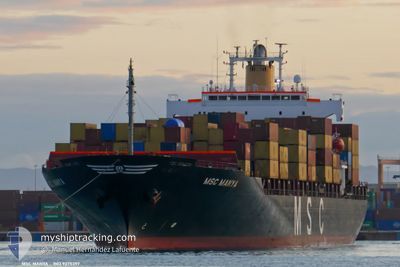
MSC MANYA
Container Ship
Current Trip
| Time Travelled | 3 days |
|---|---|
| Remaining Time | --- |
| Distance Travelled | 540.93 nm |
| Remaining Distance | 20.76 nm |
| AVG Speed | 13.7 Knots |
| MAX Speed | 16.4 Knots |
| AVG Wind | 6.4 knots |
| MAX Wind | 16 knots |
| MIN Temp | 19.7°C / 67.46°F |
| MAX Temp | 26.3°C / 79.34°F |
| Draught | 7.5 m |
| Position Received | 1 d ago |
Current Position
| Longitude | -40.39652° |
|---|---|
| Latitude | -21.55773° |
| Status | Under way using engine |
| Speed | 15.3 Knots |
| Course | 11° |
| Area | South Atlantic Ocean |
| Station | T-AIS |
| Position Received | 1 d ago |
Info
Information
The current position of MSC MANYA is in South Atlantic Ocean with coordinates -21.55773° / -40.39652° as reported on 2024-04-21 20:26 by AIS to our vessel tracker app. The vessel's current speed is 15.3 Knots and is heading at the port of BAIA DE VITORIA. The estimated time of arrival as calculated by MyShipTracking vessel tracking app is 2024-04-21 23:59 LT
The vessel MSC MANYA (IMO: 9275397, MMSI: 636015233) is a Container Ship that was built in 2003 ( 21 years old ). It's sailing under the flag of [LR] Liberia.
In this page you can find informations about the vessels current position, last detected port calls, and current voyage information. If the vessels is not in coverage by AIS you will find the latest position.
The current position of MSC MANYA is detected by our AIS receivers and we are not responsible for the reliability of the data. The last position was recorded while the vessel was in Coverage by the Ais receivers of our vessel tracking app.
The current draught of MSC MANYA as reported by AIS is 7.5 meters
Weather
| Temperature | 25.8°C / 78.44°F |
|---|---|
| Wind Speed | 2 knots |
| Direction | 5° N |
| Pressure | 1013.7 hPa |
| Humidity | 80.1 % |
| Cloud Coverage | --- |
Featured Company
Last Port Calls
| Port | Arrival | Departure | Time In Port |
|---|---|---|---|
| 2024-04-19 14:22 | 2024-04-19 14:54 | 31 m | |
| 2024-04-10 03:38 | 2024-04-10 20:35 | 16 h | |
| 2024-04-02 09:35 | 2024-04-04 18:53 | 2 d | |
| 2024-03-18 15:34 | 2024-03-22 04:14 | 3 d | |
| 2024-03-15 14:20 | 2024-03-16 15:43 | 1 d | |
| 2024-03-13 17:07 | 2024-03-14 16:00 | 22 h | |
| 2024-03-12 13:41 | 2024-03-13 10:51 | 21 h | |
| 2024-03-04 05:33 | |||
| 2024-02-25 03:57 | 2024-02-29 16:16 | 4 d | |
| 2024-02-17 16:48 | 2024-02-18 09:37 | 16 h |
Most Visited Ports (Last year)
| Port | Arrivals | |
|---|---|---|
| 8 | ||
| 7 | ||
| 7 | ||
| 6 | ||
| 6 | ||
| 5 |
Last Trips
| Origin | Departure | Destination | Arrival | Distance | |
|---|---|---|---|---|---|
| 2024-04-10 17:35 | 2024-04-19 11:22 | 2436.98 nm | |||
| 2024-04-04 14:53 | 2024-04-10 00:38 | 1151.64 nm | |||
| 2024-03-21 23:14 | 2024-04-02 05:35 | 3071.18 nm | |||
| 2024-03-16 10:43 | 2024-03-18 10:34 | 48.66 nm | |||
| 2024-03-14 11:00 | 2024-03-15 09:20 | 56.29 nm | |||
| 2024-03-13 05:51 | 2024-03-13 12:07 | 23.78 nm | |||
| 2024-02-29 12:16 | 2024-03-04 02:33 | 1118.74 nm | |||
| 2024-02-18 05:37 | 2024-02-24 23:57 | 1914.37 nm | |||
| 2024-02-12 13:18 | 2024-02-17 12:48 | 1207.31 nm | |||
| 2024-02-10 07:29 | 2024-02-11 10:47 | 22.14 nm |
Events
| Time | Event | Details | Position / Dest | Info |
|---|---|---|---|---|
| 2024-04-23 03:40 | STOP Moving | 16.76 nm, South East of JARDIM CAMBURI |
-20.47383 / -40.03072
VITORIA
|
Speed: 0.2 kn Course: 53° |
| 2024-04-22 19:00 | START Moving | 17.77 nm, South East of BAIA DE VITORIA |
-20.58102 / -40.15705
VITORIA
|
Speed: 4.5 kn Course: 183° |
| 2024-04-22 14:33 | STOP Moving | 19.62 nm, South East of JARDIM CAMBURI |
-20.55932 / -40.05867
VITORIA
|
Speed: 0.3 kn Course: 109° |
| 2024-04-22 13:10 | START Moving | 10.77 nm, South East of JARDIM CAMBURI |
-20.44465 / -40.16090
VITORIA
|
Speed: 3.1 kn Course: 350° |
| 2024-04-22 01:20 | STOP Moving | 14.11 nm, South East of JARDIM CAMBURI |
-20.49333 / -40.13167
VITORIA
|
Speed: Course: -1° |
| 2024-04-21 20:32 | Status Changed | Default Under way using engine |
-21.53125 / -40.39070
VITORIA
|
Speed: 15.3 kn Course: 11° |
| 2024-04-21 20:26 | OUT of Coverage |
-21.55773 / -40.39652
South Atlantic Ocean
VITORIA
|
Speed: 15.3 kn Course: 11° |
|
| 2024-04-21 18:17 | ETA Changed | 2024/04/21 23:59 2024/04/22 02:30 |
-22.06925 / -40.63965
VITORIA
|
Speed: 16 kn Course: 33° |
| 2024-04-21 17:43 | Status Changed | Under way using engine Default |
-22.18332 / -40.73652
VITORIA
|
Speed: 15.4 kn Course: 48° |
| 2024-04-21 17:04 | Status Changed | Default Under way using engine |
-22.29238 / -40.87818
VITORIA
|
Speed: 15.3 kn Course: 50° |