
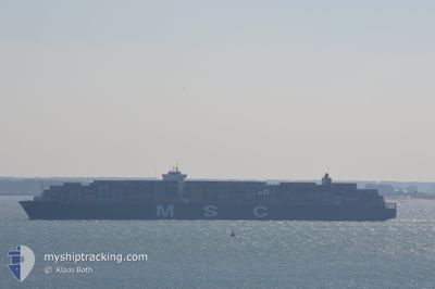
MSC LONDON
Container Ship
Current Trip
| Time Travelled | 4 days |
|---|---|
| Remaining Time | --- |
| Distance Travelled | 1527.97 nm |
| Remaining Distance | 676.92 nm |
| AVG Speed | 14.7 Knots |
| MAX Speed | 19.8 Knots |
| AVG Wind | 6.6 knots |
| MAX Wind | 14 knots |
| MIN Temp | 25.8°C / 78.44°F |
| MAX Temp | 29.7°C / 85.46°F |
| Draught | 10.9 m |
| Position Received | 4 d ago |
Current Position
| Longitude | 104.43679° |
|---|---|
| Latitude | 1.38447° |
| Status | Under way using engine |
| Speed | 19.1 Knots |
| Course | 50.3° |
| Area | South China Sea |
| Station | T-AIS |
| Position Received | 4 d ago |
Info
Information
The current position of MSC LONDON is in South China Sea with coordinates 1.38447° / 104.43679° as reported on 2024-04-21 02:04 by AIS to our vessel tracker app. The vessel's current speed is 19.1 Knots and is heading at the port of NINGBO. The estimated time of arrival as calculated by MyShipTracking vessel tracking app is 2024-04-25 11:00 LT
The vessel MSC LONDON (IMO: 9606302, MMSI: 352853000) is a Container Ship that was built in 2014 ( 10 years old ). It's sailing under the flag of [PA] Panama.
In this page you can find informations about the vessels current position, last detected port calls, and current voyage information. If the vessels is not in coverage by AIS you will find the latest position.
The current position of MSC LONDON is detected by our AIS receivers and we are not responsible for the reliability of the data. The last position was recorded while the vessel was in Coverage by the Ais receivers of our vessel tracking app.
The current draught of MSC LONDON as reported by AIS is 10.9 meters
Weather
| Temperature | 25.8°C / 78.44°F |
|---|---|
| Wind Speed | 12 knots |
| Direction | 200° SSW |
| Pressure | 1006.1 hPa |
| Humidity | 89.8 % |
| Cloud Coverage | 100 % |
Featured Company
Last Port Calls
| Port | Arrival | Departure | Time In Port |
|---|---|---|---|
| 2024-04-18 16:12 | 2024-04-20 22:48 | 2 d | |
| 2024-03-08 04:22 | 2024-03-10 11:32 | 2 d | |
| 2024-03-05 11:53 | 2024-03-07 09:19 | 1 d | |
| 2024-03-03 07:19 | 2024-03-05 02:01 | 1 d |
Most Visited Ports (Last year)
| Port | Arrivals | |
|---|---|---|
| 4 | ||
| 4 | ||
| 3 | ||
| 3 | ||
| 3 | ||
| 3 |
Last Trips
| Origin | Departure | Destination | Arrival | Distance | |
|---|---|---|---|---|---|
| 2024-03-10 12:32 | 2024-04-19 00:12 | 12352.73 nm | |||
| 2024-03-07 10:19 | 2024-03-08 05:22 | 274.46 nm | |||
| 2024-03-05 03:01 | 2024-03-05 12:53 | 127.30 nm | |||
| 2024-01-22 15:13 | 2024-03-03 08:19 | 8801.23 nm |
Events
| Time | Event | Details | Position / Dest | Info |
|---|---|---|---|---|
| 2024-04-21 02:12 | Status Changed | Default Under way using engine |
1.41183 / 104.47302
CNNGB
|
Speed: 19.1 kn Course: 50.3° |
| 2024-04-21 02:04 | OUT of Coverage |
1.38447 / 104.43679
South China Sea
CNNGB
|
Speed: 19.1 kn Course: 50.3° |
|
| 2024-04-21 01:47 | Change Sea Area | Malaysian part of the South China Sea Malaysian part of the Singapore Strait |
1.32549 / 104.36997
South China Sea
CNNGB
|
Speed: 18.8 kn Course: 49.6° |
| 2024-04-21 00:59 | Change Sea Area | Malaysian part of the Singapore Strait Indonesian part of the Singapore Strait |
1.26323 / 104.13815
Singapore Strait
CNNGB
|
Speed: 18.5 kn Course: 83.7° |
| 2024-04-20 23:53 | Change Sea Area | Indonesian part of the Singapore Strait Singaporean part of the Singapore Strait |
1.18225 / 103.83167
Singapore Strait
CNNGB
|
Speed: 10.2 kn Course: 117.1° |
| 2024-04-20 23:24 | Destination Changed | CNNGB SGSIN |
1.23013 / 103.78425
CNNGB
|
Speed: 9.1 kn Course: 139.9° |
| 2024-04-20 23:22 | Status Changed | Under way using engine Moored |
1.23335 / 103.78155
SGSIN
|
Speed: 9 kn Course: 139.8° |
| 2024-04-20 23:22 | Draught Changed | 10.9 14.9 |
1.23364 / 103.78132
SGSIN
|
Speed: 9 kn Course: 139.8° |
| 2024-04-20 23:22 | ETA Changed | 2024/04/25 11:00 2024/04/18 13:00 |
1.23364 / 103.78132
SGSIN
|
Speed: 9 kn Course: 139.8° |
| 2024-04-20 23:00 | START Moving | 2.08 nm, North of BUKOM ISLAND |
1.27129 / 103.75582
SGSIN
|
Speed: 3.1 kn Course: 151° |