
MSC KATALIN II
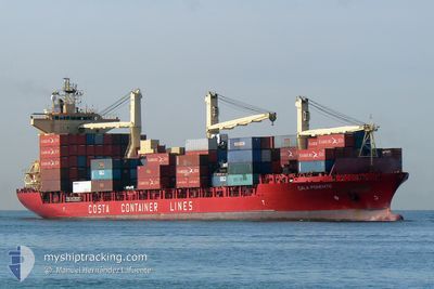
Cargo
Current Trip
| Trip Time | 1 day |
|---|---|
| Trip Distance | 262.71 nm |
| AVG Speed | 6 Knots |
| MAX Speed | 6 Knots |
| Draught | 7.8 m |
| AVG Wind | 19.8 knots |
| MAX Wind | 26.2 knots |
| MIN Temp | 15.8°C / 60.44°F |
| MAX Temp | 17.6°C / 63.68°F |
| Position Received | 14 h, 15 m ago |
Current Position
| Longitude | 14.59342° |
|---|---|
| Latitude | 35.78225° |
| Status | Under way using engine |
| Speed | 1.7 Knots |
| Course | 332° |
| Area | Mediterranean Sea - Eastern Basin |
| Station | T-AIS |
| Position Received | 14 h, 15 m ago |
Info
Information
The current position of MSC KATALIN II is in Mediterranean Sea - Eastern Basin with coordinates 35.78225° / 14.59342° as reported on 2024-04-23 09:29 by AIS to our vessel tracker app. The vessel's current speed is 1.7 Knots and is currently inside the port of MARSAXLOKK.
The vessel MSC KATALIN II (IMO: 9232656, MMSI: 636017244) is a Cargo It's sailing under the flag of [LR] Liberia.
In this page you can find informations about the vessels current position, last detected port calls, and current voyage information. If the vessels is not in coverage by AIS you will find the latest position.
The current position of MSC KATALIN II is detected by our AIS receivers and we are not responsible for the reliability of the data. The last position was recorded while the vessel was in Coverage by the Ais receivers of our vessel tracking app.
The current draught of MSC KATALIN II as reported by AIS is 7.8 meters
Weather
| Temperature | 15.1°C / 59.18°F |
|---|---|
| Wind Speed | 13 knots |
| Direction | 315° NW |
| Pressure | 1013.8 hPa |
| Humidity | 62.6 % |
| Cloud Coverage | 2 % |
Featured Company
Last Port Calls
| Port | Arrival | Departure | Time In Port |
|---|---|---|---|
| 2024-04-23 10:26 | |||
| 2024-04-17 16:08 | 2024-04-21 14:32 | 3 d | |
| 2024-04-07 21:33 | 2024-04-16 16:08 | 8 d | |
| 2024-04-04 02:07 | 2024-04-06 16:02 | 2 d | |
| 2024-03-29 09:02 | 2024-04-02 13:10 | 4 d | |
| 2024-03-26 08:07 | 2024-03-27 23:53 | 1 d | |
| 2024-03-22 13:52 | 2024-03-24 17:45 | 2 d | |
| 2024-03-14 12:43 | 2024-03-19 14:38 | 5 d | |
| 2024-03-11 08:35 | 2024-03-13 09:52 | 2 d | |
| 2024-03-08 08:31 | 2024-03-08 23:53 | 15 h |
Last Trips
| Origin | Departure | Destination | Arrival | Distance | |
|---|---|---|---|---|---|
| 2024-04-21 16:32 | 2024-04-23 12:26 | 262.71 nm | |||
| 2024-04-16 18:08 | 2024-04-17 18:08 | 109.11 nm | |||
| 2024-04-06 18:02 | 2024-04-07 23:33 | 379.30 nm | |||
| 2024-04-02 15:10 | 2024-04-04 04:07 | 375.96 nm | |||
| 2024-03-28 01:53 | 2024-03-29 11:02 | 125.47 nm | |||
| 2024-03-24 18:45 | 2024-03-26 10:07 | 377.43 nm | |||
| 2024-03-19 16:38 | 2024-03-22 14:52 | 413.27 nm | |||
| 2024-03-13 10:52 | 2024-03-14 14:43 | 366.47 nm | |||
| 2024-03-09 00:53 | 2024-03-11 09:35 | 248.10 nm | |||
| 2024-02-18 20:25 | 2024-02-25 01:20 | 476.85 nm |
Events
| Time | Event | Details | Position / Dest | Info |
|---|---|---|---|---|
| 2024-04-23 11:05 | STOP Moving |
35.81816 / 14.54207
[MT] MARSAXLOKK
|
Speed: Course: -1° |
|
| 2024-04-23 10:26 | PORT ARRIVAL |
|
35.82013 / 14.55361
[MT] MARSAXLOKK
|
Speed: 7 kn Course: 314° |
| 2024-04-23 09:32 | Status Changed | Default Under way using engine |
35.78301 / 14.59264
MT MAR
|
Speed: 1.7 kn Course: 332° |
| 2024-04-23 09:29 | OUT of Coverage |
35.78225 / 14.59342
Mediterranean Sea - Eastern Basin
|
Speed: 1.7 kn Course: 310.1° |
|
| 2024-04-23 09:24 | Status Changed | Under way using engine Default |
35.77863 / 14.59611
MT MAR
|
Speed: 2.6 kn Course: -1° |
| 2024-04-23 09:24 | IN Coverage |
35.78055 / 14.59506
Mediterranean Sea - Eastern Basin
|
Speed: 2.9 kn Course: 327.7° |
|
| 2024-04-23 08:17 | START Moving | 9.58 nm, South of MARSAXLOKK |
35.67390 / 14.61560
MT MAR
|
Speed: 5.5 kn Course: 359° |
| 2024-04-23 06:29 | Status Changed | Default Under way using engine |
35.70167 / 14.59500
MT MAR
|
Speed: 1.6 kn Course: 41° |
| 2024-04-23 06:25 | OUT of Coverage |
35.70332 / 14.59643
Mediterranean Sea - Eastern Basin
|
Speed: 1.6 kn Course: 181.6° |
|
| 2024-04-23 06:22 | Status Changed | Under way using engine Default |
35.70454 / 14.59643
MT MAR
|
Speed: 0.9 kn Course: -1° |