
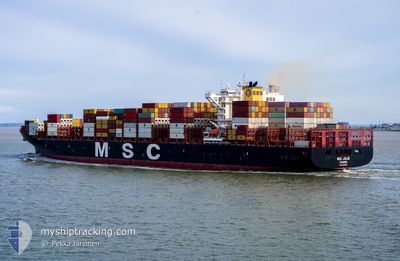
MSC JULIE
Cargo A
Current Trip
COLON
| Time Travelled | 2 days |
|---|---|
| Remaining Time | --- |
| Distance Travelled | 1226.93 nm |
| Remaining Distance | --- |
| AVG Speed | 17.7 Knots |
| MAX Speed | 18.6 Knots |
| AVG Wind | 12.8 knots |
| MAX Wind | 17 knots |
| MIN Temp | 26.4°C / 79.52°F |
| MAX Temp | 28.3°C / 82.94°F |
| Draught | 12.6 m |
| Position Received | 2 d ago |
Current Position
| Longitude | -79.78445° |
|---|---|
| Latitude | 9.59236° |
| Status | Under way using engine |
| Speed | 16.2 Knots |
| Course | 41° |
| Area | Caribbean Sea |
| Station | T-AIS |
| Position Received | 2 d ago |
Info
Information
The current position of MSC JULIE is in Caribbean Sea with coordinates 9.59236° / -79.78445° as reported on 2024-04-22 13:21 by AIS to our vessel tracker app. The vessel's current speed is 16.2 Knots
The vessel MSC JULIE (IMO: 9704996, MMSI: 255806498) is a Cargo A It's sailing under the flag of [PT] Portugal.
In this page you can find informations about the vessels current position, last detected port calls, and current voyage information. If the vessels is not in coverage by AIS you will find the latest position.
The current position of MSC JULIE is detected by our AIS receivers and we are not responsible for the reliability of the data. The last position was recorded while the vessel was in Coverage by the Ais receivers of our vessel tracking app.
The current draught of MSC JULIE as reported by AIS is 12.6 meters
Weather
| Temperature | 26.4°C / 79.52°F |
|---|---|
| Wind Speed | 15 knots |
| Direction | 82° E |
| Pressure | 1014.4 hPa |
| Humidity | 76.8 % |
| Cloud Coverage | 38 % |
Featured Company
Last Port Calls
| Port | Arrival | Departure | Time In Port |
|---|---|---|---|
| 2024-04-20 12:56 | 2024-04-22 12:05 | 1 d | |
| 2024-04-17 05:22 | 2024-04-19 11:39 | 2 d | |
| 2024-04-03 09:16 | 2024-04-04 02:54 | 17 h | |
| 2024-03-30 11:32 | 2024-03-30 23:07 | 11 h | |
| 2024-03-24 03:33 | 2024-03-25 00:24 | 20 h | |
| 2024-03-20 10:46 | 2024-03-21 17:03 | 1 d | |
| 2024-03-15 11:42 | 2024-03-16 10:22 | 22 h | |
| 2024-03-10 11:02 | 2024-03-11 12:18 | 1 d | |
| 2024-03-05 23:46 | 2024-03-06 13:47 | 14 h | |
| 2024-02-29 08:26 | 2024-03-01 17:02 | 1 d |
Most Visited Ports (Last year)
| Port | Arrivals | |
|---|---|---|
| 8 | ||
| 8 | ||
| 7 | ||
| 6 | ||
| 6 | ||
| 4 |
Last Trips
| Origin | Departure | Destination | Arrival | Distance | |
|---|---|---|---|---|---|
| 2024-04-19 06:39 | 2024-04-20 07:56 | 70.47 nm | |||
| 2024-04-03 19:54 | 2024-04-17 00:22 | 3059.34 nm | |||
| 2024-03-30 16:07 | 2024-04-03 02:16 | 434.71 nm | |||
| 2024-03-24 17:24 | 2024-03-30 04:32 | 916.34 nm | |||
| 2024-03-21 10:03 | 2024-03-23 20:33 | 164.88 nm | |||
| 2024-03-16 03:22 | 2024-03-20 03:46 | 1035.99 nm | |||
| 2024-03-11 05:18 | 2024-03-15 04:42 | 462.17 nm | |||
| 2024-03-06 07:47 | 2024-03-10 04:02 | 1222.86 nm | |||
| 2024-03-01 12:02 | 2024-03-05 17:46 | 1759.81 nm | |||
| 2024-02-14 07:58 | 2024-02-29 03:26 | 4658.04 nm |
Events
| Time | Event | Details | Position / Dest | Info |
|---|---|---|---|---|
| 2024-04-22 13:25 | Status Changed | Default Under way using engine |
9.60515 / -79.77303
COLON
|
Speed: 16.2 kn Course: 41° |
| 2024-04-22 13:21 | OUT of Coverage |
9.59236 / -79.78445
Caribbean Sea
|
Speed: 16.2 kn Course: 41° |
|
| 2024-04-22 13:17 | Status Changed | Under way using engine Default |
9.57979 / -79.79561
COLON
|
Speed: 15.8 kn Course: 41° |
| 2024-04-22 13:09 | Status Changed | Default Under way using engine |
9.55500 / -79.81667
COLON
|
Speed: 14.3 kn Course: 38.4° |
| 2024-04-22 12:26 | Status Changed | Under way using engine Default |
9.41723 / -79.89644
COLON
|
Speed: 10.7 kn Course: 1° |
| 2024-04-22 12:10 | START Moving | 0.57 nm, North West of COLON |
9.37867 / -79.89681
COLON
|
Speed: 6.4 kn Course: 358° |
| 2024-04-22 12:10 | IN Coverage |
9.41723 / -79.89644
Caribbean Sea
|
Speed: 12.1 kn Course: 0.9° |
|
| 2024-04-22 12:05 | PORT DEPARTURE |
|
9.37867 / -79.89681
COLON
|
Speed: Course: 145° |
| 2024-04-22 03:17 | Status Changed | Default Moored |
9.37291 / -79.88919
[PA] COLON
|
Speed: Course: 146° |
| 2024-04-22 03:13 | OUT of Coverage |
9.37293 / -79.88914
Caribbean Sea
[PA] COLON
|
Speed: Course: 56.7° |