
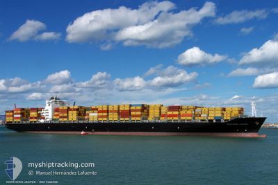
MSC JASPER VIII
Container Ship
Current Trip
| Time Travelled | 6 days |
|---|---|
| Remaining Time | --- |
| Distance Travelled | 1355.37 nm |
| Remaining Distance | --- |
| AVG Speed | 10.5 Knots |
| MAX Speed | 14.8 Knots |
| AVG Wind | 9 knots |
| MAX Wind | 17.1 knots |
| MIN Temp | 19.4°C / 66.92°F |
| MAX Temp | 31.1°C / 87.98°F |
| Draught | 10.3 m |
| Position Received | 29 m ago |
Current Position
| Longitude | -79.59068° |
|---|---|
| Latitude | 8.81029° |
| Status | At anchor |
| Speed | 0.1 Knots |
| Course | 56° |
| Area | North Pacific Ocean |
| Station | T-AIS |
| Position Received | 29 m ago |
Info
Information
The current position of MSC JASPER VIII is in North Pacific Ocean with coordinates 8.81029° / -79.59068° as reported on 2024-04-24 05:43 by AIS to our vessel tracker app. The vessel's current speed is 0.1 Knots and is heading at the port of PANAMA CITY. The estimated time of arrival as calculated by MyShipTracking vessel tracking app is 2024-04-22 06:00 LT
The vessel MSC JASPER VIII (IMO: 9466960, MMSI: 255806034) is a Container Ship that was built in 2009 ( 15 years old ). It's sailing under the flag of [PT] Portugal.
In this page you can find informations about the vessels current position, last detected port calls, and current voyage information. If the vessels is not in coverage by AIS you will find the latest position.
The current position of MSC JASPER VIII is detected by our AIS receivers and we are not responsible for the reliability of the data. The last position was recorded while the vessel was in Coverage by the Ais receivers of our vessel tracking app.
The current draught of MSC JASPER VIII as reported by AIS is 10.3 meters
Weather
| Temperature | 27.4°C / 81.32°F |
|---|---|
| Wind Speed | 9 knots |
| Direction | 357° N |
| Pressure | 1010.5 hPa |
| Humidity | 81.7 % |
| Cloud Coverage | 75 % |
Featured Company
Last Trips
| Origin | Departure | Destination | Arrival | Distance | |
|---|---|---|---|---|---|
| 2024-04-15 07:24 | 2024-04-16 10:47 | 381.00 nm | |||
| 2024-04-09 13:27 | 2024-04-12 16:04 | 603.44 nm | |||
| 2024-03-07 11:27 | 2024-04-07 13:00 | 10701.00 nm | |||
| 2024-02-10 18:49 | 2024-03-04 15:34 | 9133.66 nm | |||
| 2024-01-26 00:36 | 2024-02-09 16:54 | 1373.75 nm |
Events
| Time | Event | Details | Position / Dest | Info |
|---|---|---|---|---|
| 2024-04-24 05:49 | Status Changed | Default At anchor |
8.81007 / -79.59053
PAPTY
|
Speed: 0.1 kn Course: 56° |
| 2024-04-24 05:43 | Status Changed | At anchor Default |
8.81029 / -79.59068
PAPTY
|
Speed: Course: 57° |
| 2024-04-24 05:04 | Status Changed | Default At anchor |
8.81098 / -79.59100
PAPTY
|
Speed: 0.1 kn Course: 80° |
| 2024-04-24 04:58 | Status Changed | At anchor Default |
8.81133 / -79.59102
PAPTY
|
Speed: Course: 82° |
| 2024-04-24 04:58 | IN Coverage |
8.81133 / -79.59102
North Pacific Ocean
PAPTY
|
Speed: 0.1 kn Course: 170° |
|
| 2024-04-24 03:16 | Status Changed | Default At anchor |
8.81034 / -79.59073
PAPTY
|
Speed: Course: 53° |
| 2024-04-24 03:10 | Status Changed | At anchor Default |
8.81024 / -79.59070
PAPTY
|
Speed: 0.1 kn Course: 52° |
| 2024-04-24 03:10 | OUT of Coverage |
8.81024 / -79.59070
North Pacific Ocean
PAPTY
|
Speed: Course: 325.3° |
|
| 2024-04-24 02:52 | Status Changed | Default At anchor |
8.81009 / -79.59056
PAPTY
|
Speed: 0.1 kn Course: 44° |
| 2024-04-24 02:46 | Status Changed | At anchor Default |
8.80994 / -79.59046
PAPTY
|
Speed: 0.1 kn Course: 43° |