
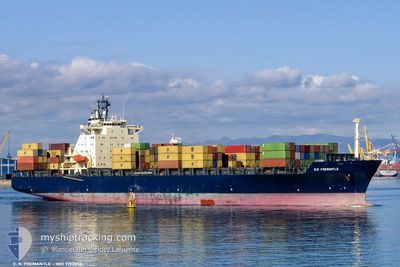
MSC GIANNA III
Container Ship
Current Trip
| Time Travelled | 1 day |
|---|---|
| Remaining Time | 19 h, 54 mins |
| Distance Travelled | 336.17 nm |
| Remaining Distance | 233.38 nm |
| AVG Speed | 11.4 Knots |
| MAX Speed | 13 Knots |
| AVG Wind | 10.5 knots |
| MAX Wind | 16.8 knots |
| MIN Temp | 10.4°C / 50.72°F |
| MAX Temp | 14.7°C / 58.46°F |
| Draught | 9.9 m |
| Position Received | 2 h, 45 m ago |
Current Position
| Longitude | 18.64952° |
|---|---|
| Latitude | 39.94444° |
| Status | Under way using engine |
| Speed | 10.2 Knots |
| Course | 180.9° |
| Area | Adriatic Sea |
| Station | T-AIS |
| Position Received | 2 h, 45 m ago |
Info
Information
The current position of MSC GIANNA III is in Adriatic Sea with coordinates 39.94444° / 18.64952° as reported on 2024-04-25 10:54 by AIS to our vessel tracker app. The vessel's current speed is 10.2 Knots and is heading at the port of GIOIA TAURO. The estimated time of arrival as calculated by MyShipTracking vessel tracking app is 2024-04-26 09:34 LT
The vessel MSC GIANNA III (IMO: 9152856, MMSI: 371711000) is a Container Ship that was built in 1998 ( 26 years old ). It's sailing under the flag of [PA] Panama.
In this page you can find informations about the vessels current position, last detected port calls, and current voyage information. If the vessels is not in coverage by AIS you will find the latest position.
The current position of MSC GIANNA III is detected by our AIS receivers and we are not responsible for the reliability of the data. The last position was recorded while the vessel was in Coverage by the Ais receivers of our vessel tracking app.
The current draught of MSC GIANNA III as reported by AIS is 9.9 meters
Weather
| Temperature | 14.5°C / 58.1°F |
|---|---|
| Wind Speed | 8 knots |
| Direction | 19° NNE |
| Pressure | 1009.4 hPa |
| Humidity | 57.9 % |
| Cloud Coverage | 35 % |
Featured Company
Last Port Calls
| Port | Arrival | Departure | Time In Port |
|---|---|---|---|
| 2024-04-23 06:17 | 2024-04-24 06:26 | 1 d | |
| 2024-04-22 03:07 | 2024-04-22 13:32 | 10 h | |
| 2024-04-21 04:42 | 2024-04-21 16:33 | 11 h | |
| 2024-04-20 04:56 | 2024-04-20 17:29 | 12 h | |
| 2024-04-17 17:11 | 2024-04-19 21:29 | 2 d | |
| 2024-04-14 03:19 | 2024-04-15 10:38 | 1 d | |
| 2024-04-09 21:16 | 2024-04-10 19:46 | 22 h | |
| 2024-04-08 14:00 | 2024-04-09 03:25 | 13 h | |
| 2024-04-06 12:48 | 2024-04-07 22:17 | 1 d | |
| 2024-04-04 06:05 | 2024-04-04 23:54 | 17 h |
Last Trips
| Origin | Departure | Destination | Arrival | Distance | |
|---|---|---|---|---|---|
| 2024-04-22 15:32 | 2024-04-23 08:17 | 169.17 nm | |||
| 2024-04-21 18:33 | 2024-04-22 05:07 | 18.73 nm | |||
| 2024-04-20 19:29 | 2024-04-21 06:42 | 116.47 nm | |||
| 2024-04-19 23:29 | 2024-04-20 06:56 | 90.84 nm | |||
| 2024-04-15 12:38 | 2024-04-17 19:11 | 698.95 nm | |||
| 2024-04-10 22:46 | 2024-04-14 05:19 | 940.68 nm | |||
| 2024-04-09 06:25 | 2024-04-10 00:16 | 138.97 nm | |||
| 2024-04-08 01:17 | 2024-04-08 17:00 | 190.60 nm | |||
| 2024-04-05 01:54 | 2024-04-06 15:48 | 453.23 nm | |||
| 2024-04-02 06:51 | 2024-04-04 08:05 | 227.10 nm |
Events
| Time | Event | Details | Position / Dest | Info |
|---|---|---|---|---|
| 2024-04-25 11:00 | Status Changed | Default Under way using engine |
39.92724 / 18.64947
IT GIT
|
Speed: 10.2 kn Course: 180.9° |
| 2024-04-25 10:54 | OUT of Coverage |
39.94444 / 18.64952
Adriatic Sea
IT GIT
|
Speed: 10.2 kn Course: 180.9° |
|
| 2024-04-25 10:53 | Status Changed | Under way using engine Default |
39.94635 / 18.64954
IT GIT
|
Speed: 10.3 kn Course: 181° |
| 2024-04-25 10:49 | Status Changed | Default Under way using engine |
39.95929 / 18.64987
IT GIT
|
Speed: 10.5 kn Course: 178° |
| 2024-04-25 06:03 | Status Changed | Under way using engine Default |
40.65421 / 18.29547
IT GIT
|
Speed: 12.2 kn Course: 133° |
| 2024-04-25 05:53 | Status Changed | Default Under way using engine |
40.67690 / 18.26298
IT GIT
|
Speed: 12.1 kn Course: 132.9° |
| 2024-04-25 05:33 | IN Coverage |
40.72340 / 18.19531
Adriatic Sea
IT GIT
|
Speed: 12.1 kn Course: 132.1° |
|
| 2024-04-24 22:15 | Status Changed | Default Under way using engine |
41.75912 / 16.77816
IT GIT
|
Speed: 12.3 kn Course: 134.6° |
| 2024-04-24 22:00 | OUT of Coverage |
41.79674 / 16.72759
Adriatic Sea
IT GIT
|
Speed: 12.3 kn Course: 134.6° |
|
| 2024-04-24 19:23 | Change Sea Area | Italian part of the Adriatic Sea Croatian part of the Adriatic Sea |
42.18495 / 16.21175
Adriatic Sea
IT GIT
|
Speed: 12.2 kn Course: 133.7° |