
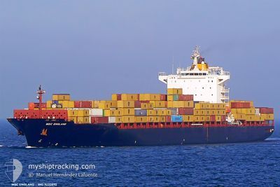
MSC ENGLAND
Container Ship
Current Trip
TTPOS
| Time Travelled | 1 day |
|---|---|
| Remaining Time | --- |
| Distance Travelled | 316.21 nm |
| Remaining Distance | --- |
| AVG Speed | 8.9 Knots |
| MAX Speed | 11.3 Knots |
| AVG Wind | 16.5 knots |
| MAX Wind | 20 knots |
| MIN Temp | 24.6°C / 76.28°F |
| MAX Temp | 28°C / 82.4°F |
| Draught | 9.4 m |
| Position Received | 1 d ago |
Current Position
| Longitude | -61.70286° |
|---|---|
| Latitude | 10.63232° |
| Status | Under way using engine |
| Speed | 10.7 Knots |
| Course | 284.3° |
| Area | Caribbean Sea |
| Station | T-AIS |
| Position Received | 1 d ago |
Info
Information
The current position of MSC ENGLAND is in Caribbean Sea with coordinates 10.63232° / -61.70286° as reported on 2024-04-24 08:26 by AIS to our vessel tracker app. The vessel's current speed is 10.7 Knots
The vessel MSC ENGLAND (IMO: 9232890, MMSI: 636019395) is a Container Ship that was built in 2001 ( 23 years old ). It's sailing under the flag of [LR] Liberia.
In this page you can find informations about the vessels current position, last detected port calls, and current voyage information. If the vessels is not in coverage by AIS you will find the latest position.
The current position of MSC ENGLAND is detected by our AIS receivers and we are not responsible for the reliability of the data. The last position was recorded while the vessel was in Coverage by the Ais receivers of our vessel tracking app.
The current draught of MSC ENGLAND as reported by AIS is 9.4 meters
Weather
| Temperature | 27.4°C / 81.32°F |
|---|---|
| Wind Speed | 16 knots |
| Direction | 92° E |
| Pressure | 1013.7 hPa |
| Humidity | 78.2 % |
| Cloud Coverage | 17 % |
Featured Company
Last Port Calls
| Port | Arrival | Departure | Time In Port |
|---|---|---|---|
| 2024-04-20 23:18 | 2024-04-24 07:26 | 3 d | |
| 2024-04-17 01:19 | 2024-04-17 15:28 | 14 h | |
| 2024-04-15 15:13 | 2024-04-16 13:39 | 22 h | |
| 2024-04-11 12:49 | 2024-04-12 07:33 | 18 h | |
| 2024-04-04 08:14 | 2024-04-05 07:58 | 23 h | |
| 2024-03-29 11:00 | 2024-03-30 01:55 | 14 h | |
| 2024-03-25 06:43 | 2024-03-29 00:43 | 3 d | |
| 2024-03-21 22:14 | 2024-03-21 22:21 | 7 m | |
| 2024-03-21 06:58 | 2024-03-21 22:05 | 15 h | |
| 2024-03-21 06:30 | 2024-03-21 06:43 | 13 m |
Most Visited Ports (Last year)
| Port | Arrivals | |
|---|---|---|
| 7 | ||
| 6 | ||
| 5 | ||
| 5 | ||
| 5 | ||
| 4 |
Last Trips
| Origin | Departure | Destination | Arrival | Distance | |
|---|---|---|---|---|---|
| 2024-04-17 10:28 | 2024-04-20 19:18 | 1166.83 nm | |||
| 2024-04-16 08:39 | 2024-04-16 20:19 | 36.04 nm | |||
| 2024-04-12 02:33 | 2024-04-15 10:13 | 51.17 nm | |||
| 2024-04-05 03:58 | 2024-04-11 07:49 | 1947.16 nm | |||
| 2024-03-29 20:55 | 2024-04-04 04:14 | 1943.22 nm | |||
| 2024-03-28 19:43 | 2024-03-29 06:00 | 34.92 nm | |||
| 2024-03-21 18:21 | 2024-03-25 01:43 | 1284.83 nm | |||
| 2024-03-21 18:05 | 2024-03-21 18:14 | 0.36 nm | |||
| 2024-03-21 02:43 | 2024-03-21 02:58 | 0.77 nm | |||
| 2024-03-15 00:03 | 2024-03-21 02:30 | 1041.54 nm |
Events
| Time | Event | Details | Position / Dest | Info |
|---|---|---|---|---|
| 2024-04-24 08:34 | Status Changed | Default Under way using engine |
10.63833 / -61.72500
TTPOS
|
Speed: 10.7 kn Course: 284.3° |
| 2024-04-24 08:26 | OUT of Coverage |
10.63232 / -61.70286
Caribbean Sea
|
Speed: 10.7 kn Course: 284.3° |
|
| 2024-04-24 08:20 | Status Changed | Under way using engine Default |
10.62779 / -61.68463
TTPOS
|
Speed: 10 kn Course: 283° |
| 2024-04-24 08:13 | IN Coverage |
10.62779 / -61.68463
Caribbean Sea
|
Speed: 10.5 kn Course: 284.5° |
|
| 2024-04-24 07:26 | PORT DEPARTURE |
|
10.64500 / -61.53886
TTPOS
|
Speed: 6.3 kn Course: 239° |
| 2024-04-24 07:22 | START Moving |
10.65018 / -61.52980
[TT] PORT OF SPAIN
|
Speed: 6.3 kn Course: 239° |
|
| 2024-04-20 23:18 | STOP Moving |
10.65494 / -61.52648
[TT] PORT OF SPAIN
|
Speed: 0.3 kn Course: 117° |
|
| 2024-04-20 23:18 | PORT ARRIVAL |
|
10.65494 / -61.52648
[TT] PORT OF SPAIN
|
Speed: 3.5 kn Course: 64° |
| 2024-04-20 22:02 | Status Changed | Default Under way using engine |
10.61283 / -61.68208
TTPOS
|
Speed: 8.1 kn Course: 117.4° |
| 2024-04-20 21:57 | OUT of Coverage |
10.61891 / -61.69374
Caribbean Sea
TTPOS
|
Speed: 8.1 kn Course: 117.4° |