
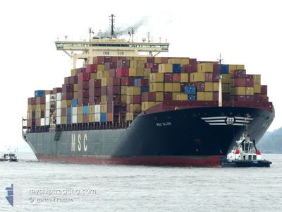
MSC ELLEN
Container Ship
Current Trip
| Time Travelled | 4 days |
|---|---|
| Remaining Time | --- |
| Distance Travelled | 1833.07 nm |
| Remaining Distance | --- |
| AVG Speed | 16.3 Knots |
| MAX Speed | 20.7 Knots |
| AVG Wind | 17.4 knots |
| MAX Wind | 34 knots |
| MIN Temp | 2.5°C / 36.5°F |
| MAX Temp | 20.2°C / 68.36°F |
| Draught | 15 m |
| Position Received | 1 m ago |
Current Position
| Longitude | -15.56682° |
|---|---|
| Latitude | 26.82542° |
| Status | Under way using engine |
| Speed | 20.1 Knots |
| Course | 196.5° |
| Area | North Atlantic Ocean |
| Station | T-AIS |
| Position Received | 1 m ago |
Info
Information
The current position of MSC ELLEN is in North Atlantic Ocean with coordinates 26.82542° / -15.56682° as reported on 2024-04-25 09:33 by AIS to our vessel tracker app. The vessel's current speed is 20.1 Knots and is heading at the port of COLOMBO. The estimated time of arrival as calculated by MyShipTracking vessel tracking app is 2024-05-17 14:30 LT
The vessel MSC ELLEN (IMO: 9166780, MMSI: 636020729) is a Container Ship that was built in 1999 ( 25 years old ). It's sailing under the flag of [LR] Liberia.
In this page you can find informations about the vessels current position, last detected port calls, and current voyage information. If the vessels is not in coverage by AIS you will find the latest position.
The current position of MSC ELLEN is detected by our AIS receivers and we are not responsible for the reliability of the data. The last position was recorded while the vessel was in Coverage by the Ais receivers of our vessel tracking app.
The current draught of MSC ELLEN as reported by AIS is 15 meters
Weather
| Temperature | 20.2°C / 68.36°F |
|---|---|
| Wind Speed | 19 knots |
| Direction | 41° NE |
| Pressure | 1015.4 hPa |
| Humidity | 77 % |
| Cloud Coverage | --- |
Featured Company
Last Port Calls
| Port | Arrival | Departure | Time In Port |
|---|---|---|---|
| 2024-04-19 23:26 | 2024-04-20 21:33 | 22 h | |
| 2024-04-15 22:37 | 2024-04-17 18:01 | 1 d | |
| 2024-04-13 11:39 | 2024-04-13 23:42 | 12 h | |
| 2024-04-11 14:10 | 2024-04-13 01:07 | 1 d | |
| 2024-04-08 23:09 | 2024-04-10 10:44 | 1 d | |
| 2024-03-08 02:27 | |||
| 2024-02-24 19:48 | 2024-02-25 19:51 | 1 d | |
| 2024-02-18 06:33 |
Most Visited Ports (Last year)
| Port | Arrivals | |
|---|---|---|
| 6 | ||
| 6 | ||
| 4 | ||
| 4 | ||
| 3 | ||
| 3 |
Last Trips
| Origin | Departure | Destination | Arrival | Distance | |
|---|---|---|---|---|---|
| 2024-04-17 20:01 | 2024-04-20 00:26 | 293.89 nm | |||
| 2024-04-14 01:42 | 2024-04-16 00:37 | 432.12 nm | |||
| 2024-04-13 03:07 | 2024-04-13 13:39 | 135.65 nm | |||
| 2024-04-10 12:44 | 2024-04-11 16:10 | 333.87 nm | |||
| 2024-03-08 07:57 | 2024-04-09 01:09 | 11073.98 nm | |||
| 2024-01-22 18:24 | 2024-02-18 12:03 | 9142.66 nm |
Events
| Time | Event | Details | Position / Dest | Info |
|---|---|---|---|---|
| 2024-04-25 09:20 | Status Changed | Under way using engine Default |
26.89394 / -15.54547
LKCMB
|
Speed: 20 kn Course: 193° |
| 2024-04-25 09:04 | Status Changed | Default Under way using engine |
26.97679 / -15.51296
LKCMB
|
Speed: 20.4 kn Course: 199.6° |
| 2024-04-25 08:58 | Status Changed | Under way using engine Default |
27.00897 / -15.49988
LKCMB
|
Speed: 20 kn Course: 200° |
| 2024-04-25 08:53 | Status Changed | Default Under way using engine |
27.03500 / -15.48833
LKCMB
|
Speed: 19.7 kn Course: 200.4° |
| 2024-04-25 08:29 | Status Changed | Under way using engine Default |
27.15812 / -15.43774
LKCMB
|
Speed: 17.7 kn Course: 202° |
| 2024-04-25 08:23 | IN Coverage |
27.15626 / -15.43857
North Atlantic Ocean
LKCMB
|
Speed: 18 kn Course: 201.6° |
|
| 2024-04-25 06:34 | Status Changed | Default Under way using engine |
27.64815 / -15.21540
LKCMB
|
Speed: 16.4 kn Course: 202° |
| 2024-04-25 06:28 | Status Changed | Under way using engine Default |
27.67353 / -15.20393
LKCMB
|
Speed: 16.4 kn Course: 203° |
| 2024-04-25 06:28 | OUT of Coverage |
27.67353 / -15.20393
North Atlantic Ocean
LKCMB
|
Speed: 16.4 kn Course: 202° |
|
| 2024-04-25 06:27 | Status Changed | Default Under way using engine |
27.68111 / -15.20046
LKCMB
|
Speed: 16.4 kn Course: 202.6° |