
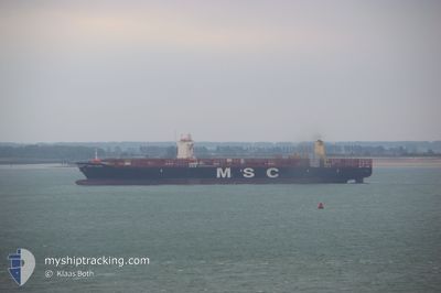
MSC CHLOE
Cargo D
Current Trip
| Time Travelled | 10 days |
|---|---|
| Remaining Time | 1 day |
| Distance Travelled | 4394.68 nm |
| Remaining Distance | 697.57 nm |
| AVG Speed | 16.7 Knots |
| MAX Speed | 18.1 Knots |
| AVG Wind | 11.3 knots |
| MAX Wind | 23 knots |
| MIN Temp | 11.8°C / 53.24°F |
| MAX Temp | 29.7°C / 85.46°F |
| Draught | 14 m |
| Position Received | 3 d ago |
Current Position
| Longitude | -28.08919° |
|---|---|
| Latitude | 9.47187° |
| Status | Under way using engine |
| Speed | 17 Knots |
| Course | 196.8° |
| Area | North Atlantic Ocean |
| Station | T-AIS |
| Position Received | 3 d ago |
Info
Information
The current position of MSC CHLOE is in North Atlantic Ocean with coordinates 9.47187° / -28.08919° as reported on 2024-04-20 02:43 by AIS to our vessel tracker app. The vessel's current speed is 17 Knots and is heading at the port of RIO DE JANEIRO. The estimated time of arrival as calculated by MyShipTracking vessel tracking app is 2024-04-25 15:08 LT
The vessel MSC CHLOE (IMO: 9720483, MMSI: 255805855) is a Cargo D It's sailing under the flag of [PT] Portugal.
In this page you can find informations about the vessels current position, last detected port calls, and current voyage information. If the vessels is not in coverage by AIS you will find the latest position.
The current position of MSC CHLOE is detected by our AIS receivers and we are not responsible for the reliability of the data. The last position was recorded while the vessel was in Coverage by the Ais receivers of our vessel tracking app.
The current draught of MSC CHLOE as reported by AIS is 14 meters
Weather
| Temperature | 27.3°C / 81.14°F |
|---|---|
| Wind Speed | 10 knots |
| Direction | 65° ENE |
| Pressure | 1012.6 hPa |
| Humidity | 81.7 % |
| Cloud Coverage | 100 % |
Featured Company
Last Port Calls
| Port | Arrival | Departure | Time In Port |
|---|---|---|---|
| 2024-04-12 11:10 | 2024-04-13 00:31 | 13 h | |
| 2024-04-01 03:57 | 2024-04-11 13:13 | 10 d | |
| 2024-03-28 15:10 | 2024-03-29 12:13 | 21 h | |
| 2024-03-27 04:21 | 2024-03-28 05:49 | 1 d | |
| 2024-03-25 11:09 | 2024-03-26 00:13 | 13 h | |
| 2024-03-23 21:43 | 2024-03-25 00:19 | 1 d | |
| 2024-03-02 11:14 | 2024-03-02 11:20 | 6 m | |
| 2024-02-29 11:04 | 2024-02-29 11:28 | 23 m | |
| 2024-02-26 21:30 | 2024-02-27 01:50 | 4 h | |
| 2024-02-19 19:32 | 2024-02-21 10:09 | 1 d |
Most Visited Ports (Last year)
| Port | Arrivals | |
|---|---|---|
| 8 | ||
| 8 | ||
| 8 | ||
| 5 | ||
| 5 | ||
| 5 |
Last Trips
| Origin | Departure | Destination | Arrival | Distance | |
|---|---|---|---|---|---|
| 2024-04-11 15:13 | 2024-04-12 13:10 | 289.28 nm | |||
| 2024-03-29 13:13 | 2024-04-01 05:57 | 462.12 nm | |||
| 2024-03-28 06:49 | 2024-03-28 16:10 | 133.33 nm | |||
| 2024-03-26 00:13 | 2024-03-27 05:21 | 433.37 nm | |||
| 2024-03-25 01:19 | 2024-03-25 11:09 | 151.13 nm | |||
| 2024-02-29 08:28 | 2024-03-02 08:14 | 245.77 nm | |||
| 2024-02-26 22:50 | 2024-02-29 08:04 | 189.92 nm | |||
| 2024-02-21 07:09 | 2024-02-26 18:30 | 883.02 nm | |||
| 2024-02-18 13:09 | 2024-02-19 16:32 | 142.36 nm | |||
| 2024-02-14 23:00 | 2024-02-17 03:25 | 816.52 nm |
Events
| Time | Event | Details | Position / Dest | Info |
|---|---|---|---|---|
| 2024-04-20 02:50 | Status Changed | Default Under way using engine |
9.43634 / -28.10007
BR RIO
|
Speed: 17 kn Course: 196.8° |
| 2024-04-20 02:43 | OUT of Coverage |
9.47187 / -28.08919
North Atlantic Ocean
BR RIO
|
Speed: 17 kn Course: 196.8° |
|
| 2024-04-20 01:36 | Status Changed | Under way using engine Default |
9.78070 / -27.99704
BR RIO
|
Speed: 17.3 kn Course: 197° |
| 2024-04-20 01:18 | IN Coverage |
9.77607 / -27.99842
North Atlantic Ocean
BR RIO
|
Speed: 17.3 kn Course: 196.2° |
|
| 2024-04-19 22:37 | Status Changed | Default Under way using engine |
10.60667 / -27.74833
BR RIO
|
Speed: 17.3 kn Course: 196.8° |
| 2024-04-19 22:32 | OUT of Coverage |
10.62835 / -27.74335
North Atlantic Ocean
BR RIO
|
Speed: 17.3 kn Course: 196.8° |
|
| 2024-04-19 21:57 | Status Changed | Under way using engine Default |
10.79430 / -27.69341
BR RIO
|
Speed: 17.1 kn Course: 196° |
| 2024-04-19 21:34 | Status Changed | Default Under way using engine |
10.89833 / -27.66167
BR RIO
|
Speed: 17.1 kn Course: 194.7° |
| 2024-04-19 21:04 | Status Changed | Under way using engine Default |
11.03936 / -27.61997
BR RIO
|
Speed: 17 kn Course: 195° |
| 2024-04-19 20:34 | Status Changed | Default Under way using engine |
11.17833 / -27.57667
BR RIO
|
Speed: 17.3 kn Course: 195.1° |