
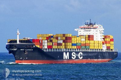
MSC CARMEN
Container Ship
Current Trip
| Time Travelled | 4 days |
|---|---|
| Remaining Time | 8 h, 45 mins |
| Distance Travelled | 1622.56 nm |
| Remaining Distance | 24.84 nm |
| AVG Speed | 13.5 Knots |
| MAX Speed | 18.5 Knots |
| AVG Wind | 12.1 knots |
| MAX Wind | 37.1 knots |
| MIN Temp | 10.3°C / 50.54°F |
| MAX Temp | 21.1°C / 69.98°F |
| Draught | 11.7 m |
| Position Received | 1 m ago |
Current Position
| Longitude | 5.20799° |
|---|---|
| Latitude | 43.05314° |
| Status | Under way using engine |
| Speed | 4.7 Knots |
| Course | 315° |
| Area | Mediterranean Sea - Western Basin |
| Station | T-AIS |
| Position Received | 1 m ago |
Info
Information
The current position of MSC CARMEN is in Mediterranean Sea - Western Basin with coordinates 43.05314° / 5.20799° as reported on 2024-04-18 09:52 by AIS to our vessel tracker app. The vessel's current speed is 4.7 Knots and is heading at the port of FOS. The estimated time of arrival as calculated by MyShipTracking vessel tracking app is 2024-04-18 18:39 LT
The vessel MSC CARMEN (IMO: 9349813, MMSI: 354530000) is a Container Ship that was built in 2008 ( 16 years old ). It's sailing under the flag of [PA] Panama.
In this page you can find informations about the vessels current position, last detected port calls, and current voyage information. If the vessels is not in coverage by AIS you will find the latest position.
The current position of MSC CARMEN is detected by our AIS receivers and we are not responsible for the reliability of the data. The last position was recorded while the vessel was in Coverage by the Ais receivers of our vessel tracking app.
The current draught of MSC CARMEN as reported by AIS is 11.7 meters
Weather
| Temperature | 10.6°C / 51.08°F |
|---|---|
| Wind Speed | 28 knots |
| Direction | 327° NNW |
| Pressure | 1013.5 hPa |
| Humidity | 62.8 % |
| Cloud Coverage | --- |
Featured Company
Last Port Calls
| Port | Arrival | Departure | Time In Port |
|---|---|---|---|
| 2024-04-12 22:24 | 2024-04-13 12:18 | 13 h | |
| 2024-04-11 20:39 | |||
| 2024-04-08 20:45 | 2024-04-09 20:49 | 1 d | |
| 2024-04-05 20:59 | 2024-04-06 18:49 | 21 h | |
| 2024-04-03 06:45 | 2024-04-04 13:10 | 1 d | |
| 2024-03-19 03:55 | 2024-03-19 23:04 | 19 h | |
| 2024-03-12 23:49 | 2024-03-14 00:24 | 1 d | |
| 2024-03-12 00:28 | 2024-03-12 00:37 | 8 m | |
| 2024-03-11 07:06 | 2024-03-12 00:17 | 17 h | |
| 2024-03-11 06:32 | 2024-03-11 06:48 | 16 m |
Last Trips
| Origin | Departure | Destination | Arrival | Distance | |
|---|---|---|---|---|---|
| 2024-04-09 23:49 | 2024-04-11 23:39 | 377.18 nm | |||
| 2024-04-06 21:49 | 2024-04-08 23:45 | 631.74 nm | |||
| 2024-04-04 15:10 | 2024-04-05 23:59 | 528.62 nm | |||
| 2024-03-19 18:04 | 2024-04-03 08:45 | 5676.09 nm | |||
| 2024-03-13 20:24 | 2024-03-18 22:55 | 1316.77 nm | |||
| 2024-03-11 20:37 | 2024-03-12 19:49 | 120.77 nm | |||
| 2024-03-11 20:17 | 2024-03-11 20:28 | 0.47 nm | |||
| 2024-03-11 02:48 | 2024-03-11 03:06 | 0.72 nm | |||
| 2024-03-08 09:40 | 2024-03-11 02:32 | 402.78 nm | |||
| 2024-03-04 21:52 | 2024-03-07 04:25 | 560.08 nm |
Events
| Time | Event | Details | Position / Dest | Info |
|---|---|---|---|---|
| 2024-04-18 09:35 | ETA Changed | 2024/04/18 12:45 2024/04/18 02:00 |
43.03854 / 5.22549
FOS SUR MER
|
Speed: 3 kn Course: 337° |
| 2024-04-18 08:02 | Status Changed | Under way using engine Default |
43.00939 / 5.05293
FOS SUR MER
|
Speed: 5.3 kn Course: 93° |
| 2024-04-18 07:40 | Status Changed | Default Under way using engine |
43.00331 / 5.01134
FOS SUR MER
|
Speed: 5.5 kn Course: 97.7° |
| 2024-04-18 07:31 | Status Changed | Under way using engine Default |
43.00500 / 4.99343
FOS SUR MER
|
Speed: 5.7 kn Course: 87° |
| 2024-04-18 07:31 | IN Coverage |
43.00500 / 4.99343
Mediterranean Sea - Western Basin
|
Speed: 5.5 kn Course: 97.7° |
|
| 2024-04-18 00:01 | Status Changed | Default Under way using engine |
43.09557 / 5.17825
FOS SUR MER
|
Speed: 9.2 kn Course: 304.4° |
| 2024-04-17 23:57 | OUT of Coverage |
43.09386 / 5.18938
Mediterranean Sea - Western Basin
FOS SUR MER
|
Speed: 9.2 kn Course: 304.4° |
|
| 2024-04-17 23:47 | Status Changed | Under way using engine Default |
43.07858 / 5.22083
FOS SUR MER
|
Speed: 10.7 kn Course: 303° |
| 2024-04-17 23:44 | Status Changed | Default Under way using engine |
43.07373 / 5.23104
FOS SUR MER
|
Speed: 10.7 kn Course: 303.2° |
| 2024-04-17 23:18 | Status Changed | Under way using engine Default |
43.03294 / 5.32053
FOS SUR MER
|
Speed: 10 kn Course: 302° |