
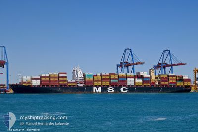
MSC CARLOTTA
Cargo D
Current Trip
| Time Travelled | 5 days |
|---|---|
| Remaining Time | --- |
| Distance Travelled | 2078.74 nm |
| Remaining Distance | --- |
| AVG Speed | 16.6 Knots |
| MAX Speed | 17.7 Knots |
| AVG Wind | 13.6 knots |
| MAX Wind | 25.9 knots |
| MIN Temp | 24.6°C / 76.28°F |
| MAX Temp | 30°C / 86°F |
| Draught | 13.1 m |
| Position Received | 2 d ago |
Current Position
| Longitude | -61.51424° |
|---|---|
| Latitude | 16.75617° |
| Status | Under way using engine |
| Speed | 17.1 Knots |
| Course | 73.2° |
| Area | Caribbean Sea |
| Station | T-AIS |
| Position Received | 2 d ago |
Info
Information
The current position of MSC CARLOTTA is in Caribbean Sea with coordinates 16.75617° / -61.51424° as reported on 2024-04-17 16:01 by AIS to our vessel tracker app. The vessel's current speed is 17.1 Knots and is heading at the port of MARSAXLOKK. The estimated time of arrival as calculated by MyShipTracking vessel tracking app is 2024-04-28 04:00 LT
The vessel MSC CARLOTTA (IMO: 9756731, MMSI: 636018106) is a Cargo D It's sailing under the flag of [LR] Liberia.
In this page you can find informations about the vessels current position, last detected port calls, and current voyage information. If the vessels is not in coverage by AIS you will find the latest position.
The current position of MSC CARLOTTA is detected by our AIS receivers and we are not responsible for the reliability of the data. The last position was recorded while the vessel was in Coverage by the Ais receivers of our vessel tracking app.
The current draught of MSC CARLOTTA as reported by AIS is 13.1 meters
Weather
| Temperature | 24.6°C / 76.28°F |
|---|---|
| Wind Speed | 12 knots |
| Direction | 183° S |
| Pressure | 1016.5 hPa |
| Humidity | 74.7 % |
| Cloud Coverage | 54 % |
Featured Company
Last Port Calls
| Port | Arrival | Departure | Time In Port |
|---|---|---|---|
| 2024-04-13 15:10 | 2024-04-14 18:42 | 1 d | |
| 2024-04-10 17:49 | 2024-04-12 09:44 | 1 d | |
| 2024-04-03 05:19 | 2024-04-03 16:59 | 11 h | |
| 2024-03-28 22:06 | 2024-03-30 02:10 | 1 d | |
| 2024-03-25 20:24 | 2024-03-27 09:51 | 1 d | |
| 2024-03-17 18:09 | 2024-03-19 01:48 | 1 d | |
| 2024-03-16 12:12 | 2024-03-17 08:43 | 20 h | |
| 2024-03-12 04:50 | 2024-03-13 10:00 | 1 d | |
| 2024-03-04 13:21 | 2024-03-05 13:15 | 23 h | |
| 2024-02-29 01:34 | 2024-02-29 17:06 | 15 h |
Most Visited Ports (Last year)
| Port | Arrivals | |
|---|---|---|
| 8 | ||
| 8 | ||
| 7 | ||
| 6 | ||
| 5 | ||
| 4 |
Last Trips
| Origin | Departure | Destination | Arrival | Distance | |
|---|---|---|---|---|---|
| 2024-04-12 04:44 | 2024-04-13 10:10 | 103.76 nm | |||
| 2024-04-03 10:59 | 2024-04-10 12:49 | 1620.80 nm | |||
| 2024-03-29 19:10 | 2024-04-02 23:19 | 1376.10 nm | |||
| 2024-03-27 02:51 | 2024-03-28 15:06 | 403.44 nm | |||
| 2024-03-18 18:48 | 2024-03-25 13:24 | 858.04 nm | |||
| 2024-03-17 01:43 | 2024-03-17 11:09 | 162.40 nm | |||
| 2024-03-13 03:00 | 2024-03-16 05:12 | 943.25 nm | |||
| 2024-03-05 05:15 | 2024-03-11 21:50 | 395.23 nm | |||
| 2024-02-29 11:06 | 2024-03-04 05:21 | 1213.74 nm | |||
| 2024-02-23 20:35 | 2024-02-28 19:34 | 1748.97 nm |
Events
| Time | Event | Details | Position / Dest | Info |
|---|---|---|---|---|
| 2024-04-17 16:07 | Status Changed | Default Under way using engine |
16.76333 / -61.48500
MTMAR! PLT
|
Speed: 17.1 kn Course: 73.2° |
| 2024-04-17 16:01 | Status Changed | Under way using engine Default |
16.75617 / -61.51424
MTMAR! PLT
|
Speed: 17 kn Course: 71° |
| 2024-04-17 16:01 | OUT of Coverage |
16.75617 / -61.51424
Caribbean Sea
MTMAR! PLT
|
Speed: 17.1 kn Course: 73.2° |
|
| 2024-04-17 15:35 | Status Changed | Default Under way using engine |
16.71683 / -61.63475
MTMAR! PLT
|
Speed: 17.3 kn Course: 71.2° |
| 2024-04-17 14:49 | Change Sea Area | Guadeloupe and Martinique part of the Caribbean Sea Montserrat part of the Caribbean Sea |
16.65073 / -61.85240
Caribbean Sea
MTMAR! PLT
|
Speed: 17.3 kn Course: 74.7° |
| 2024-04-17 13:37 | Change Sea Area | Montserrat part of the Caribbean Sea Venezuelan part of the Caribbean Sea |
16.54566 / -62.18759
Caribbean Sea
MTMAR! PLT
|
Speed: 16.4 kn Course: 62.9° |
| 2024-04-17 13:36 | Status Changed | Under way using engine Default |
16.54335 / -62.19266
MTMAR! PLT
|
Speed: 16.8 kn Course: 75° |
| 2024-04-17 13:29 | IN Coverage |
16.54566 / -62.18759
Caribbean Sea
MTMAR! PLT
|
Speed: 16.4 kn Course: 62.9° |
|
| 2024-04-17 10:16 | Status Changed | Default Under way using engine |
16.27865 / -63.15301
MTMAR! PLT
|
Speed: 17.3 kn Course: 74.1° |
| 2024-04-17 10:14 | OUT of Coverage |
16.27579 / -63.16358
Caribbean Sea
MTMAR! PLT
|
Speed: 17.3 kn Course: 74.1° |