
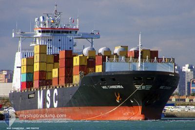
MSC CANBERRA
Container Ship
Current Trip
| Time Travelled | 1 day |
|---|---|
| Remaining Time | --- |
| Distance Travelled | 354.42 nm |
| Remaining Distance | --- |
| AVG Speed | 12 Knots |
| MAX Speed | 13.3 Knots |
| AVG Wind | 20.5 knots |
| MAX Wind | 29.2 knots |
| MIN Temp | 17.3°C / 63.14°F |
| MAX Temp | 20.8°C / 69.44°F |
| Draught | 11 m |
| Position Received | 22 h, 35 m ago |
Current Position
| Longitude | -54.73169° |
|---|---|
| Latitude | -35.08298° |
| Status | Under way using engine |
| Speed | 12.2 Knots |
| Course | 89.4° |
| Area | South Atlantic Ocean |
| Station | T-AIS |
| Position Received | 22 h, 35 m ago |
Info
Information
The current position of MSC CANBERRA is in South Atlantic Ocean with coordinates -35.08298° / -54.73169° as reported on 2024-04-23 01:51 by AIS to our vessel tracker app. The vessel's current speed is 12.2 Knots and is heading at the port of PORT LOUIS. The estimated time of arrival as calculated by MyShipTracking vessel tracking app is 2024-05-11 17:00 LT
The vessel MSC CANBERRA (IMO: 9102722, MMSI: 357455000) is a Container Ship that was built in 1995 ( 29 years old ). It's sailing under the flag of [PA] Panama.
In this page you can find informations about the vessels current position, last detected port calls, and current voyage information. If the vessels is not in coverage by AIS you will find the latest position.
The current position of MSC CANBERRA is detected by our AIS receivers and we are not responsible for the reliability of the data. The last position was recorded while the vessel was in Coverage by the Ais receivers of our vessel tracking app.
The current draught of MSC CANBERRA as reported by AIS is 11 meters
Weather
| Temperature | 17.5°C / 63.5°F |
|---|---|
| Wind Speed | 29 knots |
| Direction | 256° WSW |
| Pressure | 1005.3 hPa |
| Humidity | 69.3 % |
| Cloud Coverage | 7 % |
Featured Company
Last Port Calls
| Port | Arrival | Departure | Time In Port |
|---|---|---|---|
| 2024-04-21 15:49 | 2024-04-22 19:13 | 1 d | |
| 2024-04-17 09:01 | 2024-04-17 18:38 | 9 h | |
| 2024-04-04 18:57 | 2024-04-04 19:46 | 48 m | |
| 2024-04-04 00:05 | 2024-04-04 00:54 | 48 m | |
| 2024-03-27 07:57 | 2024-03-29 20:22 | 2 d | |
| 2024-03-24 22:48 | 2024-03-25 21:46 | 22 h | |
| 2024-03-21 13:17 | 2024-03-22 08:12 | 18 h | |
| 2024-03-18 01:15 | |||
| 2024-03-06 02:39 | 2024-03-07 20:43 | 1 d | |
| 2024-03-01 07:55 | 2024-03-03 04:04 | 1 d |
Most Visited Ports (Last year)
| Port | Arrivals | |
|---|---|---|
| 15 | ||
| 9 | ||
| 7 | ||
| 7 | ||
| 7 | ||
| 7 |
Last Trips
| Origin | Departure | Destination | Arrival | Distance | |
|---|---|---|---|---|---|
| 2024-04-17 15:38 | 2024-04-21 12:49 | 791.49 nm | |||
| 2024-04-04 16:46 | 2024-04-17 06:01 | 811.23 nm | |||
| 2024-04-03 21:54 | 2024-04-04 15:57 | 3.12 nm | |||
| 2024-03-29 17:22 | 2024-04-03 21:05 | 639.98 nm | |||
| 2024-03-25 18:46 | 2024-03-27 04:57 | 525.80 nm | |||
| 2024-03-22 05:12 | 2024-03-24 19:48 | 886.18 nm | |||
| 2024-03-17 22:15 | 2024-03-21 10:17 | 567.74 nm | |||
| 2024-03-02 23:04 | 2024-03-05 22:39 | 852.67 nm | |||
| 2024-02-23 21:29 | 2024-03-01 02:55 | 1460.20 nm | |||
| 2024-02-21 13:47 | 2024-02-23 12:15 | 738.98 nm |
Events
| Time | Event | Details | Position / Dest | Info |
|---|---|---|---|---|
| 2024-04-23 01:56 | Status Changed | Default Under way using engine |
-35.08274 / -54.71062
PORT LOUIS
|
Speed: 12.2 kn Course: 89.4° |
| 2024-04-23 01:51 | Status Changed | Under way using engine Default |
-35.08298 / -54.73169
PORT LOUIS
|
Speed: 12.1 kn Course: 90° |
| 2024-04-23 01:51 | OUT of Coverage |
-35.08298 / -54.73169
South Atlantic Ocean
PORT LOUIS
|
Speed: 12.2 kn Course: 89.4° |
|
| 2024-04-23 01:43 | Status Changed | Default Under way using engine |
-35.08167 / -54.76167
PORT LOUIS
|
Speed: 12.1 kn Course: 91.3° |
| 2024-04-23 01:14 | ETA Changed | 2024/05/11 17:00 2024/05/11 12:00 |
-35.08453 / -54.88343
PORT LOUIS
|
Speed: 12.1 kn Course: 89.2° |
| 2024-04-23 00:26 | Change Sea Area | Uruguayan part of the South Atlantic Ocean Uruguayan part of the Rio de La Plata |
-35.04760 / -55.07160
South Atlantic Ocean
PORT LOUIS
|
Speed: 12.1 kn Course: 104.7° |
| 2024-04-22 22:53 | Draught Changed | 11 9.2 |
-35.05388 / -55.45716
PORT LOUIS
|
Speed: 12 kn Course: 86.4° |
| 2024-04-22 22:53 | Destination Changed | PORT LOUIS MONTEVEDIO |
-35.05388 / -55.45716
PORT LOUIS
|
Speed: 12 kn Course: 86.4° |
| 2024-04-22 22:53 | ETA Changed | 2024/05/11 12:00 2024/04/21 11:30 |
-35.05388 / -55.45716
PORT LOUIS
|
Speed: 12 kn Course: 86.4° |
| 2024-04-22 22:50 | Status Changed | Under way using engine Default |
-35.05417 / -55.46331
MONTEVEDIO
|
Speed: 12.1 kn Course: 86° |