
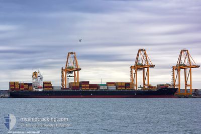
MSC ARUSHI R.
Container Ship
Current Trip
| Time Travelled | 2 days |
|---|---|
| Remaining Time | 6 h, 59 mins |
| Distance Travelled | 894.79 nm |
| Remaining Distance | 124.35 nm |
| AVG Speed | 14.9 Knots |
| MAX Speed | 17.3 Knots |
| AVG Wind | 12.2 knots |
| MAX Wind | 18.1 knots |
| MIN Temp | 3°C / 37.4°F |
| MAX Temp | 8.1°C / 46.58°F |
| Draught | 11.3 m |
| Position Received | 30 m ago |
Current Position
| Longitude | 16.29220° |
|---|---|
| Latitude | 55.35258° |
| Status | Under way using engine |
| Speed | 16.1 Knots |
| Course | 103.3° |
| Area | Kattegat |
| Station | T-AIS |
| Position Received | 30 m ago |
Info
Information
The current position of MSC ARUSHI R. is in Kattegat with coordinates 55.35258° / 16.29220° as reported on 2024-04-19 11:24 by AIS to our vessel tracker app. The vessel's current speed is 16.1 Knots and is heading at the port of GDYNIA. The estimated time of arrival as calculated by MyShipTracking vessel tracking app is 2024-04-19 18:53 LT
The vessel MSC ARUSHI R. (IMO: 9244881, MMSI: 636016432) is a Container Ship that was built in 2002 ( 22 years old ). It's sailing under the flag of [LR] Liberia.
In this page you can find informations about the vessels current position, last detected port calls, and current voyage information. If the vessels is not in coverage by AIS you will find the latest position.
The current position of MSC ARUSHI R. is detected by our AIS receivers and we are not responsible for the reliability of the data. The last position was recorded while the vessel was in Coverage by the Ais receivers of our vessel tracking app.
The current draught of MSC ARUSHI R. as reported by AIS is 11.3 meters
Weather
| Temperature | 3°C / 37.4°F |
|---|---|
| Wind Speed | 7 knots |
| Direction | 124° SE |
| Pressure | 1004.2 hPa |
| Humidity | 94.2 % |
| Cloud Coverage | 100 % |
Featured Company
Last Port Calls
| Port | Arrival | Departure | Time In Port |
|---|---|---|---|
| 2024-04-16 16:49 | 2024-04-17 01:25 | 8 h | |
| 2024-04-14 02:21 | 2024-04-15 00:45 | 22 h | |
| 2024-03-30 21:07 | 2024-03-31 10:01 | 12 h | |
| 2024-03-29 17:06 | 2024-03-30 11:34 | 18 h | |
| 2024-03-25 11:41 | 2024-03-26 16:09 | 1 d | |
| 2024-03-22 05:25 | 2024-03-23 05:25 | 23 h | |
| 2024-03-19 20:04 | 2024-03-21 00:55 | 1 d | |
| 2024-03-17 01:50 | 2024-03-17 17:05 | 15 h | |
| 2024-03-11 02:37 | 2024-03-12 13:14 | 1 d | |
| 2024-03-03 11:13 | 2024-03-03 23:47 | 12 h |
Most Visited Ports (Last year)
| Port | Arrivals | |
|---|---|---|
| 6 | ||
| 5 | ||
| 4 | ||
| 4 | ||
| 3 | ||
| 3 |
Last Trips
| Origin | Departure | Destination | Arrival | Distance | |
|---|---|---|---|---|---|
| 2024-04-15 02:45 | 2024-04-16 18:49 | 269.31 nm | |||
| 2024-03-31 05:01 | 2024-04-14 04:21 | 5272.15 nm | |||
| 2024-03-30 06:34 | 2024-03-30 16:07 | 30.85 nm | |||
| 2024-03-26 11:09 | 2024-03-29 12:06 | 837.33 nm | |||
| 2024-03-23 00:25 | 2024-03-25 06:41 | 142.37 nm | |||
| 2024-03-20 19:55 | 2024-03-22 00:25 | 107.13 nm | |||
| 2024-03-17 12:05 | 2024-03-19 15:04 | 790.98 nm | |||
| 2024-03-12 09:14 | 2024-03-16 20:50 | 1279.58 nm | |||
| 2024-03-03 18:47 | 2024-03-10 22:37 | 1063.64 nm | |||
| 2024-03-02 04:23 | 2024-03-03 06:13 | 250.12 nm |
Events
| Time | Event | Details | Position / Dest | Info |
|---|---|---|---|---|
| 2024-04-19 10:26 | ETA Changed | 2024/04/19 19:30 2024/04/19 19:00 |
55.40746 / 15.83450
PLGDY
|
Speed: 16.4 kn Course: 100.9° |
| 2024-04-19 05:58 | Change Sea Area | Danish part of the Kattegat Swedish part of the Baltic Sea |
54.98773 / 14.03643
Kattegat
PLGDY
|
Speed: 16.8 kn Course: 72° |
| 2024-04-19 05:49 | Change Sea Area | Swedish part of the Baltic Sea German part of the Baltic Sea |
54.97454 / 13.96678
Baltic Sea
PLGDY
|
Speed: 16.8 kn Course: 71.8° |
| 2024-04-19 03:22 | Change Sea Area | German part of the Baltic Sea Danish part of the Baltic Sea |
54.78547 / 12.81961
Baltic Sea
PLGDY
|
Speed: 16.2 kn Course: 80.6° |
| 2024-04-19 02:55 | Change Sea Area | Danish part of the Baltic Sea German part of the Baltic Sea |
54.73526 / 12.63393
Baltic Sea
PLGDY
|
Speed: 16.3 kn Course: 55.3° |
| 2024-04-19 02:16 | Change Sea Area | German part of the Baltic Sea Danish part of the Baltic Sea |
54.63058 / 12.37700
Baltic Sea
PLGDY
|
Speed: 16.7 kn Course: 55.2° |
| 2024-04-19 01:41 | Change Sea Area | Danish part of the Baltic Sea German part of the Baltic Sea |
54.52534 / 12.24728
Baltic Sea
PLGDY
|
Speed: 7.4 kn Course: 16.9° |
| 2024-04-19 01:15 | ETA Changed | 2024/04/19 19:00 2024/04/19 18:00 |
54.45544 / 12.20390
PLGDY
|
Speed: 15.6 kn Course: 39.5° |
| 2024-04-19 00:59 | Change Sea Area | German part of the Baltic Sea Danish part of the Baltic Sea |
54.41062 / 12.12135
Baltic Sea
PLGDY
|
Speed: 15.9 kn Course: 86.6° |
| 2024-04-18 23:25 | Change Sea Area | Danish part of the Baltic Sea German part of the Baltic Sea |
54.50406 / 11.44049
Baltic Sea
PLGDY
|
Speed: 16.2 kn Course: 115.6° |