
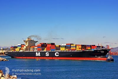
MSC ARICA
Container Ship
Current Trip
| Time Travelled | 10 days |
|---|---|
| Remaining Time | 2 h, 44 mins |
| Distance Travelled | 3239.37 nm |
| Remaining Distance | 25.75 nm |
| AVG Speed | 13 Knots |
| MAX Speed | 16.3 Knots |
| AVG Wind | 12.6 knots |
| MAX Wind | 27.9 knots |
| MIN Temp | 6.7°C / 44.06°F |
| MAX Temp | 18.9°C / 66.02°F |
| Draught | 12.8 m |
| Position Received | 1 m ago |
Current Position
| Longitude | -73.61445° |
|---|---|
| Latitude | 40.35012° |
| Status | Under way using engine |
| Speed | 5.4 Knots |
| Course | 303.6° |
| Area | North Atlantic Ocean |
| Station | T-AIS |
| Position Received | 1 m ago |
Info
Information
The current position of MSC ARICA is in North Atlantic Ocean with coordinates 40.35012° / -73.61445° as reported on 2024-04-20 05:20 by AIS to our vessel tracker app. The vessel's current speed is 5.4 Knots and is heading at the port of NEW YORK. The estimated time of arrival as calculated by MyShipTracking vessel tracking app is 2024-04-20 08:05 LT
The vessel MSC ARICA (IMO: 9619452, MMSI: 636019582) is a Container Ship that was built in 2012 ( 12 years old ). It's sailing under the flag of [LR] Liberia.
In this page you can find informations about the vessels current position, last detected port calls, and current voyage information. If the vessels is not in coverage by AIS you will find the latest position.
The current position of MSC ARICA is detected by our AIS receivers and we are not responsible for the reliability of the data. The last position was recorded while the vessel was in Coverage by the Ais receivers of our vessel tracking app.
The current draught of MSC ARICA as reported by AIS is 12.8 meters
Weather
| Temperature | 8.6°C / 47.48°F |
|---|---|
| Wind Speed | 5 knots |
| Direction | 180° S |
| Pressure | 1017 hPa |
| Humidity | 95.8 % |
| Cloud Coverage | 100 % |
Featured Company
Last Port Calls
| Port | Arrival | Departure | Time In Port |
|---|---|---|---|
| 2024-04-08 16:36 | 2024-04-09 11:46 | 19 h | |
| 2024-04-06 10:36 | 2024-04-06 23:15 | 12 h | |
| 2024-04-03 03:32 | 2024-04-04 22:00 | 1 d | |
| 2024-03-31 05:31 | 2024-04-02 16:16 | 2 d | |
| 2024-03-27 05:08 | 2024-03-29 10:50 | 2 d | |
| 2024-03-25 07:29 | 2024-03-26 18:20 | 1 d | |
| 2024-03-21 20:11 | 2024-03-23 02:55 | 1 d | |
| 2024-03-18 20:59 | 2024-03-19 17:23 | 20 h | |
| 2024-03-07 22:54 | 2024-03-09 07:18 | 1 d | |
| 2024-03-05 18:17 | 2024-03-07 01:40 | 1 d |
Last Trips
| Origin | Departure | Destination | Arrival | Distance | |
|---|---|---|---|---|---|
| 2024-04-07 01:15 | 2024-04-08 18:36 | 403.31 nm | |||
| 2024-04-05 00:00 | 2024-04-06 12:36 | 512.28 nm | |||
| 2024-04-02 18:16 | 2024-04-03 05:32 | 95.12 nm | |||
| 2024-03-29 11:50 | 2024-03-31 07:31 | 345.32 nm | |||
| 2024-03-26 19:20 | 2024-03-27 06:08 | 170.11 nm | |||
| 2024-03-23 03:55 | 2024-03-25 08:29 | 767.99 nm | |||
| 2024-03-19 17:23 | 2024-03-21 21:11 | 440.87 nm | |||
| 2024-03-09 02:18 | 2024-03-18 20:59 | 3932.50 nm | |||
| 2024-03-06 20:40 | 2024-03-07 17:54 | 135.21 nm | |||
| 2024-02-29 13:50 | 2024-03-05 13:17 | 796.87 nm |
Events
| Time | Event | Details | Position / Dest | Info |
|---|---|---|---|---|
| 2024-04-20 02:15 | START Moving |
40.16672 / -73.15347
USNYC
|
Speed: 3.1 kn Course: 340° |
|
| 2024-04-20 01:50 | Status Changed | Under way using engine Default |
40.16143 / -73.15002
USNYC
|
Speed: 0.2 kn Course: 80° |
| 2024-04-20 01:33 | Status Changed | Default Under way using engine |
40.15975 / -73.14876
USNYC
|
Speed: 0.2 kn Course: 83° |
| 2024-04-20 01:25 | STOP Moving |
40.15953 / -73.14927
USNYC
|
Speed: 0.3 kn Course: 88° |
|
| 2024-04-20 01:10 | Status Changed | Under way using engine Default |
40.16179 / -73.15244
USNYC
|
Speed: 2.9 kn Course: 145° |
| 2024-04-20 00:59 | Status Changed | Default Under way using engine |
40.16714 / -73.15591
USNYC
|
Speed: 5.1 kn Course: 194.8° |
| 2024-04-19 12:31 | Status Changed | Under way using engine Default |
40.17204 / -72.76711
USNYC
|
Speed: 1.2 kn Course: 328° |
| 2024-04-19 11:49 | Status Changed | Default Under way using engine |
40.17318 / -72.74764
USNYC
|
Speed: 2.1 kn Course: 330° |
| 2024-04-19 10:44 | ETA Changed | 2024/04/20 07:00 2024/04/18 14:00 |
40.16851 / -72.55315
USNYC
|
Speed: 10.9 kn Course: 270.4° |
| 2024-04-19 10:02 | Detected in Sea | United States part of the North Atlantic Ocean |
40.17483 / -72.39617
North Atlantic Ocean
|
Speed: 11 kn Course: 268.4° |