
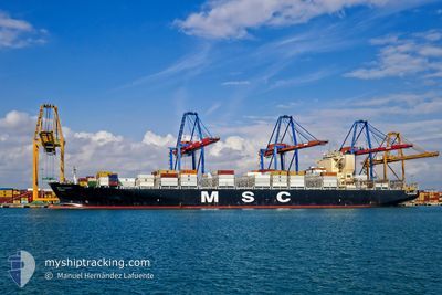
MSC ALBANY
Container Ship
Current Trip
| Time Travelled | 5 days |
|---|---|
| Remaining Time | --- |
| Distance Travelled | 1648.96 nm |
| Remaining Distance | 2087.01 nm |
| AVG Speed | 16.1 Knots |
| MAX Speed | 19 Knots |
| AVG Wind | 9.5 knots |
| MAX Wind | 24 knots |
| MIN Temp | 23.4°C / 74.12°F |
| MAX Temp | 29.3°C / 84.74°F |
| Draught | 14.5 m |
| Position Received | 2 d ago |
Current Position
| Longitude | -40.58427° |
|---|---|
| Latitude | -21.98574° |
| Status | Under way sailing |
| Speed | 18.2 Knots |
| Course | 53.9° |
| Area | South Atlantic Ocean |
| Station | T-AIS |
| Position Received | 2 d ago |
Info
Information
The current position of MSC ALBANY is in South Atlantic Ocean with coordinates -21.98574° / -40.58427° as reported on 2024-04-17 01:08 by AIS to our vessel tracker app. The vessel's current speed is 18.2 Knots and is heading at the port of LAS PALMAS. The estimated time of arrival as calculated by MyShipTracking vessel tracking app is 2024-04-24 11:00 LT
The vessel MSC ALBANY (IMO: 9619438, MMSI: 636015665) is a Container Ship that was built in 2013 ( 11 years old ). It's sailing under the flag of [LR] Liberia.
In this page you can find informations about the vessels current position, last detected port calls, and current voyage information. If the vessels is not in coverage by AIS you will find the latest position.
The current position of MSC ALBANY is detected by our AIS receivers and we are not responsible for the reliability of the data. The last position was recorded while the vessel was in Coverage by the Ais receivers of our vessel tracking app.
The current draught of MSC ALBANY as reported by AIS is 14.5 meters
Weather
| Temperature | 29.1°C / 84.38°F |
|---|---|
| Wind Speed | 10 knots |
| Direction | 110° ESE |
| Pressure | 1011.5 hPa |
| Humidity | 77.5 % |
| Cloud Coverage | 52 % |
Featured Company
Last Port Calls
| Port | Arrival | Departure | Time In Port |
|---|---|---|---|
| 2024-04-14 09:38 | 2024-04-14 09:51 | 13 m | |
| 2024-04-12 06:31 | 2024-04-13 02:15 | 19 h | |
| 2024-04-04 16:44 | 2024-04-05 14:57 | 22 h | |
| 2024-03-31 16:14 | 2024-04-02 03:22 | 1 d | |
| 2024-03-23 21:12 | 2024-03-24 20:48 | 23 h | |
| 2024-03-21 20:56 | 2024-03-22 12:40 | 15 h | |
| 2024-03-20 06:39 | 2024-03-20 06:46 | 6 m | |
| 2024-03-14 18:09 | |||
| 2024-03-03 10:17 | 2024-03-05 13:23 | 2 d | |
| 2024-02-28 15:55 | 2024-03-01 21:49 | 2 d |
Last Trips
| Origin | Departure | Destination | Arrival | Distance | |
|---|---|---|---|---|---|
| 2024-04-12 23:15 | 2024-04-14 06:38 | 227.28 nm | |||
| 2024-04-05 11:57 | 2024-04-12 03:31 | 719.83 nm | |||
| 2024-04-02 00:22 | 2024-04-04 13:44 | 808.47 nm | |||
| 2024-03-24 17:48 | 2024-03-31 13:14 | 74.90 nm | |||
| 2024-03-22 09:40 | 2024-03-23 18:12 | 195.45 nm | |||
| 2024-03-20 03:46 | 2024-03-21 17:56 | 234.65 nm | |||
| 2024-03-05 14:23 | 2024-03-14 15:09 | 3549.66 nm | |||
| 2024-03-01 22:49 | 2024-03-03 11:17 | 511.06 nm | |||
| 2024-02-28 09:08 | 2024-02-28 16:55 | 91.55 nm | |||
| 2024-02-25 18:51 | 2024-02-27 13:01 | 399.18 nm |
Events
| Time | Event | Details | Position / Dest | Info |
|---|---|---|---|---|
| 2024-04-17 01:11 | Status Changed | Default Under way sailing |
-21.97448 / -40.56750
ESLPA
|
Speed: 18.2 kn Course: 53.9° |
| 2024-04-17 01:08 | OUT of Coverage |
-21.98574 / -40.58427
South Atlantic Ocean
ESLPA
|
Speed: 18.2 kn Course: 53.9° |
|
| 2024-04-17 00:21 | Status Changed | Under way sailing Default |
-22.14284 / -40.76633
ESLPA
|
Speed: 17.6 kn Course: 48° |
| 2024-04-17 00:07 | IN Coverage |
-22.13831 / -40.76093
South Atlantic Ocean
ESLPA
|
Speed: 17.6 kn Course: 48.4° |
|
| 2024-04-16 17:27 | Status Changed | Default Under way sailing |
-23.28767 / -42.54788
ESLPA
|
Speed: 17.4 kn Course: 70.4° |
| 2024-04-16 17:23 | OUT of Coverage |
-23.29389 / -42.56663
South Atlantic Ocean
ESLPA
|
Speed: 17.4 kn Course: 70.4° |
|
| 2024-04-16 12:05 | Status Changed | Under way sailing Default |
-23.82145 / -44.17992
ESLPA
|
Speed: 17.6 kn Course: 70° |
| 2024-04-16 11:59 | Status Changed | Default Under way sailing |
-23.83008 / -44.20654
ESLPA
|
Speed: 17.6 kn Course: 71.5° |
| 2024-04-16 11:34 | Status Changed | Under way sailing Default |
-23.86998 / -44.33487
ESLPA
|
Speed: 17.6 kn Course: 71° |
| 2024-04-16 11:16 | IN Coverage |
-23.86813 / -44.32881
South Atlantic Ocean
ESLPA
|
Speed: 17.5 kn Course: 71.4° |