
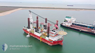
MPI ADVENTURE
Offshore Construction Jack Up
Current Trip
| Time Travelled | 3 days |
|---|---|
| Remaining Time | --- |
| Distance Travelled | 142.36 nm |
| Remaining Distance | --- |
| AVG Speed | 7.2 Knots |
| MAX Speed | 10.9 Knots |
| AVG Wind | 15.4 knots |
| MAX Wind | 26 knots |
| MIN Temp | 5.6°C / 42.08°F |
| MAX Temp | 8.9°C / 48.02°F |
| Draught | 5.9 m |
| Position Received | 3 m ago |
Current Position
| Longitude | --- |
|---|---|
| Latitude | --- |
| Status | Moored |
| Speed | |
| Course | 271° |
| Area | Irish Sea and St. George's Channel |
| Station | T-AIS |
| Position Received | 3 m ago |
Info
Information
The current position of MPI ADVENTURE is in Irish Sea and St. George's Channel with coordinates 53.45760° / -3.48041° as reported on 2024-12-11 19:35 by AIS to our vessel tracker app. The vessel's current speed is 0 Knots
The vessel MPI ADVENTURE (IMO: 9530084, MMSI: 245924000) is a Offshore Construction Jack Up that was built in 2011 ( 13 years old ). It's sailing under the flag of [NL] Netherlands.
In this page you can find informations about the vessels current position, last detected port calls, and current voyage information. If the vessels is not in coverage by AIS you will find the latest position.
The current position of MPI ADVENTURE is detected by our AIS receivers and we are not responsible for the reliability of the data. The last position was recorded while the vessel was in Coverage by the Ais receivers of our vessel tracking app.
The current draught of MPI ADVENTURE as reported by AIS is 5.9 meters
Weather
| Temperature | 6.6°C / 43.88°F |
|---|---|
| Wind Speed | 8 knots |
| Direction | 103° ESE |
| Pressure | 1035.1 hPa |
| Humidity | 70.9 % |
| Cloud Coverage | 6 % |
Featured Company
Last Port Calls
| Port | Arrival | Departure | Time In Port |
|---|---|---|---|
| 2024-12-02 18:44 | 2024-12-08 14:29 | 5 d | |
| 2024-11-26 07:15 | 2024-11-26 22:54 | 15 h | |
| 2024-11-16 12:36 | 2024-11-17 18:51 | 1 d | |
| 2024-11-11 18:39 | 2024-11-12 18:48 | 1 d | |
| 2024-11-06 17:01 | 2024-11-08 14:16 | 1 d | |
| 2024-11-01 14:13 | 2024-11-02 07:49 | 17 h | |
| 2024-10-27 01:19 | 2024-10-28 22:12 | 1 d | |
| 2024-10-18 02:17 | 2024-10-21 22:39 | 3 d | |
| 2024-10-08 10:07 | 2024-10-13 15:50 | 5 d | |
| 2024-10-07 15:18 |
Most Visited Ports (Last year)
| Port | Arrivals | |
|---|---|---|
| 29 | ||
| 2 | ||
| 1 |
Last Trips
| Origin | Departure | Destination | Arrival | Distance | |
|---|---|---|---|---|---|
| 2024-11-26 22:54 | 2024-12-02 18:44 | 274.16 nm | |||
| 2024-11-17 18:51 | 2024-11-26 07:15 | 282.84 nm | |||
| 2024-11-12 18:48 | 2024-11-16 12:36 | 278.94 nm | |||
| 2024-11-08 14:16 | 2024-11-11 18:39 | 271.94 nm | |||
| 2024-11-02 07:49 | 2024-11-06 17:01 | 279.78 nm | |||
| 2024-10-28 22:12 | 2024-11-01 14:13 | 172.69 nm | |||
| 2024-10-21 22:39 | 2024-10-27 01:19 | 270.67 nm | |||
| 2024-10-13 15:50 | 2024-10-18 02:17 | 68.86 nm | |||
| 2024-10-07 15:18 | 2024-10-08 10:07 | 19.44 nm |
Events
| Time | Event | Details | Position / Dest | Info |
|---|---|---|---|---|
| 2024-12-11 16:49 | Destination Changed | WANDELAAR PILOT GWYNT Y MOR WF |
53.45761 / -3.48037
WANDELAAR PILOT
|
Speed: Course: 271° |
| 2024-12-11 16:49 | ETA Changed | 2024/12/15 11:00 2024/12/11 05:00 |
53.45761 / -3.48037
WANDELAAR PILOT
|
Speed: Course: 271° |
| 2024-12-11 06:26 | Status Changed | Moored Restricted manoeuverability |
53.45756 / -3.48037
GWYNT Y MOR WF
|
Speed: Course: 271° |
| 2024-12-11 05:45 | STOP Moving | 3.16 nm, West of LIVERPOOL ANCH |
53.45873 / -3.48212
GWYNT Y MOR WF
|
Speed: 0.3 kn Course: 256° |
| 2024-12-11 05:34 | START Moving | 2.77 nm, West of LIVERPOOL ANCH |
53.46041 / -3.47172
GWYNT Y MOR WF
|
Speed: 3.1 kn Course: 254° |
| 2024-12-11 04:24 | Status Changed | Restricted manoeuverability Under way using engine |
53.46148 / -3.46347
GWYNT Y MOR WF
|
Speed: Course: 92° |
| 2024-12-11 04:19 | STOP Moving | 2.48 nm, West of LIVERPOOL ANCH |
53.46152 / -3.46367
GWYNT Y MOR WF
|
Speed: 0.3 kn Course: 99° |
| 2024-12-11 02:11 | Destination Changed | GWYNT Y MOR WF ORMONDE WINDFARM |
53.51611 / -3.74041
GWYNT Y MOR WF
|
Speed: 4.7 kn Course: 137° |
| 2024-12-11 02:11 | ETA Changed | 2024/12/11 05:00 2024/12/09 01:00 |
53.51611 / -3.74041
GWYNT Y MOR WF
|
Speed: 4.7 kn Course: 137° |
| 2024-12-11 01:04 | IN Coverage |
53.62015 / -3.75579
Irish Sea and St. George's Channel
|
Speed: 5.7 kn Course: 178.4° |