
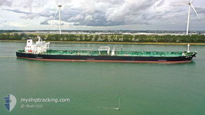
MONTREAL SPIRIT
Tanker
Current Trip
| Time Travelled | 29 days |
|---|---|
| Remaining Time | --- |
| Distance Travelled | 5901.15 nm |
| Remaining Distance | --- |
| AVG Speed | 9.3 Knots |
| MAX Speed | 15.5 Knots |
| AVG Wind | 15.5 knots |
| MAX Wind | 39 knots |
| MIN Temp | 6.2°C / 43.16°F |
| MAX Temp | 29.1°C / 84.38°F |
| Draught | 8.5 m |
| Position Received | 2 d ago |
Current Position
| Longitude | -42.68667° |
|---|---|
| Latitude | -23.38740° |
| Status | Under way using engine |
| Speed | 7.6 Knots |
| Course | 134° |
| Area | South Atlantic Ocean |
| Station | T-AIS |
| Position Received | 2 d ago |
Info
Information
The current position of MONTREAL SPIRIT is in South Atlantic Ocean with coordinates -23.38740° / -42.68667° as reported on 2024-04-17 20:17 by AIS to our vessel tracker app. The vessel's current speed is 7.6 Knots
The vessel MONTREAL SPIRIT (IMO: 9296389, MMSI: 311000454) is a Tanker It's sailing under the flag of [BS] Bahamas.
In this page you can find informations about the vessels current position, last detected port calls, and current voyage information. If the vessels is not in coverage by AIS you will find the latest position.
The current position of MONTREAL SPIRIT is detected by our AIS receivers and we are not responsible for the reliability of the data. The last position was recorded while the vessel was in Coverage by the Ais receivers of our vessel tracking app.
The current draught of MONTREAL SPIRIT as reported by AIS is 8.5 meters
Weather
| Temperature | 24.2°C / 75.56°F |
|---|---|
| Wind Speed | 7 knots |
| Direction | 178° S |
| Pressure | 1020.3 hPa |
| Humidity | 57 % |
| Cloud Coverage | 28 % |
Featured Company
Last Port Calls
| Port | Arrival | Departure | Time In Port |
|---|---|---|---|
| 2024-03-20 18:42 | 2024-03-22 05:13 | 1 d | |
| 2024-02-04 05:03 | 2024-02-05 18:53 | 1 d |
Most Visited Ports (Last year)
| Port | Arrivals | |
|---|---|---|
| 3 | ||
| 2 | ||
| 2 | ||
| 1 | ||
| 1 | ||
| 1 |
Last Trips
| Origin | Departure | Destination | Arrival | Distance | |
|---|---|---|---|---|---|
| 2024-02-05 19:53 | 2024-03-20 19:42 | 10478.41 nm | |||
| 2024-01-31 05:29 | 2024-02-04 06:03 | 1097.77 nm |
Events
| Time | Event | Details | Position / Dest | Info |
|---|---|---|---|---|
| 2024-04-19 14:18 | STOP Moving |
-24.12180 / -41.88528
BR RIO
|
Speed: 0.3 kn Course: 181° |
|
| 2024-04-19 04:09 | START Moving |
-23.53175 / -42.48174
BR RIO
|
Speed: 7.7 kn Course: 147° |
|
| 2024-04-18 07:32 | STOP Moving |
-24.08667 / -42.06167
BR RIO
|
Speed: Course: -1° |
|
| 2024-04-17 20:21 | Status Changed | Default Under way using engine |
-23.39262 / -42.68075
BR RIO
|
Speed: 7.6 kn Course: 134° |
| 2024-04-17 20:17 | OUT of Coverage |
-23.38740 / -42.68667
South Atlantic Ocean
|
Speed: 7.6 kn Course: 134° |
|
| 2024-04-17 19:35 | Status Changed | Under way using engine Default |
-23.32645 / -42.75753
BR RIO
|
Speed: 7.7 kn Course: 132° |
| 2024-04-17 19:29 | Status Changed | Default Under way using engine |
-23.31777 / -42.76788
BR RIO
|
Speed: 7.6 kn Course: 131° |
| 2024-04-17 19:17 | Status Changed | Under way using engine Default |
-23.30013 / -42.78923
BR RIO
|
Speed: 7.6 kn Course: 132° |
| 2024-04-17 19:05 | Status Changed | Default Under way using engine |
-23.28167 / -42.80833
BR RIO
|
Speed: 7.6 kn Course: 131° |
| 2024-04-17 15:04 | START Moving | 1.35 nm, North East of RIO DE JANEIRO |
-22.88145 / -43.15283
BR RIO
|
Speed: 3.2 kn Course: 189° |