
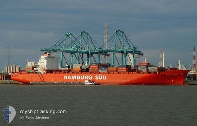
MAERSK MONTE ALEGRE
Cargo
Current Trip
| Time Travelled | 2 days |
|---|---|
| Remaining Time | 9 days |
| Distance Travelled | 920.48 nm |
| Remaining Distance | 3827.41 nm |
| AVG Speed | 17.4 Knots |
| MAX Speed | 20 Knots |
| AVG Wind | 11.5 knots |
| MAX Wind | 15 knots |
| MIN Temp | 23.6°C / 74.48°F |
| MAX Temp | 26.2°C / 79.16°F |
| Draught | 9 m |
| Position Received | 13 m ago |
Current Position
| Longitude | -65.18167° |
|---|---|
| Latitude | 19.76670° |
| Status | Under way using engine |
| Speed | 17.8 Knots |
| Course | 119.4° |
| Area | North Atlantic Ocean |
| Station | T-AIS |
| Position Received | 13 m ago |
Info
Information
The current position of MAERSK MONTE ALEGRE is in North Atlantic Ocean with coordinates 19.76670° / -65.18167° as reported on 2024-04-23 08:03 by AIS to our vessel tracker app. The vessel's current speed is 17.8 Knots and is heading at the port of SANTOS. The estimated time of arrival as calculated by MyShipTracking vessel tracking app is 2024-05-02 09:58 LT
The vessel MAERSK MONTE ALEGRE (MMSI: 563050400) is a Cargo It's sailing under the flag of [SG] Singapore.
In this page you can find informations about the vessels current position, last detected port calls, and current voyage information. If the vessels is not in coverage by AIS you will find the latest position.
The current position of MAERSK MONTE ALEGRE is detected by our AIS receivers and we are not responsible for the reliability of the data. The last position was recorded while the vessel was in Coverage by the Ais receivers of our vessel tracking app.
The current draught of MAERSK MONTE ALEGRE as reported by AIS is 9 meters
Weather
| Temperature | 26.1°C / 78.98°F |
|---|---|
| Wind Speed | 11 knots |
| Direction | 127° SE |
| Pressure | 1013.9 hPa |
| Humidity | 84.5 % |
| Cloud Coverage | --- |
Featured Company
Last Port Calls
| Port | Arrival | Departure | Time In Port |
|---|---|---|---|
| 2024-04-20 07:36 | 2024-04-21 04:43 | 21 h | |
| 2024-04-17 09:52 | 2024-04-18 01:11 | 15 h | |
| 2024-04-15 05:12 | 2024-04-15 21:02 | 15 h | |
| 2024-04-13 09:36 | 2024-04-13 23:06 | 13 h | |
| 2024-04-11 08:29 | 2024-04-12 10:58 | 1 d | |
| 2024-04-03 03:02 | 2024-04-03 09:30 | 6 h | |
| 2024-03-31 19:31 | 2024-04-01 05:33 | 10 h | |
| 2024-03-26 20:05 | 2024-03-26 20:12 | 7 m | |
| 2024-03-24 02:00 | 2024-03-25 00:38 | 22 h | |
| 2024-03-21 18:01 | 2024-03-23 13:46 | 1 d |
Most Visited Ports (Last year)
| Port | Arrivals | |
|---|---|---|
| 10 | ||
| 6 | ||
| 5 | ||
| 5 | ||
| 5 | ||
| 5 |
Last Trips
| Origin | Departure | Destination | Arrival | Distance | |
|---|---|---|---|---|---|
| 2024-04-17 21:11 | 2024-04-20 03:36 | 517.41 nm | |||
| 2024-04-15 17:02 | 2024-04-17 05:52 | 451.70 nm | |||
| 2024-04-13 19:06 | 2024-04-15 01:12 | 272.74 nm | |||
| 2024-04-12 06:58 | 2024-04-13 05:36 | 253.24 nm | |||
| 2024-04-03 06:30 | 2024-04-11 04:29 | 3288.43 nm | |||
| 2024-04-01 02:33 | 2024-04-03 00:02 | 841.93 nm | |||
| 2024-03-26 17:12 | 2024-03-31 16:31 | 780.76 nm | |||
| 2024-03-24 21:38 | 2024-03-26 17:05 | 247.17 nm | |||
| 2024-03-23 10:46 | 2024-03-23 23:00 | 189.53 nm | |||
| 2024-03-15 19:54 | 2024-03-21 15:01 | 1051.49 nm |
Events
| Time | Event | Details | Position / Dest | Info |
|---|---|---|---|---|
| 2024-04-23 08:15 | Status Changed | Under way using engine Default |
19.73674 / -65.12580
USPEV>>BRSSZ
|
Speed: 17.8 kn Course: 119° |
| 2024-04-23 08:08 | Status Changed | Default Under way using engine |
19.75410 / -65.15829
USPEV>>BRSSZ
|
Speed: 17.8 kn Course: 119.4° |
| 2024-04-23 08:03 | Change Sea Area | British Virgin Islands part of the North Atlantic Ocean Bahamas part of the North Atlantic Ocean |
19.76670 / -65.18167
North Atlantic Ocean
|
Speed: 17.8 kn Course: 119.4° |
| 2024-04-23 08:03 | Status Changed | Under way using engine Default |
19.76715 / -65.18251
USPEV>>BRSSZ
|
Speed: 18 kn Course: 120° |
| 2024-04-23 08:01 | IN Coverage |
19.76670 / -65.18167
North Atlantic Ocean
|
Speed: 17.8 kn Course: 119.4° |
|
| 2024-04-21 19:21 | Status Changed | Default Under way using engine |
25.11688 / -75.48444
USPEV>>BRSSZ
|
Speed: 17.9 kn Course: 120° |
| 2024-04-21 19:10 | OUT of Coverage |
25.14604 / -75.54056
North Atlantic Ocean
|
Speed: 17.9 kn Course: 120° |
|
| 2024-04-21 17:03 | Status Changed | Under way using engine Default |
25.46329 / -76.18192
USPEV>>BRSSZ
|
Speed: 19.2 kn Course: 117° |
| 2024-04-21 17:00 | Status Changed | Default Under way using engine |
25.47061 / -76.19781
USPEV>>BRSSZ
|
Speed: 19.3 kn Course: 117.7° |
| 2024-04-21 16:46 | Draught Changed | 9 9.5 |
25.50646 / -76.27496
USPEV>>BRSSZ
|
Speed: 18.9 kn Course: 117° |