
MONIKA
Cargo
Current Trip
| Time Travelled | 19 days |
|---|---|
| Remaining Time | 2 days |
| Distance Travelled | 3772.96 nm |
| Remaining Distance | 631.80 nm |
| AVG Speed | 9.4 Knots |
| MAX Speed | 14.3 Knots |
| AVG Wind | 18.7 knots |
| MAX Wind | 35.3 knots |
| MIN Temp | 1°C / 33.8°F |
| MAX Temp | 17.8°C / 64.04°F |
| Draught | 5.1 m |
| Position Received | 1 m ago |
Current Position
| Longitude | --- |
|---|---|
| Latitude | --- |
| Status | Under way using engine |
| Speed | 9.6 Knots |
| Course | 95.1° |
| Area | Ionian Sea |
| Station | T-AIS |
| Position Received | 1 m ago |
Info
Information
The current position of MONIKA is in Ionian Sea with coordinates 37.84555° / 15.81799° as reported on 2025-12-09 00:29 by AIS to our vessel tracker app. The vessel's current speed is 9.6 Knots and is heading at the port of MONFALCONE. The estimated time of arrival as calculated by MyShipTracking vessel tracking app is 2025-12-11 18:47 LT
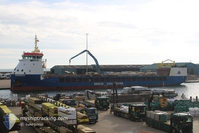
The vessel MONIKA (IMO: 9815317, MMSI: 255915721) is a Cargo It's sailing under the flag of [PT] Portugal.
In this page you can find informations about the vessels current position, last detected port calls, and current voyage information. If the vessels is not in coverage by AIS you will find the latest position.
The current position of MONIKA is detected by our AIS receivers and we are not responsible for the reliability of the data. The last position was recorded while the vessel was in Coverage by the Ais receivers of our vessel tracking app.
The current draught of MONIKA as reported by AIS is 5.1 meters
Weather
| Temperature | 16.5°C / 61.7°F |
|---|---|
| Wind Speed | 4 knots |
| Direction | 256° WSW |
| Pressure | 1023.6 hPa |
| Humidity | 69.7 % |
| Cloud Coverage | 3 % |
Featured Company
Last Port Calls
| Port | Arrival | Departure | Time In Port |
|---|---|---|---|
| 2025-11-17 08:46 | 2025-11-19 15:14 | 2 d | |
| 2025-11-12 23:20 | 2025-11-13 21:19 | 21 h | |
| 2025-11-10 03:56 | 2025-11-11 11:38 | 1 d | |
| 2025-11-05 08:50 | 2025-11-06 20:34 | 1 d | |
| 2025-10-29 12:46 | 2025-10-29 16:16 | 3 h | |
| 2025-10-28 05:14 | 2025-10-29 00:54 | 19 h | |
| 2025-10-23 08:40 | 2025-10-24 20:28 | 1 d | |
| 2025-10-14 16:58 | 2025-10-15 21:18 | 1 d | |
| 2025-10-10 13:05 | 2025-10-11 16:10 | 1 d | |
| 2025-10-03 19:08 | 2025-10-07 15:05 | 3 d |
Last Trips
| Origin | Departure | Destination | Arrival | Distance | |
|---|---|---|---|---|---|
| 2025-11-13 21:19 | 2025-11-17 08:46 | 779.14 nm | |||
| 2025-11-11 11:38 | 2025-11-12 23:20 | 358.47 nm | |||
| 2025-11-06 20:34 | 2025-11-10 03:56 | 747.53 nm | |||
| 2025-10-29 16:16 | 2025-11-05 08:50 | 1354.27 nm | |||
| 2025-10-29 00:54 | 2025-10-29 12:46 | 102.26 nm | |||
| 2025-10-24 20:28 | 2025-10-28 05:14 | 792.04 nm | |||
| 2025-10-15 21:18 | 2025-10-23 08:40 | 1678.29 nm | |||
| 2025-10-11 16:10 | 2025-10-14 16:58 | 706.65 nm | |||
| 2025-10-07 15:05 | 2025-10-10 13:05 | 543.64 nm | |||
| 2025-10-01 08:26 | 2025-10-03 19:08 | 546.81 nm |
Events
| Time | Event | Details | Position / Dest | Info |
|---|---|---|---|---|
| 2025-12-08 20:58 | Change Sea Area | Italian part of the Ionian Sea Italian part of the Tyrrhenian Sea |
38.25589 / 15.64838
Ionian Sea
ITMNF
|
Speed: 8.3 kn Course: 245.8° |
| 2025-12-08 19:22 | ETA Changed | 2025/12/11 20:00 2025/12/11 17:00 |
38.33828 / 15.40922
ITMNF
|
Speed: 9.8 kn Course: 88.9° |
| 2025-12-08 15:21 | Status Changed | Under way using engine Default |
38.36358 / 14.54423
ITMNF
|
Speed: 10.7 kn Course: 95° |
| 2025-12-08 15:16 | Status Changed | Default Under way using engine |
38.36497 / 14.52303
ITMNF
|
Speed: 10.7 kn Course: 94.8° |
| 2025-12-08 15:01 | Status Changed | Under way using engine Default |
38.36882 / 14.46907
ITMNF
|
Speed: 10.5 kn Course: 95° |
| 2025-12-08 14:54 | IN Coverage |
38.36845 / 14.47403
Tyrrhenian Sea
ITMNF
|
Speed: 10.7 kn Course: 94.8° |
|
| 2025-12-08 06:45 | Status Changed | Default Under way using engine |
38.41651 / 12.67840
ITMNF
|
Speed: 10.5 kn Course: 89.8° |
| 2025-12-08 06:38 | OUT of Coverage |
38.41618 / 12.65362
Tyrrhenian Sea
ITMNF
|
Speed: 10.5 kn Course: 89.8° |
|
| 2025-12-08 06:25 | Status Changed | Under way using engine Default |
38.41664 / 12.60351
ITMNF
|
Speed: 10.8 kn Course: 90° |
| 2025-12-08 06:13 | Status Changed | Default Under way using engine |
38.41614 / 12.55761
ITMNF
|
Speed: 11.1 kn Course: 88.7° |