
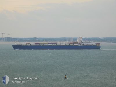
MSC RONIT R
Container Ship
Current Trip
| Time Travelled | 10 days |
|---|---|
| Remaining Time | 2 days |
| Distance Travelled | 3934.16 nm |
| Remaining Distance | 1202.55 nm |
| AVG Speed | 17.1 Knots |
| MAX Speed | 20.8 Knots |
| AVG Wind | 11.1 knots |
| MAX Wind | 23 knots |
| MIN Temp | 11.2°C / 52.16°F |
| MAX Temp | 30°C / 86°F |
| Draught | 11.8 m |
| Position Received | 5 d ago |
Current Position
| Longitude | -70.82067° |
|---|---|
| Latitude | 21.18828° |
| Status | Under way using engine |
| Speed | 18.2 Knots |
| Course | 56° |
| Area | North Atlantic Ocean |
| Station | T-AIS |
| Position Received | 5 d ago |
Info
Information
The current position of MSC RONIT R is in North Atlantic Ocean with coordinates 21.18828° / -70.82067° as reported on 2024-04-18 23:43 by AIS to our vessel tracker app. The vessel's current speed is 18.2 Knots and is heading at the port of ANTWERP. The estimated time of arrival as calculated by MyShipTracking vessel tracking app is 2024-04-27 16:29 LT
The vessel MSC RONIT R (IMO: 9293167, MMSI: 636017000) is a Container Ship that was built in 2005 ( 19 years old ). It's sailing under the flag of [LR] Liberia.
In this page you can find informations about the vessels current position, last detected port calls, and current voyage information. If the vessels is not in coverage by AIS you will find the latest position.
The current position of MSC RONIT R is detected by our AIS receivers and we are not responsible for the reliability of the data. The last position was recorded while the vessel was in Coverage by the Ais receivers of our vessel tracking app.
The current draught of MSC RONIT R as reported by AIS is 11.8 meters
Weather
| Temperature | 11.2°C / 52.16°F |
|---|---|
| Wind Speed | 21 knots |
| Direction | 359° N |
| Pressure | 1030.7 hPa |
| Humidity | 69.4 % |
| Cloud Coverage | 66 % |
Featured Company
Last Port Calls
| Port | Arrival | Departure | Time In Port |
|---|---|---|---|
| 2024-04-14 01:54 | 2024-04-14 17:11 | 15 h | |
| 2024-04-12 20:02 | 2024-04-13 16:26 | 20 h | |
| 2024-04-08 13:09 | 2024-04-09 19:07 | 1 d | |
| 2024-04-06 20:51 | 2024-04-07 09:48 | 12 h | |
| 2024-04-05 05:33 | 2024-04-06 03:08 | 21 h | |
| 2024-04-02 17:57 | 2024-04-03 19:49 | 1 d | |
| 2024-03-30 23:14 | 2024-03-31 16:18 | 17 h | |
| 2024-03-30 03:17 | 2024-03-30 08:53 | 5 h | |
| 2024-03-24 15:49 | 2024-03-26 17:46 | 2 d | |
| 2024-03-19 09:12 | 2024-03-19 22:29 | 13 h |
Most Visited Ports (Last year)
| Port | Arrivals | |
|---|---|---|
| 5 | ||
| 5 | ||
| 4 | ||
| 4 | ||
| 4 | ||
| 4 |
Last Trips
| Origin | Departure | Destination | Arrival | Distance | |
|---|---|---|---|---|---|
| 2024-04-13 11:26 | 2024-04-13 20:54 | 32.74 nm | |||
| 2024-04-09 14:07 | 2024-04-12 15:02 | 842.51 nm | |||
| 2024-04-07 04:48 | 2024-04-08 08:09 | 21.21 nm | |||
| 2024-04-05 22:08 | 2024-04-06 15:51 | 113.32 nm | |||
| 2024-04-03 14:49 | 2024-04-05 00:33 | 132.14 nm | |||
| 2024-03-31 11:18 | 2024-04-02 12:57 | 802.61 nm | |||
| 2024-03-30 03:53 | 2024-03-30 18:14 | 56.55 nm | |||
| 2024-03-26 13:46 | 2024-03-29 22:17 | 1286.88 nm | |||
| 2024-03-19 18:29 | 2024-03-24 11:49 | 938.95 nm | |||
| 2024-03-17 20:49 | 2024-03-19 05:12 | 272.78 nm |
Events
| Time | Event | Details | Position / Dest | Info |
|---|---|---|---|---|
| 2024-04-19 00:38 | Status Changed | Default Under way using engine |
21.35167 / -70.57333
BEANR
|
Speed: 18.2 kn Course: 56° |
| 2024-04-18 23:43 | OUT of Coverage |
21.18828 / -70.82067
North Atlantic Ocean
BEANR
|
Speed: 18.2 kn Course: 56° |
|
| 2024-04-18 23:13 | Status Changed | Under way using engine Default |
21.09981 / -70.96023
BEANR
|
Speed: 18 kn Course: 56° |
| 2024-04-18 23:08 | Status Changed | Default Under way using engine |
21.08667 / -70.97833
BEANR
|
Speed: 18.6 kn Course: 55.3° |
| 2024-04-18 21:55 | Draught Changed | 11.8 12 |
20.89620 / -71.32425
BEANR
|
Speed: 18.2 kn Course: 67.2° |
| 2024-04-18 21:55 | Destination Changed | BEANR CRMOB |
20.89620 / -71.32425
BEANR
|
Speed: 18.2 kn Course: 67.2° |
| 2024-04-18 21:55 | ETA Changed | 2024/04/27 20:00 2024/04/15 06:00 |
20.89620 / -71.32425
BEANR
|
Speed: 18.2 kn Course: 67.2° |
| 2024-04-18 21:47 | Change Sea Area | Turks and Caicos part of the North Atlantic Ocean Panamanian part of the Caribbean Sea |
20.88077 / -71.36388
North Atlantic Ocean
|
Speed: 18 kn Course: 69° |
| 2024-04-18 21:47 | Status Changed | Under way using engine Default |
20.87990 / -71.36638
CRMOB
|
Speed: 17 kn Course: 67° |
| 2024-04-18 21:47 | IN Coverage |
20.88077 / -71.36388
North Atlantic Ocean
|
Speed: 18 kn Course: 69° |