
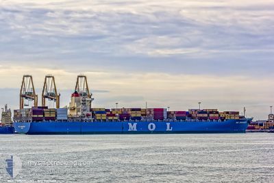
MARCOS V
Container Ship
Current Trip
| Time Travelled | 21 days |
|---|---|
| Remaining Time | --- |
| Distance Travelled | 9204.65 nm |
| Remaining Distance | --- |
| AVG Speed | 17.7 Knots |
| MAX Speed | 21.3 Knots |
| AVG Wind | 10.9 knots |
| MAX Wind | 26.2 knots |
| MIN Temp | 16.6°C / 61.88°F |
| MAX Temp | 30.1°C / 86.18°F |
| Draught | 13.5 m |
| Position Received | 3 d ago |
Current Position
| Longitude | -0.21917° |
|---|---|
| Latitude | -12.37268° |
| Status | Under way using engine |
| Speed | 17.7 Knots |
| Course | 322° |
| Area | South Atlantic Ocean |
| Station | T-AIS |
| Position Received | 3 d ago |
Info
Information
The current position of MARCOS V is in South Atlantic Ocean with coordinates -12.37268° / -0.21917° as reported on 2024-04-20 01:13 by AIS to our vessel tracker app. The vessel's current speed is 17.7 Knots and is heading at the port of ROTTERDAM. The estimated time of arrival as calculated by MyShipTracking vessel tracking app is 2024-05-01 02:30 LT
The vessel MARCOS V (IMO: 9307059, MMSI: 371519000) is a Container Ship that was built in 2005 ( 19 years old ). It's sailing under the flag of [PA] Panama.
In this page you can find informations about the vessels current position, last detected port calls, and current voyage information. If the vessels is not in coverage by AIS you will find the latest position.
The current position of MARCOS V is detected by our AIS receivers and we are not responsible for the reliability of the data. The last position was recorded while the vessel was in Coverage by the Ais receivers of our vessel tracking app.
The current draught of MARCOS V as reported by AIS is 13.5 meters
Weather
| Temperature | 27.1°C / 80.78°F |
|---|---|
| Wind Speed | 7 knots |
| Direction | 347° NNW |
| Pressure | 1011.1 hPa |
| Humidity | 74.4 % |
| Cloud Coverage | 5 % |
Featured Company
Last Port Calls
| Port | Arrival | Departure | Time In Port |
|---|---|---|---|
| 2024-03-31 14:24 | 2024-04-01 22:54 | 1 d | |
| 2024-03-19 18:40 | 2024-03-20 13:56 | 19 h | |
| 2024-02-11 17:08 | 2024-02-12 20:50 | 1 d |
Most Visited Ports (Last year)
| Port | Arrivals | |
|---|---|---|
| 7 | ||
| 4 | ||
| 4 | ||
| 4 | ||
| 4 | ||
| 4 |
Last Trips
| Origin | Departure | Destination | Arrival | Distance | |
|---|---|---|---|---|---|
| 2024-03-20 21:56 | 2024-03-31 22:24 | 2763.29 nm | |||
| 2024-02-13 05:50 | 2024-03-20 02:40 | 1163.06 nm | |||
| 2024-01-19 11:51 | 2024-02-12 02:08 | 9041.74 nm |
Events
| Time | Event | Details | Position / Dest | Info |
|---|---|---|---|---|
| 2024-04-20 01:21 | Status Changed | Default Under way using engine |
-12.34330 / -.24173
MYTPP=>NLRTM
|
Speed: 17.7 kn Course: 322° |
| 2024-04-20 01:13 | OUT of Coverage |
-12.37268 / -.21917
South Atlantic Ocean
MYTPP=>NLRTM
|
Speed: 17.7 kn Course: 322° |
|
| 2024-04-20 00:53 | Status Changed | Under way using engine Default |
-12.45258 / -.15782
MYTPP=>NLRTM
|
Speed: 17.7 kn Course: 323° |
| 2024-04-20 00:41 | IN Coverage |
-12.44713 / -.16205
South Atlantic Ocean
MYTPP=>NLRTM
|
Speed: 17.7 kn Course: 322° |
|
| 2024-04-19 23:42 | Status Changed | Default Under way using engine |
-12.73617 / .05983
MYTPP=>NLRTM
|
Speed: 17.9 kn Course: 322° |
| 2024-04-19 23:35 | Status Changed | Under way using engine Default |
-12.76342 / .08070
MYTPP=>NLRTM
|
Speed: 17.8 kn Course: 322° |
| 2024-04-19 23:35 | OUT of Coverage |
-12.76342 / .08070
South Atlantic Ocean
MYTPP=>NLRTM
|
Speed: 17.9 kn Course: 322° |
|
| 2024-04-19 23:19 | Status Changed | Default Under way using engine |
-12.82883 / .13087
MYTPP=>NLRTM
|
Speed: 17.8 kn Course: 323° |
| 2024-04-19 23:16 | Change Sea Area | High seas of the South Atlantic Ocean South African part of the South Atlantic Ocean |
-12.83918 / .13888
South Atlantic Ocean
MYTPP=>NLRTM
|
Speed: 17.9 kn Course: 322° |
| 2024-04-19 23:14 | Status Changed | Under way using engine Default |
-12.84698 / .14492
MYTPP=>NLRTM
|
Speed: 17.9 kn Course: 323° |