
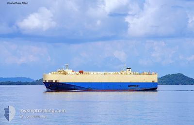
MODERN LINK
Ro-Ro/Passenger Ship
Current Trip
| Time Travelled | 22 days |
|---|---|
| Remaining Time | --- |
| Distance Travelled | 4628.66 nm |
| Remaining Distance | --- |
| AVG Speed | 14 Knots |
| MAX Speed | 18 Knots |
| AVG Wind | 9.7 knots |
| MAX Wind | 26.8 knots |
| MIN Temp | 20.4°C / 68.72°F |
| MAX Temp | 30.5°C / 86.9°F |
| Draught | 8.5 m |
| Position Received | 6 h, 20 m ago |
Current Position
| Longitude | 50.51069° |
|---|---|
| Latitude | 26.82685° |
| Status | At anchor |
| Speed | |
| Course | 335° |
| Area | Persian Gulf |
| Station | T-AIS |
| Position Received | 6 h, 20 m ago |
Info
Information
The current position of MODERN LINK is in Persian Gulf with coordinates 26.82685° / 50.51069° as reported on 2024-04-25 10:57 by AIS to our vessel tracker app. The vessel's current speed is 0 Knots
The vessel MODERN LINK (IMO: 9188829, MMSI: 353923000) is a Ro-Ro/Passenger Ship that was built in 2000 ( 24 years old ). It's sailing under the flag of [PA] Panama.
In this page you can find informations about the vessels current position, last detected port calls, and current voyage information. If the vessels is not in coverage by AIS you will find the latest position.
The current position of MODERN LINK is detected by our AIS receivers and we are not responsible for the reliability of the data. The last position was recorded while the vessel was in Coverage by the Ais receivers of our vessel tracking app.
The current draught of MODERN LINK as reported by AIS is 8.5 meters
Weather
| Temperature | 25.6°C / 78.08°F |
|---|---|
| Wind Speed | 3 knots |
| Direction | 42° NE |
| Pressure | 1008 hPa |
| Humidity | 68.3 % |
| Cloud Coverage | --- |
Featured Company
Last Port Calls
| Port | Arrival | Departure | Time In Port |
|---|---|---|---|
| 2024-04-03 04:37 | 2024-04-03 16:04 | 11 h | |
| 2024-03-25 21:53 | 2024-03-26 07:05 | 9 h | |
| 2024-03-22 22:11 | 2024-03-23 06:00 | 7 h | |
| 2024-03-03 13:00 | |||
| 2024-02-26 22:57 | 2024-02-27 22:09 | 23 h | |
| 2024-02-12 20:43 | 2024-02-13 06:07 | 9 h | |
| 2024-02-09 07:29 | 2024-02-10 07:55 | 1 d | |
| 2024-02-08 21:49 | 2024-02-09 06:10 | 8 h |
Last Trips
| Origin | Departure | Destination | Arrival | Distance | |
|---|---|---|---|---|---|
| 2024-03-26 16:05 | 2024-04-03 11:37 | 2706.67 nm | |||
| 2024-03-23 15:00 | 2024-03-26 06:53 | 612.47 nm | |||
| 2024-02-27 14:09 | 2024-03-03 05:00 | 998.58 nm | |||
| 2024-02-13 15:07 | 2024-02-26 14:57 | 4685.08 nm | |||
| 2024-02-10 16:55 | 2024-02-13 05:43 | 614.45 nm | |||
| 2024-02-09 15:10 | 2024-02-09 16:29 | 11.74 nm | |||
| 2024-01-07 22:17 | 2024-02-09 06:49 | 6335.99 nm |
Events
| Time | Event | Details | Position / Dest | Info |
|---|---|---|---|---|
| 2024-04-25 16:45 | START Moving | 9.98 nm, North East of DAMMAM |
26.62109 / 50.28903
SA DMN
|
Speed: 7.8 kn Course: 270° |
| 2024-04-25 16:23 | STOP Moving | 10.22 nm, North East of DAMMAM |
26.62167 / 50.29500
SA DMN
|
Speed: Course: -1° |
| 2024-04-25 14:11 | START Moving |
26.81427 / 50.50861
SA DMN
|
Speed: 11.4 kn Course: 200° |
|
| 2024-04-25 11:00 | Status Changed | Default At anchor |
26.82684 / 50.51064
SA DMN
|
Speed: Course: 335° |
| 2024-04-25 10:57 | Status Changed | At anchor Default |
26.82685 / 50.51069
SA DMN
|
Speed: Course: 333° |
| 2024-04-25 10:57 | OUT of Coverage |
26.82685 / 50.51069
Persian Gulf
|
Speed: Course: 120.1° |
|
| 2024-04-25 10:54 | IN Coverage |
26.82685 / 50.51069
Persian Gulf
|
Speed: Course: 120.1° |
|
| 2024-04-25 09:33 | Status Changed | Default At anchor |
26.82693 / 50.51078
SA DMN
|
Speed: Course: 322° |
| 2024-04-25 09:30 | Status Changed | At anchor Default |
26.82691 / 50.51078
SA DMN
|
Speed: Course: 316° |
| 2024-04-25 09:30 | OUT of Coverage |
26.82691 / 50.51078
Persian Gulf
|
Speed: Course: 120.1° |