
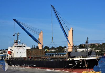
MITO
Bulk Carrier
Current Trip
| Time Travelled | 1 day |
|---|---|
| Remaining Time | --- |
| Distance Travelled | 45.89 nm |
| Remaining Distance | --- |
| AVG Speed | 10.4 Knots |
| MAX Speed | 12.7 Knots |
| AVG Wind | 4.8 knots |
| MAX Wind | 6.9 knots |
| MIN Temp | 26.8°C / 80.24°F |
| MAX Temp | 28.2°C / 82.76°F |
| Draught | 5.5 m |
| Position Received | 1 d ago |
Current Position
| Longitude | 107.01560° |
|---|---|
| Latitude | 10.42952° |
| Status | Under way using engine |
| Speed | 10.1 Knots |
| Course | 152° |
| Area | South China Sea |
| Station | T-AIS |
| Position Received | 1 d ago |
Info
Information
The current position of MITO is in South China Sea with coordinates 10.42952° / 107.01560° as reported on 2024-04-17 23:26 by AIS to our vessel tracker app. The vessel's current speed is 10.1 Knots
The vessel MITO (IMO: 9587788, MMSI: 351646000) is a Bulk Carrier that was built in 2010 ( 14 years old ). It's sailing under the flag of [PA] Panama.
In this page you can find informations about the vessels current position, last detected port calls, and current voyage information. If the vessels is not in coverage by AIS you will find the latest position.
The current position of MITO is detected by our AIS receivers and we are not responsible for the reliability of the data. The last position was recorded while the vessel was in Coverage by the Ais receivers of our vessel tracking app.
The current draught of MITO as reported by AIS is 5.5 meters
Weather
| Temperature | 29.1°C / 84.38°F |
|---|---|
| Wind Speed | 3 knots |
| Direction | 45° NE |
| Pressure | 1007.7 hPa |
| Humidity | 72.1 % |
| Cloud Coverage | 100 % |
Featured Company
Last Port Calls
| Port | Arrival | Departure | Time In Port |
|---|---|---|---|
| 2024-04-16 06:48 | 2024-04-17 22:37 | 1 d | |
| 2024-04-09 05:25 | 2024-04-10 10:00 | 1 d | |
| 2024-03-30 16:17 | 2024-04-01 04:41 | 1 d | |
| 2024-03-20 15:53 | 2024-03-22 23:44 | 2 d | |
| 2024-03-18 01:46 | 2024-03-20 02:32 | 2 d | |
| 2024-03-02 08:51 | 2024-03-04 02:16 | 1 d | |
| 2024-02-21 16:13 | 2024-02-24 00:55 | 2 d | |
| 2024-02-14 04:04 | 2024-02-15 12:50 | 1 d | |
| 2024-02-01 05:49 |
Last Trips
| Origin | Departure | Destination | Arrival | Distance | |
|---|---|---|---|---|---|
| 2024-04-10 18:00 | 2024-04-16 13:48 | 1726.25 nm | |||
| 2024-04-01 12:41 | 2024-04-09 13:25 | 761.80 nm | |||
| 2024-03-23 06:44 | 2024-03-31 00:17 | 1909.65 nm | |||
| 2024-03-20 10:32 | 2024-03-20 22:53 | 137.75 nm | |||
| 2024-03-04 10:16 | 2024-03-18 09:46 | 3210.88 nm | |||
| 2024-02-24 11:25 | 2024-03-02 16:51 | 1564.12 nm | |||
| 2024-02-15 20:50 | 2024-02-22 02:43 | 1388.85 nm | |||
| 2024-02-01 13:49 | 2024-02-14 12:04 | 3559.44 nm |
Events
| Time | Event | Details | Position / Dest | Info |
|---|---|---|---|---|
| 2024-04-17 23:33 | Status Changed | Default Under way using engine |
10.41243 / 107.02375
VN PHU
|
Speed: 10.1 kn Course: 152° |
| 2024-04-17 23:26 | OUT of Coverage |
10.42952 / 107.01560
South China Sea
|
Speed: 10.1 kn Course: 152° |
|
| 2024-04-17 23:15 | Status Changed | Under way using engine Default |
10.45458 / 106.99692
VN PHU
|
Speed: 10.2 kn Course: 165° |
| 2024-04-17 23:13 | Status Changed | Default Under way using engine |
10.46113 / 106.99519
VN PHU
|
Speed: 10.3 kn Course: 190° |
| 2024-04-17 22:55 | Status Changed | Under way using engine Default |
10.50827 / 107.00255
VN PHU
|
Speed: 9.4 kn Course: 219° |
| 2024-04-17 22:37 | START Moving | 0.32 nm, North West of CAI MEP |
10.54518 / 107.02412
VN PHU
|
Speed: 4.2 kn Course: 154° |
| 2024-04-17 22:37 | IN Coverage |
10.50705 / 107.00182
South China Sea
|
Speed: 8.8 kn Course: 209° |
|
| 2024-04-17 22:37 | PORT DEPARTURE |
|
10.54518 / 107.02412
VN PHU
|
Speed: 0.2 kn Course: 114° |
| 2024-04-16 07:27 | STOP Moving |
10.54838 / 107.02270
[VN] CAI MEP
|
Speed: Course: 106° |
|
| 2024-04-16 06:19 | OUT of Coverage |
10.48722 / 106.99722
South China Sea
VN PHU
|
Speed: 10.6 kn Course: 3° |