
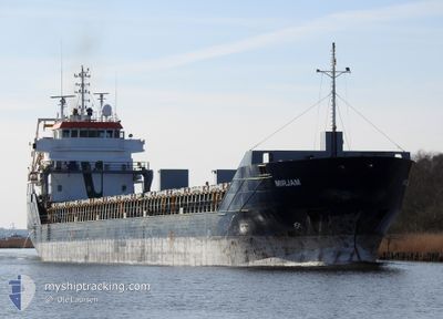
MIRJAM
General Cargo
Current Trip
| Time Travelled | 23 h, 56 mins |
|---|---|
| Remaining Time | --- |
| Distance Travelled | 158.79 nm |
| Remaining Distance | --- |
| AVG Speed | 10.5 Knots |
| MAX Speed | 14.1 Knots |
| AVG Wind | 15.7 knots |
| MAX Wind | 23.9 knots |
| MIN Temp | 8°C / 46.4°F |
| MAX Temp | 9.9°C / 49.82°F |
| Draught | 4 m |
| Position Received | 2 m ago |
Current Position
| Longitude | 1.52860° |
|---|---|
| Latitude | 50.74244° |
| Status | At anchor |
| Speed | 0.2 Knots |
| Course | 255° |
| Area | English Channel |
| Station | T-AIS |
| Position Received | 2 m ago |
Info
Information
The current position of MIRJAM is in English Channel with coordinates 50.74244° / 1.52860° as reported on 2024-04-19 05:59 by AIS to our vessel tracker app. The vessel's current speed is 0.2 Knots
The vessel MIRJAM (IMO: 9454802, MMSI: 255806440) is a General Cargo that was built in 2008 ( 16 years old ). It's sailing under the flag of [PT] Portugal.
In this page you can find informations about the vessels current position, last detected port calls, and current voyage information. If the vessels is not in coverage by AIS you will find the latest position.
The current position of MIRJAM is detected by our AIS receivers and we are not responsible for the reliability of the data. The last position was recorded while the vessel was in Coverage by the Ais receivers of our vessel tracking app.
The current draught of MIRJAM as reported by AIS is 4 meters
Weather
| Temperature | 9.6°C / 49.28°F |
|---|---|
| Wind Speed | 22 knots |
| Direction | 282° WNW |
| Pressure | 1015.5 hPa |
| Humidity | 85.9 % |
| Cloud Coverage | 100 % |
Featured Company
Last Port Calls
| Port | Arrival | Departure | Time In Port |
|---|---|---|---|
| 2024-04-16 23:04 | 2024-04-18 06:05 | 1 d | |
| 2024-04-15 05:18 | 2024-04-16 21:59 | 1 d | |
| 2024-04-08 16:18 | 2024-04-10 11:51 | 1 d | |
| 2024-04-01 17:30 | 2024-04-06 06:05 | 4 d | |
| 2024-03-26 15:31 | 2024-03-27 00:02 | 8 h | |
| 2024-03-25 11:58 | 2024-03-26 15:16 | 1 d | |
| 2024-03-23 19:35 | 2024-03-23 19:36 | 1 m | |
| 2024-03-18 01:35 | 2024-03-20 13:16 | 2 d | |
| 2024-03-08 23:15 | 2024-03-10 06:04 | 1 d | |
| 2024-03-04 04:40 | 2024-03-05 22:26 | 1 d |
Most Visited Ports (Last year)
| Port | Arrivals | |
|---|---|---|
| 4 | ||
| 3 | ||
| 3 | ||
| 2 | ||
| 2 | ||
| 2 |
Last Trips
| Origin | Departure | Destination | Arrival | Distance | |
|---|---|---|---|---|---|
| 2024-04-16 23:59 | 2024-04-17 01:04 | 11.31 nm | |||
| 2024-04-10 14:51 | 2024-04-15 07:18 | 1106.49 nm | |||
| 2024-04-06 08:05 | 2024-04-08 19:18 | 690.34 nm | |||
| 2024-03-27 02:02 | 2024-04-01 19:30 | 627.25 nm | |||
| 2024-03-26 17:16 | 2024-03-26 17:31 | 0.83 nm | |||
| 2024-03-23 21:36 | 2024-03-25 13:58 | 373.78 nm | |||
| 2024-03-20 14:16 | 2024-03-23 21:35 | 604.64 nm | |||
| 2024-03-10 07:04 | 2024-03-18 02:35 | 1008.53 nm | |||
| 2024-03-05 23:26 | 2024-03-09 00:15 | 792.37 nm | |||
| 2024-03-01 23:22 | 2024-03-04 05:40 | 227.36 nm |
Events
| Time | Event | Details | Position / Dest | Info |
|---|---|---|---|---|
| 2024-04-18 19:32 | Status Changed | At anchor Under way using engine |
50.74360 / 1.52720
FRBOL
|
Speed: 1.7 kn Course: 193° |
| 2024-04-18 19:26 | STOP Moving | 2.77 nm, West of BOULOGNE-SUR-MER |
50.74282 / 1.52497
FRBOL
|
Speed: 0.3 kn Course: 210° |
| 2024-04-18 19:18 | START Moving | 2.47 nm, West of BOULOGNE-SUR-MER |
50.74372 / 1.53388
FRBOL
|
Speed: 3.5 kn Course: 286° |
| 2024-04-18 19:14 | STOP Moving | 2.46 nm, West of BOULOGNE-SUR-MER |
50.74196 / 1.53316
FRBOL
|
Speed: 0.3 kn Course: 252° |
| 2024-04-18 18:20 | Change Sea Area | French part of the English Channel United Kingdom part of the English Channel |
50.79517 / 1.28610
English Channel
FRBOL
|
Speed: 11.9 kn Course: 112.4° |
| 2024-04-18 17:41 | Change Sea Area | United Kingdom part of the English Channel French part of the English Channel |
50.87199 / 1.27214
English Channel
FRBOL
|
Speed: 11.1 kn Course: 216.9° |
| 2024-04-18 17:11 | Change Sea Area | French part of the English Channel United Kingdom part of the English Channel |
50.95129 / 1.36416
English Channel
FRBOL
|
Speed: 12.4 kn Course: 216° |
| 2024-04-18 16:32 | Detected in Sea | United Kingdom part of the English Channel |
51.05524 / 1.51417
English Channel
FRBOL
|
Speed: 13.5 kn Course: 221.4° |
| 2024-04-18 12:38 | Change Sea Area | United Kingdom part of the North Sea Belgian part of the North Sea |
51.69791 / 2.35250
North Sea
FRBOL
|
Speed: 11.5 kn Course: 221.9° |
| 2024-04-18 11:35 | Change Sea Area | Belgian part of the North Sea Dutch part of the North Sea |
51.84461 / 2.56639
North Sea
FRBOL
|
Speed: 11.1 kn Course: 223.6° |