
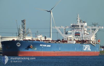
MILTIADIS JUNIOR
Tanker
Current Trip
BASRAH
| Time Travelled | --- |
|---|---|
| Remaining Time | --- |
| Distance Travelled | 11126.94 nm |
| Remaining Distance | --- |
| AVG Speed | 11.1 Knots |
| MAX Speed | 14.4 Knots |
| AVG Wind | 11.3 knots |
| MAX Wind | 26 knots |
| MIN Temp | 16.7°C / 62.06°F |
| MAX Temp | 28.4°C / 83.12°F |
| Draught | 11 m |
| Position Received | 3 m ago |
Current Position
| Longitude | 48.89738° |
|---|---|
| Latitude | 29.64089° |
| Status | At anchor |
| Speed | 0.1 Knots |
| Course | 146° |
| Area | Persian Gulf |
| Station | T-AIS |
| Position Received | 3 m ago |
Info
Information
The current position of MILTIADIS JUNIOR is in Persian Gulf with coordinates 29.64089° / 48.89738° as reported on 2024-04-19 13:36 by AIS to our vessel tracker app. The vessel's current speed is 0.1 Knots
The vessel MILTIADIS JUNIOR (IMO: 9693745, MMSI: 636016370) is a Tanker It's sailing under the flag of [LR] Liberia.
In this page you can find informations about the vessels current position, last detected port calls, and current voyage information. If the vessels is not in coverage by AIS you will find the latest position.
The current position of MILTIADIS JUNIOR is detected by our AIS receivers and we are not responsible for the reliability of the data. The last position was recorded while the vessel was in Coverage by the Ais receivers of our vessel tracking app.
The current draught of MILTIADIS JUNIOR as reported by AIS is 11 meters
Weather
| Temperature | 25.9°C / 78.62°F |
|---|---|
| Wind Speed | 10 knots |
| Direction | 180° S |
| Pressure | 1006.4 hPa |
| Humidity | 61.8 % |
| Cloud Coverage | --- |
Featured Company
Last Port Calls
Most Visited Ports (Last year)
| Port | Arrivals |
|---|
Last Trips
| Origin | Departure | Destination | Arrival | Distance |
|---|
Events
| Time | Event | Details | Position / Dest | Info |
|---|---|---|---|---|
| 2024-04-19 07:03 | IN Coverage |
29.64038 / 48.89672
Persian Gulf
|
Speed: 0.2 kn Course: 216.7° |
|
| 2024-04-19 05:39 | OUT of Coverage |
29.64028 / 48.89697
Persian Gulf
|
Speed: 0.1 kn Course: 102.2° |
|
| 2024-04-18 10:24 | IN Coverage |
29.63942 / 48.89637
Persian Gulf
BASRAH
|
Speed: 0.3 kn Course: 20.4° |
|
| 2024-04-18 09:18 | OUT of Coverage |
29.63789 / 48.89635
Persian Gulf
BASRAH
|
Speed: 0.3 kn Course: 293.2° |
|
| 2024-04-18 09:18 | Status Changed | At anchor Under way using engine |
29.63789 / 48.89635
BASRAH
|
Speed: 0.3 kn Course: 80° |
| 2024-04-18 09:09 | STOP Moving |
29.63808 / 48.89734
BASRAH
|
Speed: 0.3 kn Course: 73° |
|
| 2024-04-18 08:22 | Detected in Sea | Iranian part of the Persian Gulf |
29.57776 / 48.90939
Persian Gulf
BASRAH
|
Speed: 8.6 kn Course: 340.6° |
| 2024-04-18 05:41 | Change Sea Area | Kuwaiti part of the Persian Gulf Iranian part of the Persian Gulf |
29.25397 / 49.27784
Persian Gulf
BASRAH
|
Speed: 11.8 kn Course: 291° |
| 2024-04-18 05:05 | ETA Changed | 2024/04/18 10:00 2024/04/18 13:00 |
29.21891 / 49.40915
BASRAH
|
Speed: 12.3 kn Course: 288.4° |
| 2024-04-18 01:00 | Status Changed | Under way using engine Default |
28.75340 / 50.17168
BASRAH
|
Speed: 12.8 kn Course: 328° |