
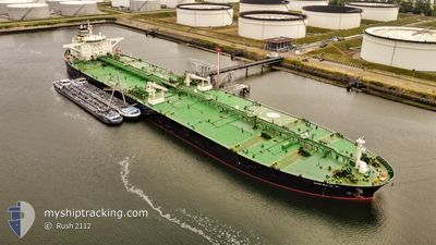
MIKELA P.
Crude Oil Tanker
Current Trip
| Time Travelled | 2 days |
|---|---|
| Remaining Time | --- |
| Distance Travelled | 511.52 nm |
| Remaining Distance | --- |
| AVG Speed | 11.1 Knots |
| MAX Speed | 12.7 Knots |
| AVG Wind | 9.8 knots |
| MAX Wind | 24.8 knots |
| MIN Temp | 21.6°C / 70.88°F |
| MAX Temp | 27.2°C / 80.96°F |
| Draught | 15.1 m |
| Position Received | 13 h, 22 m ago |
Current Position
| Longitude | 56.81243° |
|---|---|
| Latitude | 24.95220° |
| Status | Under way using engine |
| Speed | 12.5 Knots |
| Course | 166° |
| Area | Gulf of Oman |
| Station | T-AIS |
| Position Received | 13 h, 22 m ago |
Info
Information
The current position of MIKELA P. is in Gulf of Oman with coordinates 24.95220° / 56.81243° as reported on 2024-04-16 03:18 by AIS to our vessel tracker app. The vessel's current speed is 12.5 Knots
The vessel MIKELA P. (IMO: 9440382, MMSI: 538008330) is a Crude Oil Tanker that was built in 2009 ( 15 years old ). It's sailing under the flag of [MH] Marshall Is.
In this page you can find informations about the vessels current position, last detected port calls, and current voyage information. If the vessels is not in coverage by AIS you will find the latest position.
The current position of MIKELA P. is detected by our AIS receivers and we are not responsible for the reliability of the data. The last position was recorded while the vessel was in Coverage by the Ais receivers of our vessel tracking app.
The current draught of MIKELA P. as reported by AIS is 15.1 meters
Weather
| Temperature | 27.4°C / 81.32°F |
|---|---|
| Wind Speed | 26 knots |
| Direction | 141° SE |
| Pressure | 1007.1 hPa |
| Humidity | 77.7 % |
| Cloud Coverage | 100 % |
Featured Company
Last Port Calls
| Port | Arrival | Departure | Time In Port |
|---|---|---|---|
| 2024-04-11 17:27 | 2024-04-14 06:11 | 2 d |
Most Visited Ports (Last year)
| Port | Arrivals | |
|---|---|---|
| 4 | ||
| 1 | ||
| 1 | ||
| 1 | ||
| 1 | ||
| 1 |
Last Trips
| Origin | Departure | Destination | Arrival | Distance |
|---|
Events
| Time | Event | Details | Position / Dest | Info |
|---|---|---|---|---|
| 2024-04-16 03:23 | Status Changed | Default Under way using engine |
24.93893 / 56.82073
FUJAIRAH
|
Speed: 12.5 kn Course: 166° |
| 2024-04-16 03:18 | Status Changed | Under way using engine Default |
24.95220 / 56.81243
FUJAIRAH
|
Speed: 12.7 kn Course: 177° |
| 2024-04-16 03:18 | OUT of Coverage |
24.95220 / 56.81243
Gulf of Oman
FUJAIRAH
|
Speed: 12.5 kn Course: 166° |
|
| 2024-04-16 03:11 | Status Changed | Default Under way using engine |
24.97902 / 56.81055
FUJAIRAH
|
Speed: 12.5 kn Course: 180° |
| 2024-04-16 02:53 | Change Sea Area | Omani part of the Gulf of Oman United Arab Emirates part of the Gulf of Oman |
25.04195 / 56.80832
Gulf of Oman
FUJAIRAH
|
Speed: 12.4 kn Course: 169° |
| 2024-04-15 23:53 | Change Sea Area | United Arab Emirates part of the Gulf of Oman Omani part of the Gulf of Oman |
25.66668 / 56.73525
Gulf of Oman
FUJAIRAH
|
Speed: 10.6 kn Course: 170° |
| 2024-04-15 22:41 | Change Sea Area | Omani part of the Gulf of Oman Omani part of the Persian Gulf |
25.91500 / 56.70763
Gulf of Oman
FUJAIRAH
|
Speed: 11 kn Course: 185° |
| 2024-04-15 22:39 | Status Changed | Under way using engine Default |
25.92292 / 56.70847
FUJAIRAH
|
Speed: 11.1 kn Course: 180° |
| 2024-04-15 22:39 | IN Coverage |
25.91500 / 56.70763
Gulf of Oman
FUJAIRAH
|
Speed: 11 kn Course: 185° |
|
| 2024-04-15 16:31 | OUT of Coverage |
26.23793 / 55.91370
Persian Gulf
FUJAIRAH
|
Speed: 11.2 kn Course: 52° |