
MIGUEL OLIVER
Fishery Research Vessel
Current Trip
Current Position
| Longitude | -8.73697° |
|---|---|
| Latitude | 42.23087° |
| Status | Moored |
| Speed | |
| Course | 117° |
| Area | North Atlantic Ocean |
| Station | T-AIS |
| Position Received | 3 m ago |
Info
Information
The current position of MIGUEL OLIVER is in North Atlantic Ocean with coordinates 42.23087° / -8.73697° as reported on 2024-04-20 08:23 by AIS to our vessel tracker app. The vessel's current speed is 0 Knots and is currently inside the port of VIGO.
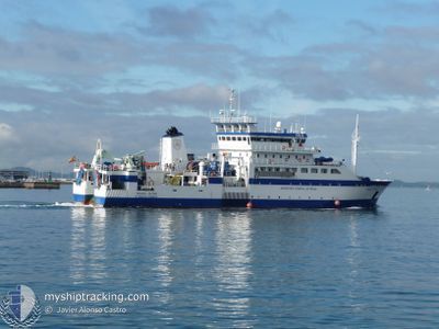
The vessel MIGUEL OLIVER (IMO: 9335381, MMSI: 225322000) is a Fishery Research Vessel that was built in 2007 ( 17 years old ). It's sailing under the flag of [ES] Spain.
In this page you can find informations about the vessels current position, last detected port calls, and current voyage information. If the vessels is not in coverage by AIS you will find the latest position.
The current position of MIGUEL OLIVER is detected by our AIS receivers and we are not responsible for the reliability of the data. The last position was recorded while the vessel was in Coverage by the Ais receivers of our vessel tracking app.
The current draught of MIGUEL OLIVER as reported by AIS is 6 meters
Weather
| Temperature | 15.1°C / 59.18°F |
|---|---|
| Wind Speed | 3 knots |
| Direction | 118° ESE |
| Pressure | 1015.8 hPa |
| Humidity | 71.8 % |
| Cloud Coverage | 100 % |
Featured Company
Last Port Calls
| Port | Arrival | Departure | Time In Port |
|---|---|---|---|
| 2024-04-16 18:43 | |||
| 2024-04-05 13:30 | 2024-04-06 17:15 | 1 d | |
| 2024-03-31 12:46 | 2024-03-31 18:39 | 5 h | |
| 2024-03-22 18:10 | 2024-03-25 18:56 | 3 d | |
| 2024-03-06 21:53 | 2024-03-11 08:01 | 4 d | |
| 2024-02-29 11:42 | 2024-02-29 23:07 | 11 h | |
| 2024-02-21 08:56 | 2024-02-27 17:53 | 6 d | |
| 2024-02-20 10:56 | 2024-02-20 12:56 | 2 h | |
| 2024-02-16 15:54 | 2024-02-18 06:33 | 1 d | |
| 2024-02-09 19:44 | 2024-02-12 19:47 | 3 d |
Most Visited Ports (Last year)
| Port | Arrivals | |
|---|---|---|
| 11 | ||
| 5 | ||
| 4 | ||
| 3 | ||
| 3 | ||
| 2 |
Last Trips
| Origin | Departure | Destination | Arrival | Distance | |
|---|---|---|---|---|---|
| 2024-04-06 19:15 | 2024-04-16 20:43 | 1309.22 nm | |||
| 2024-03-31 20:39 | 2024-04-05 15:30 | 334.57 nm | |||
| 2024-03-25 19:56 | 2024-03-31 14:46 | 882.01 nm | |||
| 2024-03-11 08:01 | 2024-03-22 19:10 | 1678.35 nm | |||
| 2024-03-01 00:07 | 2024-03-06 21:53 | 800.02 nm | |||
| 2024-02-27 18:53 | 2024-02-29 12:42 | 502.13 nm | |||
| 2024-02-20 13:56 | 2024-02-21 09:56 | 247.41 nm | |||
| 2024-02-18 07:33 | 2024-02-20 11:56 | 185.64 nm | |||
| 2024-02-12 20:47 | 2024-02-16 16:54 | 453.41 nm | |||
| 2024-02-05 22:21 | 2024-02-09 20:44 | 541.88 nm |
Events
| Time | Event | Details | Position / Dest | Info |
|---|---|---|---|---|
| 2024-04-16 18:57 | Status Changed | Moored Under way using engine |
42.23089 / -8.73696
[ES] VIGO
|
Speed: Course: 117° |
| 2024-04-16 18:45 | STOP Moving |
42.23094 / -8.73701
[ES] VIGO
|
Speed: 0.3 kn Course: 115° |
|
| 2024-04-16 18:43 | PORT ARRIVAL |
|
42.23114 / -8.73716
[ES] VIGO
|
Speed: 0.6 kn Course: 102° |
| 2024-04-16 17:07 | Destination Changed | PORT OF VIGO OCEANOGRAPHIC WORKS |
42.06949 / -8.94733
PORT OF VIGO
|
Speed: 10.2 kn Course: 349.3° |
| 2024-04-16 16:59 | Status Changed | Under way using engine Restricted manoeuverability |
42.04863 / -8.94180
OCEANOGRAPHIC WORKS
|
Speed: 9.7 kn Course: 91.2° |
| 2024-04-16 14:59 | IN Coverage |
41.94178 / -9.12756
North Atlantic Ocean
|
Speed: 3.9 kn Course: 346.1° |
|
| 2024-04-16 09:14 | OUT of Coverage |
42.10406 / -9.09902
North Atlantic Ocean
|
Speed: 10.9 kn Course: 233.7° |
|
| 2024-04-16 01:14 | IN Coverage |
41.99846 / -8.97333
North Atlantic Ocean
|
Speed: 4.4 kn Course: 357.7° |
|
| 2024-04-15 23:51 | OUT of Coverage |
41.94474 / -9.03399
North Atlantic Ocean
|
Speed: 1.6 kn Course: 20.2° |
|
| 2024-04-15 23:38 | IN Coverage |
41.94418 / -9.03382
North Atlantic Ocean
|
Speed: 0.1 kn Course: 273.1° |