
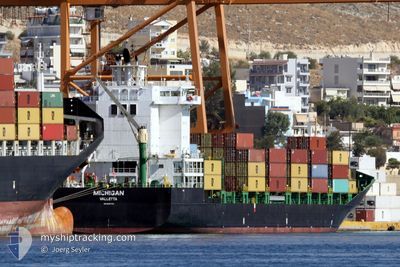
MICHIGAN
Container Ship
Current Trip
| Time Travelled | 12 h, 43 mins |
|---|---|
| Remaining Time | --- |
| Distance Travelled | 90.14 nm |
| Remaining Distance | --- |
| AVG Speed | 12.3 Knots |
| MAX Speed | 13.6 Knots |
| AVG Wind | 11.5 knots |
| MAX Wind | 22.2 knots |
| MIN Temp | 15.1°C / 59.18°F |
| MAX Temp | 17.1°C / 62.78°F |
| Draught | 7.3 m |
| Position Received | 5 h, 57 m ago |
Current Position
| Longitude | 14.83881° |
|---|---|
| Latitude | 36.15105° |
| Status | Under way using engine |
| Speed | 2.1 Knots |
| Course | 356° |
| Area | Mediterranean Sea - Eastern Basin |
| Station | T-AIS |
| Position Received | 5 h, 57 m ago |
Info
Information
The current position of MICHIGAN is in Mediterranean Sea - Eastern Basin with coordinates 36.15105° / 14.83881° as reported on 2024-04-23 22:26 by AIS to our vessel tracker app. The vessel's current speed is 2.1 Knots
The vessel MICHIGAN (IMO: 9437139, MMSI: 215020000) is a Container Ship that was built in 2008 ( 16 years old ). It's sailing under the flag of [MT] Malta.
In this page you can find informations about the vessels current position, last detected port calls, and current voyage information. If the vessels is not in coverage by AIS you will find the latest position.
The current position of MICHIGAN is detected by our AIS receivers and we are not responsible for the reliability of the data. The last position was recorded while the vessel was in Coverage by the Ais receivers of our vessel tracking app.
The current draught of MICHIGAN as reported by AIS is 7.3 meters
Weather
| Temperature | 15.1°C / 59.18°F |
|---|---|
| Wind Speed | 15 knots |
| Direction | 303° WNW |
| Pressure | 1012.9 hPa |
| Humidity | 63.3 % |
| Cloud Coverage | 23 % |
Featured Company
Last Port Calls
| Port | Arrival | Departure | Time In Port |
|---|---|---|---|
| 2024-04-23 03:52 | 2024-04-23 15:40 | 11 h | |
| 2024-04-20 09:06 | 2024-04-22 16:20 | 2 d | |
| 2024-04-15 13:18 | 2024-04-17 08:23 | 1 d | |
| 2024-04-14 12:37 | 2024-04-15 03:03 | 14 h | |
| 2024-04-12 02:42 | 2024-04-12 15:57 | 13 h | |
| 2024-04-10 07:11 | 2024-04-10 23:39 | 16 h | |
| 2024-04-07 06:27 | 2024-04-08 18:57 | 1 d | |
| 2024-04-04 04:17 | 2024-04-05 08:03 | 1 d | |
| 2024-04-02 04:50 | 2024-04-03 05:52 | 1 d | |
| 2024-03-30 04:41 | 2024-03-30 16:05 | 11 h |
Last Trips
| Origin | Departure | Destination | Arrival | Distance | |
|---|---|---|---|---|---|
| 2024-04-22 18:20 | 2024-04-23 05:52 | 87.44 nm | |||
| 2024-04-17 10:23 | 2024-04-20 11:06 | 456.13 nm | |||
| 2024-04-15 05:03 | 2024-04-15 15:18 | 115.55 nm | |||
| 2024-04-12 17:57 | 2024-04-14 14:37 | 369.59 nm | |||
| 2024-04-11 01:39 | 2024-04-12 04:42 | 323.93 nm | |||
| 2024-04-08 20:57 | 2024-04-10 09:11 | 330.75 nm | |||
| 2024-04-05 10:03 | 2024-04-07 08:27 | 372.67 nm | |||
| 2024-04-03 07:52 | 2024-04-04 06:17 | 292.19 nm | |||
| 2024-03-30 17:05 | 2024-04-02 06:50 | 633.02 nm | |||
| 2024-03-29 21:52 | 2024-03-30 05:41 | 87.53 nm |
Events
| Time | Event | Details | Position / Dest | Info |
|---|---|---|---|---|
| 2024-04-24 04:03 | STOP Moving | 20.55 nm, North East of VALLETTA |
36.15461 / 14.80551
MTMAR
|
Speed: 0.1 kn Course: 321° |
| 2024-04-23 22:33 | Status Changed | Default Under way using engine |
36.14876 / 14.84228
MTMAR
|
Speed: 2.1 kn Course: 356° |
| 2024-04-23 22:26 | OUT of Coverage |
36.15105 / 14.83881
Mediterranean Sea - Eastern Basin
MTMAR
|
Speed: 2.1 kn Course: 123.7° |
|
| 2024-04-23 22:24 | Status Changed | Under way using engine Default |
36.15145 / 14.83818
MTMAR
|
Speed: 2.7 kn Course: 11° |
| 2024-04-23 22:00 | Status Changed | Default Under way using engine |
36.15899 / 14.82573
MTMAR
|
Speed: 1.8 kn Course: 343° |
| 2024-04-23 21:31 | Change Sea Area | Maltese part of the Mediterranean Sea - Eastern Basin Italian part of the Mediterranean Sea - Eastern Basin |
36.20907 / 14.87813
Mediterranean Sea - Eastern Basin
MTMAR
|
Speed: 12.9 kn Course: 223.5° |
| 2024-04-23 21:29 | Status Changed | Under way using engine Default |
36.21336 / 14.88309
MTMAR
|
Speed: 12.9 kn Course: 221° |
| 2024-04-23 21:18 | IN Coverage |
36.20907 / 14.87813
Mediterranean Sea - Eastern Basin
MTMAR
|
Speed: 12.9 kn Course: 223.5° |
|
| 2024-04-23 20:02 | Status Changed | Default Under way using engine |
36.43279 / 15.14255
MTMAR
|
Speed: 12 kn Course: 227.4° |
| 2024-04-23 20:01 | OUT of Coverage |
36.43555 / 15.14618
Mediterranean Sea - Eastern Basin
MTMAR
|
Speed: 12 kn Course: 227.4° |