
MICHIGAN HIGHWAY
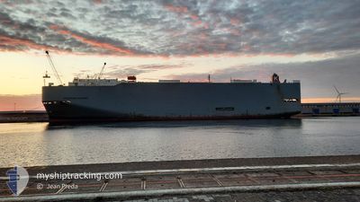
Vehicles Carrier
Current Trip
| Time Travelled | 1 day |
|---|---|
| Remaining Time | --- |
| Distance Travelled | 647.65 nm |
| Remaining Distance | --- |
| AVG Speed | 14.8 Knots |
| MAX Speed | 18.4 Knots |
| AVG Wind | 4.7 knots |
| MAX Wind | 6.8 knots |
| MIN Temp | 27.7°C / 81.86°F |
| MAX Temp | 29.4°C / 84.92°F |
| Draught | 7.8 m |
| Position Received | 1 d ago |
Current Position
| Longitude | 104.62774° |
|---|---|
| Latitude | 1.72123° |
| Status | Under way using engine |
| Speed | 16.8 Knots |
| Course | 15° |
| Area | South China Sea |
| Station | T-AIS |
| Position Received | 1 d ago |
Info
Information
The current position of MICHIGAN HIGHWAY is in South China Sea with coordinates 1.72123° / 104.62774° as reported on 2024-04-18 04:58 by AIS to our vessel tracker app. The vessel's current speed is 16.8 Knots and is heading at the port of INCHEON. The estimated time of arrival as calculated by MyShipTracking vessel tracking app is 2024-04-25 03:00 LT
The vessel MICHIGAN HIGHWAY (IMO: 9339832, MMSI: 432633000) is a Vehicles Carrier that was built in 2008 ( 16 years old ). It's sailing under the flag of [JP] Japan.
In this page you can find informations about the vessels current position, last detected port calls, and current voyage information. If the vessels is not in coverage by AIS you will find the latest position.
The current position of MICHIGAN HIGHWAY is detected by our AIS receivers and we are not responsible for the reliability of the data. The last position was recorded while the vessel was in Coverage by the Ais receivers of our vessel tracking app.
The current draught of MICHIGAN HIGHWAY as reported by AIS is 7.8 meters
Weather
| Temperature | 28.8°C / 83.84°F |
|---|---|
| Wind Speed | 10 knots |
| Direction | 146° SE |
| Pressure | 1007.5 hPa |
| Humidity | 77.2 % |
| Cloud Coverage | 34 % |
Featured Company
Last Port Calls
| Port | Arrival | Departure | Time In Port |
|---|---|---|---|
| 2024-04-17 15:06 | 2024-04-18 00:30 | 9 h | |
| 2024-04-13 03:19 | 2024-04-13 12:58 | 9 h | |
| 2024-04-08 07:02 | 2024-04-09 13:45 | 1 d | |
| 2024-04-03 22:05 | 2024-04-04 23:46 | 1 d | |
| 2024-04-02 05:03 | 2024-04-03 18:24 | 1 d | |
| 2024-04-01 02:21 | 2024-04-01 08:05 | 5 h | |
| 2024-03-22 16:07 | 2024-03-22 22:05 | 5 h | |
| 2024-03-20 01:23 | 2024-03-20 12:14 | 10 h | |
| 2024-03-13 06:48 | 2024-03-13 18:53 | 12 h | |
| 2024-03-10 16:15 | 2024-03-11 05:02 | 12 h |
Most Visited Ports (Last year)
| Port | Arrivals | |
|---|---|---|
| 6 | ||
| 4 | ||
| 3 | ||
| 2 | ||
| 2 | ||
| 2 |
Last Trips
| Origin | Departure | Destination | Arrival | Distance | |
|---|---|---|---|---|---|
| 2024-04-13 18:28 | 2024-04-17 23:06 | 1482.78 nm | |||
| 2024-04-09 19:15 | 2024-04-13 08:49 | 1386.89 nm | |||
| 2024-04-05 03:46 | 2024-04-08 12:32 | 992.85 nm | |||
| 2024-04-03 22:24 | 2024-04-04 02:05 | 45.40 nm | |||
| 2024-04-01 12:05 | 2024-04-02 09:03 | 276.47 nm | |||
| 2024-03-23 06:05 | 2024-04-01 06:21 | 3326.62 nm | |||
| 2024-03-20 19:14 | 2024-03-23 00:07 | 787.16 nm | |||
| 2024-03-14 02:53 | 2024-03-20 08:23 | 2280.88 nm | |||
| 2024-03-11 13:02 | 2024-03-13 14:48 | 384.04 nm | |||
| 2024-03-07 15:01 | 2024-03-11 00:15 | 1179.64 nm |
Events
| Time | Event | Details | Position / Dest | Info |
|---|---|---|---|---|
| 2024-04-18 04:58 | OUT of Coverage |
1.72123 / 104.62774
South China Sea
KR INC
|
Speed: 16.8 kn Course: 15° |
|
| 2024-04-18 03:20 | Change Sea Area | Malaysian part of the South China Sea Malaysian part of the Singapore Strait |
1.32607 / 104.37891
South China Sea
KR INC
|
Speed: 18.4 kn Course: 51° |
| 2024-04-18 03:20 | Status Changed | Under way using engine Default |
1.32607 / 104.37891
KR INC
|
Speed: 18.3 kn Course: 52° |
| 2024-04-18 02:53 | Status Changed | Default Under way using engine |
1.28016 / 104.25585
KR INC
|
Speed: 18.1 kn Course: 84° |
| 2024-04-18 02:29 | Change Sea Area | Malaysian part of the Singapore Strait Indonesian part of the Singapore Strait |
1.26342 / 104.13518
Singapore Strait
KR INC
|
Speed: 17.9 kn Course: 81° |
| 2024-04-18 01:23 | Change Sea Area | Indonesian part of the Singapore Strait Singaporean part of the Singapore Strait |
1.18699 / 103.84073
Singapore Strait
KR INC
|
Speed: 11.9 kn Course: 85° |
| 2024-04-18 00:30 | PORT DEPARTURE |
|
1.27974 / 103.74659
KR INC
|
Speed: 4 kn Course: 213° |
| 2024-04-18 00:29 | START Moving |
1.28076 / 103.74727
[SG] SINGAPORE
|
Speed: 3.1 kn Course: 222° |
|
| 2024-04-18 00:18 | Status Changed | Under way using engine Moored |
1.28290 / 103.75149
[SG] SINGAPORE
|
Speed: Course: 32° |
| 2024-04-18 00:18 | ETA Changed | 2024/04/25 03:00 2024/04/26 13:00 |
1.28288 / 103.75150
[SG] SINGAPORE
|
Speed: Course: 32° |