
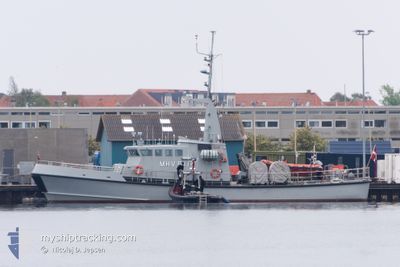
MHV 911 BOPA
Military ops
Current Trip
| Trip Time | 2 h, 29 mins |
|---|---|
| Trip Distance | 12.74 nm |
| AVG Speed | 6.4 Knots |
| MAX Speed | 6.4 Knots |
| Draught | 2.5 m |
| AVG Wind | 8.9 knots |
| MAX Wind | 9.9 knots |
| MIN Temp | 4.5°C / 40.1°F |
| MAX Temp | 5.3°C / 41.54°F |
| Position Received | 3 m ago |
Current Position
| Longitude | 12.67993° |
|---|---|
| Latitude | 55.59291° |
| Status | Moored |
| Speed | |
| Course | 223° |
| Area | Kattegat |
| Station | T-AIS |
| Position Received | 3 m ago |
Info
Information
The current position of MHV 911 BOPA is in Kattegat with coordinates 55.59291° / 12.67993° as reported on 2024-04-19 15:30 by AIS to our vessel tracker app. The vessel's current speed is 0 Knots and is currently inside the port of DRAGOER.
The vessel MHV 911 BOPA (MMSI: 219000174) is a Military ops It's sailing under the flag of [DK] Denmark.
In this page you can find informations about the vessels current position, last detected port calls, and current voyage information. If the vessels is not in coverage by AIS you will find the latest position.
The current position of MHV 911 BOPA is detected by our AIS receivers and we are not responsible for the reliability of the data. The last position was recorded while the vessel was in Coverage by the Ais receivers of our vessel tracking app.
The current draught of MHV 911 BOPA as reported by AIS is 2.5 meters
Weather
| Temperature | 4°C / 39.2°F |
|---|---|
| Wind Speed | 21 knots |
| Direction | 77° ENE |
| Pressure | 1002.2 hPa |
| Humidity | 91.3 % |
| Cloud Coverage | 100 % |
Featured Company
Last Port Calls
| Port | Arrival | Departure | Time In Port |
|---|---|---|---|
| 2024-04-16 20:01 | |||
| 2024-04-09 20:45 | 2024-04-16 17:32 | 6 d | |
| 2024-04-02 19:50 | 2024-04-09 16:06 | 6 d | |
| 2024-03-26 21:18 | 2024-04-02 17:15 | 6 d | |
| 2024-03-24 16:36 | 2024-03-26 18:09 | 2 d | |
| 2024-03-24 14:02 | 2024-03-24 15:34 | 1 h | |
| 2024-03-23 16:26 | 2024-03-24 05:43 | 13 h | |
| 2024-03-19 21:08 | 2024-03-22 16:52 | 2 d | |
| 2024-03-12 20:54 | 2024-03-19 18:51 | 6 d | |
| 2024-03-07 10:34 | 2024-03-12 17:55 | 5 d |
Last Trips
| Origin | Departure | Destination | Arrival | Distance | |
|---|---|---|---|---|---|
| 2024-04-16 19:32 | 2024-04-16 22:01 | 12.74 nm | |||
| 2024-04-09 18:06 | 2024-04-09 22:45 | 40.81 nm | |||
| 2024-04-02 19:15 | 2024-04-02 21:50 | 11.16 nm | |||
| 2024-03-26 19:09 | 2024-03-26 22:18 | 16.11 nm | |||
| 2024-03-24 16:34 | 2024-03-24 17:36 | 8.90 nm | |||
| 2024-03-24 06:43 | 2024-03-24 15:02 | 90.27 nm | |||
| 2024-03-22 17:52 | 2024-03-23 17:26 | 130.28 nm | |||
| 2024-03-19 19:51 | 2024-03-19 22:08 | 21.14 nm | |||
| 2024-03-12 18:55 | 2024-03-12 21:54 | 26.65 nm | |||
| 2024-03-07 09:55 | 2024-03-07 11:34 | 18.49 nm |
Events
| Time | Event | Details | Position / Dest | Info |
|---|---|---|---|---|
| 2024-04-16 20:06 | Status Changed | Moored Under way using engine |
55.59292 / 12.67992
[DK] DRAGOER
|
Speed: Course: 223° |
| 2024-04-16 20:03 | STOP Moving |
55.59301 / 12.68009
[DK] DRAGOER
|
Speed: 0.2 kn Course: 221° |
|
| 2024-04-16 20:01 | PORT ARRIVAL |
|
55.59420 / 12.68248
[DK] DRAGOER
|
Speed: 5.2 kn Course: 215.6° |
| 2024-04-16 19:03 | START Moving | 2.45 nm, South East of DRAGOER |
55.56253 / 12.72965
NA
|
Speed: 6.3 kn Course: 352.5° |
| 2024-04-16 18:55 | STOP Moving | 2.56 nm, South East of DRAGOER |
55.56093 / 12.73112
NA
|
Speed: 0.3 kn Course: 215° |
| 2024-04-16 18:51 | START Moving | 2.44 nm, South East of DRAGOER |
55.56473 / 12.73315
NA
|
Speed: 3.2 kn Course: 203° |
| 2024-04-16 18:46 | STOP Moving | 2.41 nm, South East of DRAGOER |
55.56638 / 12.73460
NA
|
Speed: 0.2 kn Course: 214° |
| 2024-04-16 18:31 | Status Changed | Under way using engine Moored |
55.55405 / 12.73823
NA
|
Speed: 3.3 kn Course: 225° |
| 2024-04-16 17:32 | PORT DEPARTURE |
|
55.59527 / 12.68468
NA
|
Speed: 9.6 kn Course: 52° |
| 2024-04-16 17:31 | START Moving |
55.59415 / 12.68234
[DK] DRAGOER
|
Speed: 8 kn Course: 45° |