
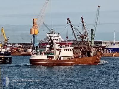
MFV Z38 ZUIDERZEE
Fishing
Current Trip
SEA
| Time Travelled | 5 days |
|---|---|
| Remaining Time | --- |
| Distance Travelled | 19.08 nm |
| Remaining Distance | --- |
| AVG Speed | 10.2 Knots |
| MAX Speed | 11.2 Knots |
| AVG Wind | 13 knots |
| MAX Wind | 14.8 knots |
| MIN Temp | 10.5°C / 50.9°F |
| MAX Temp | 11.3°C / 52.34°F |
| Draught | 4 m |
| Position Received | 5 d ago |
Current Position
| Longitude | -4.29429° |
|---|---|
| Latitude | 48.94835° |
| Status | Engaged in Fishing |
| Speed | 9.9 Knots |
| Course | 310° |
| Area | English Channel |
| Station | T-AIS |
| Position Received | 5 d ago |
Info
Information
The current position of MFV Z38 ZUIDERZEE is in English Channel with coordinates 48.94835° / -4.29429° as reported on 2024-04-19 09:04 by AIS to our vessel tracker app. The vessel's current speed is 9.9 Knots
The vessel MFV Z38 ZUIDERZEE (MMSI: 205149000) is a Fishing It's sailing under the flag of [BE] Belgium.
In this page you can find informations about the vessels current position, last detected port calls, and current voyage information. If the vessels is not in coverage by AIS you will find the latest position.
The current position of MFV Z38 ZUIDERZEE is detected by our AIS receivers and we are not responsible for the reliability of the data. The last position was recorded while the vessel was in Coverage by the Ais receivers of our vessel tracking app.
The current draught of MFV Z38 ZUIDERZEE as reported by AIS is 4 meters
Weather
| Temperature | 11.3°C / 52.34°F |
|---|---|
| Wind Speed | 14 knots |
| Direction | 305° NW |
| Pressure | 1023 hPa |
| Humidity | 77.9 % |
| Cloud Coverage | 100 % |
Featured Company
Last Port Calls
| Port | Arrival | Departure | Time In Port |
|---|---|---|---|
| 2024-04-18 12:17 | 2024-04-19 07:06 | 18 h | |
| 2024-03-17 07:22 | 2024-04-09 11:04 | 23 d | |
| 2024-03-07 09:42 | 2024-03-08 08:07 | 22 h | |
| 2024-02-25 11:16 | 2024-02-27 17:00 | 2 d | |
| 2024-02-06 23:05 | 2024-02-15 12:51 | 8 d | |
| 2024-02-03 07:36 | 2024-02-03 15:33 | 7 h |
Most Visited Ports (Last year)
| Port | Arrivals | |
|---|---|---|
| 8 | ||
| 4 | ||
| 4 | ||
| 1 | ||
| 1 | ||
| 1 |
Last Trips
| Origin | Departure | Destination | Arrival | Distance | |
|---|---|---|---|---|---|
| 2024-04-09 13:04 | 2024-04-18 14:17 | 539.03 nm | |||
| 2024-03-08 09:07 | 2024-03-17 08:22 | 918.39 nm | |||
| 2024-02-27 18:00 | 2024-03-07 10:42 | 386.69 nm | |||
| 2024-02-15 13:51 | 2024-02-25 12:16 | 850.14 nm | |||
| 2024-02-03 16:33 | 2024-02-07 00:05 | 507.80 nm | |||
| 2024-01-24 13:17 | 2024-02-03 08:36 | 773.99 nm |
Events
| Time | Event | Details | Position / Dest | Info |
|---|---|---|---|---|
| 2024-04-19 09:04 | OUT of Coverage |
48.94835 / -4.29429
English Channel
|
Speed: 9.9 kn Course: 310° |
|
| 2024-04-19 07:06 | PORT DEPARTURE |
|
48.72038 / -3.95834
SEA
|
Speed: 8.2 kn Course: 34° |
| 2024-04-19 07:05 | START Moving |
48.71939 / -3.96226
[FR] ROSCOFF
|
Speed: 6 kn Course: 103° |
|
| 2024-04-18 12:20 | STOP Moving |
48.71952 / -3.96524
[FR] ROSCOFF
|
Speed: 0.3 kn Course: 179° |
|
| 2024-04-18 12:17 | PORT ARRIVAL |
|
48.71950 / -3.96049
[FR] ROSCOFF
|
Speed: 6.8 kn Course: 246.5° |
| 2024-04-18 10:28 | Detected in Sea | French part of the English Channel |
48.94230 / -4.26210
English Channel
|
Speed: 10.4 kn Course: 124.6° |
| 2024-04-18 10:28 | IN Coverage |
48.94230 / -4.26210
English Channel
|
Speed: 10.4 kn Course: 124.6° |
|
| 2024-04-16 00:39 | OUT of Coverage |
50.87104 / -5.37318
Celtic Sea
|
Speed: 3 kn Course: 297.1° |
|
| 2024-04-16 00:32 | IN Coverage |
50.87098 / -5.36526
Celtic Sea
|
Speed: 3.4 kn Course: 278.9° |
|
| 2024-04-15 01:01 | OUT of Coverage |
50.89298 / -5.43900
Celtic Sea
|
Speed: 3.7 kn Course: 43.7° |