
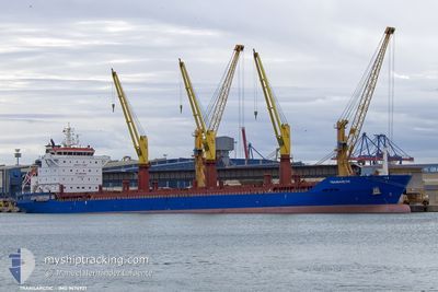
TRANSARCTIC
General Cargo
Current Trip
| Time Travelled | 3 days |
|---|---|
| Remaining Time | --- |
| Distance Travelled | 938.07 nm |
| Remaining Distance | --- |
| AVG Speed | 10.6 Knots |
| MAX Speed | 12.2 Knots |
| AVG Wind | 12.8 knots |
| MAX Wind | 26.8 knots |
| MIN Temp | -0.9°C / 30.38°F |
| MAX Temp | 7.6°C / 45.68°F |
| Draught | 8.7 m |
| Position Received | 1 m ago |
Current Position
| Longitude | 11.50086° |
|---|---|
| Latitude | 57.43390° |
| Status | Under way using engine |
| Speed | 11.1 Knots |
| Course | 341.3° |
| Area | Kattegat |
| Station | T-AIS |
| Position Received | 1 m ago |
Info
Information
The current position of TRANSARCTIC is in Kattegat with coordinates 57.43390° / 11.50086° as reported on 2024-04-25 04:11 by AIS to our vessel tracker app. The vessel's current speed is 11.1 Knots and is heading at the port of TEMA. The estimated time of arrival as calculated by MyShipTracking vessel tracking app is 2024-05-11 12:00 LT
The vessel TRANSARCTIC (IMO: 9674921, MMSI: 636021112) is a General Cargo that was built in 2013 ( 11 years old ). It's sailing under the flag of [LR] Liberia.
In this page you can find informations about the vessels current position, last detected port calls, and current voyage information. If the vessels is not in coverage by AIS you will find the latest position.
The current position of TRANSARCTIC is detected by our AIS receivers and we are not responsible for the reliability of the data. The last position was recorded while the vessel was in Coverage by the Ais receivers of our vessel tracking app.
The current draught of TRANSARCTIC as reported by AIS is 8.7 meters
Weather
| Temperature | 5.8°C / 42.44°F |
|---|---|
| Wind Speed | 6 knots |
| Direction | 134° SE |
| Pressure | 1004.9 hPa |
| Humidity | 73.8 % |
| Cloud Coverage | 100 % |
Featured Company
Last Port Calls
| Port | Arrival | Departure | Time In Port |
|---|---|---|---|
| 2024-04-16 14:35 | 2024-04-21 10:16 | 4 d | |
| 2024-03-12 20:45 | 2024-03-20 00:35 | 7 d | |
| 2024-03-02 21:58 | 2024-03-09 01:03 | 6 d |
Most Visited Ports (Last year)
| Port | Arrivals | |
|---|---|---|
| 2 | ||
| 2 | ||
| 2 | ||
| 1 | ||
| 1 | ||
| 1 |
Events
| Time | Event | Details | Position / Dest | Info |
|---|---|---|---|---|
| 2024-04-25 01:23 | Change Sea Area | Swedish part of the Kattegat Danish part of the Kattegat |
56.95645 / 11.79307
Kattegat
GH TEM
|
Speed: 10.6 kn Course: 342.7° |
| 2024-04-25 00:56 | Change Sea Area | Danish part of the Kattegat Swedish part of the Kattegat |
56.88330 / 11.84953
Kattegat
GH TEM
|
Speed: 10.6 kn Course: 333.5° |
| 2024-04-25 00:29 | Change Sea Area | Swedish part of the Kattegat Danish part of the Kattegat |
56.81218 / 11.90991
Kattegat
GH TEM
|
Speed: 10.6 kn Course: 349.2° |
| 2024-04-24 18:10 | START Moving | 11.03 nm, East of SAELVIG |
55.86249 / 10.87567
GH TEM
|
Speed: 10.6 kn Course: 41° |
| 2024-04-24 18:10 | STOP Moving | 10.96 nm, East of SAELVIG |
55.86110 / 10.87360
GH TEM
|
Speed: Course: 0° |
| 2024-04-24 17:00 | START Moving | 9.8 nm, West of KALUNDBORG |
55.67214 / 10.80006
GH TEM
|
Speed: 10.9 kn Course: 5.5° |
| 2024-04-24 17:00 | STOP Moving | 9.81 nm, West of KALUNDBORG |
55.67013 / 10.79968
GH TEM
|
Speed: Course: 0° |
| 2024-04-24 16:53 | START Moving | 9.91 nm, West of KALUNDBORG |
55.64947 / 10.79942
GH TEM
|
Speed: 11.4 kn Course: 339.3° |
| 2024-04-24 16:52 | STOP Moving | 9.88 nm, West of KALUNDBORG |
55.64774 / 10.80065
GH TEM
|
Speed: Course: 0° |
| 2024-04-24 16:52 | START Moving | 9.86 nm, West of KALUNDBORG |
55.64666 / 10.80145
GH TEM
|
Speed: 11.5 kn Course: 337.3° |