
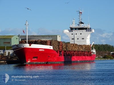
MERITA
General Cargo
Current Trip
| Time Travelled | 3 days |
|---|---|
| Remaining Time | 1 day |
| Distance Travelled | 465.23 nm |
| Remaining Distance | 406.69 nm |
| AVG Speed | 11.6 Knots |
| MAX Speed | 13.6 Knots |
| AVG Wind | 11.8 knots |
| MAX Wind | 20 knots |
| MIN Temp | 1.5°C / 34.7°F |
| MAX Temp | 6°C / 42.8°F |
| Draught | 6.2 m |
| Position Received | 3 h, 20 m ago |
Current Position
| Longitude | 16.67937° |
|---|---|
| Latitude | 56.04205° |
| Status | Under way using engine |
| Speed | 12.4 Knots |
| Course | 56.8° |
| Area | Baltic Sea |
| Station | T-AIS |
| Position Received | 3 h, 20 m ago |
Info
Information
The current position of MERITA is in Baltic Sea with coordinates 56.04205° / 16.67937° as reported on 2024-04-25 11:00 by AIS to our vessel tracker app. The vessel's current speed is 12.4 Knots and is heading at the port of OSTRAND. The estimated time of arrival as calculated by MyShipTracking vessel tracking app is 2024-04-26 23:02 LT
The vessel MERITA (IMO: 8422034, MMSI: 255805880) is a General Cargo that was built in 1985 ( 39 years old ). It's sailing under the flag of [PT] Portugal.
In this page you can find informations about the vessels current position, last detected port calls, and current voyage information. If the vessels is not in coverage by AIS you will find the latest position.
The current position of MERITA is detected by our AIS receivers and we are not responsible for the reliability of the data. The last position was recorded while the vessel was in Coverage by the Ais receivers of our vessel tracking app.
The current draught of MERITA as reported by AIS is 6.2 meters
Weather
| Temperature | 3.2°C / 37.76°F |
|---|---|
| Wind Speed | 5 knots |
| Direction | 57° ENE |
| Pressure | 1006.6 hPa |
| Humidity | 77.3 % |
| Cloud Coverage | 61 % |
Featured Company
Last Port Calls
| Port | Arrival | Departure | Time In Port |
|---|---|---|---|
| 2024-04-20 05:52 | 2024-04-21 19:41 | 1 d | |
| 2024-03-24 16:52 | 2024-04-17 10:20 | 23 d | |
| 2024-03-22 13:25 | 2024-03-23 16:21 | 1 d | |
| 2024-03-04 04:36 | 2024-03-20 20:50 | 16 d | |
| 2024-03-01 04:28 | 2024-03-03 07:39 | 2 d | |
| 2024-02-13 22:35 | 2024-02-27 20:47 | 13 d | |
| 2024-02-09 22:42 | 2024-02-11 14:24 | 1 d | |
| 2024-02-07 18:20 | 2024-02-09 05:26 | 1 d | |
| 2024-02-04 13:14 | 2024-02-05 14:10 | 1 d | |
| 2024-02-01 04:21 | 2024-02-02 13:45 | 1 d |
Last Trips
| Origin | Departure | Destination | Arrival | Distance | |
|---|---|---|---|---|---|
| 2024-04-17 13:20 | 2024-04-20 07:52 | 503.02 nm | |||
| 2024-03-23 17:21 | 2024-03-24 18:52 | 325.50 nm | |||
| 2024-03-20 21:50 | 2024-03-22 14:25 | 466.43 nm | |||
| 2024-03-03 08:39 | 2024-03-04 05:36 | 218.59 nm | |||
| 2024-02-27 22:47 | 2024-03-01 05:28 | 491.86 nm | |||
| 2024-02-11 15:24 | 2024-02-14 00:35 | 599.80 nm | |||
| 2024-02-09 06:26 | 2024-02-09 23:42 | 195.96 nm | |||
| 2024-02-05 16:10 | 2024-02-07 19:20 | 589.93 nm | |||
| 2024-02-02 14:45 | 2024-02-04 15:14 | 496.11 nm | |||
| 2024-01-30 02:53 | 2024-02-01 05:21 | 525.22 nm |
Events
| Time | Event | Details | Position / Dest | Info |
|---|---|---|---|---|
| 2024-04-25 11:08 | Status Changed | Default Under way using engine |
56.05802 / 16.72175
SEOST
|
Speed: 12.4 kn Course: 56.8° |
| 2024-04-25 11:00 | OUT of Coverage |
56.04205 / 16.67937
Baltic Sea
SEOST
|
Speed: 12.4 kn Course: 56.8° |
|
| 2024-04-25 10:58 | Status Changed | Under way using engine Default |
56.03881 / 16.67084
SEOST
|
Speed: 12.3 kn Course: 56° |
| 2024-04-25 10:52 | Status Changed | Default Under way using engine |
56.02698 / 16.63968
SEOST
|
Speed: 12.5 kn Course: 55.6° |
| 2024-04-25 08:36 | Status Changed | Under way using engine Default |
55.64620 / 16.16587
SEOST
|
Speed: 12.3 kn Course: 31° |
| 2024-04-25 08:33 | Status Changed | Default Under way using engine |
55.63533 / 16.15431
SEOST
|
Speed: 12.5 kn Course: 30.4° |
| 2024-04-25 07:41 | Change Sea Area | Swedish part of the Baltic Sea Danish part of the Kattegat |
55.47813 / 16.00710
Baltic Sea
SEOST
|
Speed: 12.3 kn Course: 20.3° |
| 2024-04-25 07:32 | ETA Changed | 2024/04/26 23:00 2024/04/27 03:00 |
55.45175 / 15.98594
SEOST
|
Speed: 12.3 kn Course: 24.5° |
| 2024-04-25 04:53 | Change Sea Area | Danish part of the Kattegat Polish part of the Baltic Sea |
54.94988 / 15.57616
Kattegat
SEOST
|
Speed: 12.4 kn Course: 24.6° |
| 2024-04-25 02:09 | Status Changed | Under way using engine Default |
54.51215 / 15.00411
SEOST
|
Speed: 12 kn Course: 41° |