
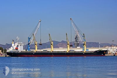
MELOI
Bulk Carrier
Current Trip
| Time Travelled | 27 days |
|---|---|
| Remaining Time | --- |
| Distance Travelled | 6836.97 nm |
| Remaining Distance | --- |
| AVG Speed | 10.9 Knots |
| MAX Speed | 15.4 Knots |
| AVG Wind | 14.4 knots |
| MAX Wind | 32 knots |
| MIN Temp | 14°C / 57.2°F |
| MAX Temp | 33°C / 91.4°F |
| Draught | 9.1 m |
| Position Received | 1 m ago |
Current Position
| Longitude | 35.49088° |
|---|---|
| Latitude | 33.81825° |
| Status | Moored |
| Speed | |
| Course | 70° |
| Area | Mediterranean Sea - Eastern Basin |
| Station | T-AIS |
| Position Received | 1 m ago |
Info
Information
The current position of MELOI is in Mediterranean Sea - Eastern Basin with coordinates 33.81825° / 35.49088° as reported on 2024-04-25 15:15 by AIS to our vessel tracker app. The vessel's current speed is 0 Knots
The vessel MELOI (IMO: 9392119, MMSI: 351132000) is a Bulk Carrier that was built in 2009 ( 15 years old ). It's sailing under the flag of [PA] Panama.
In this page you can find informations about the vessels current position, last detected port calls, and current voyage information. If the vessels is not in coverage by AIS you will find the latest position.
The current position of MELOI is detected by our AIS receivers and we are not responsible for the reliability of the data. The last position was recorded while the vessel was in Coverage by the Ais receivers of our vessel tracking app.
The current draught of MELOI as reported by AIS is 9.1 meters
Weather
| Temperature | 31.1°C / 87.98°F |
|---|---|
| Wind Speed | 7 knots |
| Direction | 35° NE |
| Pressure | 1005.4 hPa |
| Humidity | 24.1 % |
| Cloud Coverage | 100 % |
Featured Company
Last Port Calls
| Port | Arrival | Departure | Time In Port |
|---|---|---|---|
| 2024-03-24 13:23 | 2024-03-29 13:50 | 5 d | |
| 2024-03-17 18:41 | 2024-03-20 22:30 | 3 d | |
| 2024-03-09 17:17 | |||
| 2024-03-01 20:42 | |||
| 2024-02-14 06:39 | 2024-02-19 05:39 | 4 d |
Most Visited Ports (Last year)
| Port | Arrivals | |
|---|---|---|
| 4 | ||
| 2 | ||
| 2 | ||
| 2 | ||
| 2 | ||
| 2 |
Last Trips
| Origin | Departure | Destination | Arrival | Distance | |
|---|---|---|---|---|---|
| 2024-03-20 17:30 | 2024-03-24 08:23 | 167.27 nm | |||
| 2024-03-09 13:17 | 2024-03-17 13:41 | 1991.08 nm | |||
| 2024-01-29 06:05 | 2024-02-14 00:39 | 723.33 nm |
Events
| Time | Event | Details | Position / Dest | Info |
|---|---|---|---|---|
| 2024-04-25 09:02 | Status Changed | Moored Under way using engine |
33.81802 / 35.49085
IL HFA
|
Speed: Course: 70° |
| 2024-04-25 05:35 | IN Coverage |
33.81829 / 35.49078
Mediterranean Sea - Eastern Basin
IL HFA
|
Speed: Course: 6° |
|
| 2024-04-24 04:34 | Status Changed | Default Under way using engine |
34.40555 / 29.26500
IL HFA
|
Speed: 12.5 kn Course: 111° |
| 2024-04-24 04:30 | OUT of Coverage |
34.41085 / 29.24942
Mediterranean Sea - Eastern Basin
IL HFA
|
Speed: 12.5 kn Course: 111° |
|
| 2024-04-24 01:51 | Status Changed | Under way using engine Default |
34.60325 / 28.62712
IL HFA
|
Speed: 12 kn Course: 109° |
| 2024-04-24 01:45 | Status Changed | Default Under way using engine |
34.60998 / 28.60482
IL HFA
|
Speed: 12 kn Course: 110° |
| 2024-04-24 01:24 | Status Changed | Under way using engine Default |
34.63378 / 28.52540
IL HFA
|
Speed: 11.7 kn Course: 110° |
| 2024-04-24 01:13 | Status Changed | Default Under way using engine |
34.64652 / 28.48452
IL HFA
|
Speed: 11.7 kn Course: 109° |
| 2024-04-23 23:56 | Status Changed | Under way using engine Default |
34.73717 / 28.20027
IL HFA
|
Speed: 11.7 kn Course: 112° |
| 2024-04-23 23:33 | Status Changed | Default Under way using engine |
34.76377 / 28.11562
IL HFA
|
Speed: 11.7 kn Course: 110° |